Highway M18 (Ukraine)
| ||||
|---|---|---|---|---|
| Автошлях M18 | ||||
 | ||||
| Route information | ||||
|
Part of | ||||
| Length: | 682.6 km (424.1 mi) | |||
| Major junctions | ||||
| West end: |
| |||
|
| ||||
| West end: | Yalta | |||
| Location | ||||
| Regions: | Kharkiv Oblast, Dnipropetrovsk Oblast, Zaporizhia Oblast, Kherson Oblast, Crimea | |||
| Highway system | ||||
| ||||

_Ukraine.jpg)
M18 and M29 interchange near Valky, Kharkiv Oblast

A roadside cafe on M18 near Melitopol
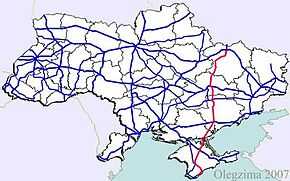
M18 is a Ukrainian international highway (M-highway) connecting Kharkiv to the southern coast of Crimea in Yalta.[1] The highway is also has an alternative route M29 which runs parallel and designed as an expressway between Kharkiv and Novomoskovsk. ![]() is concurrent with M29 and continues concurrent with M18 from Novomoskovsk to Yalta.[2]
is concurrent with M29 and continues concurrent with M18 from Novomoskovsk to Yalta.[2]
Main route
Main route and connections to/intersections with other highways in Ukraine.
| Marker | Main settlements | Notes | Highway Interchanges |
|---|---|---|---|
| 0 km | Kharkiv | ||
| Novoselivka | M29 | ||
| Hubynykha | M29 | ||
| Pishchanka (Novomoskovsk) | |||
| Zaporizhia | H08 • H15 | ||
| Melitopol | |||
| Dzhankoy | |||
| Simferopol | H05 • H06 | ||
| 682 km | Yalta | H19 |
See also
References
External links
- International Roads in Ukraine in Russian
- European Roads in Russian
| |||||||||||||||||||||||||