High Street, Lincoln
|
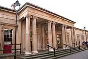
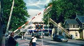
Two main railway lines used to cross the High Street. St Marks has gone, leaving this one at Lincoln Central | |
| Former name(s) | Ermine Street, Iter VI of the Antonine Itinerary |
|---|---|
| Maintained by | Lincolnshire County Council |
| Length | 1.9 km[1] (1.2 mi) |
| Addresses | 1-480 |
| Location | Lincoln, England |
| Postal code | LN5 7DW |
| Coordinates | 53°13′36″N 0°32′29″W / 53.226797°N 0.541486°WCoordinates: 53°13′36″N 0°32′29″W / 53.226797°N 0.541486°W |
| Northern end |
The Strait,Motherby Lane 53°13′53″N 0°32′22″W / 53.231465°N 0.539499°W |
| Major junctions | Clasketgate, Mint Street, Saltergate, St Mary's Street, Railway Line |
| Southern end |
St Catherine Roundabout (A15) 53°12′53″N 0°32′46″W / 53.214602°N 0.546228°W |
| Construction | |
| Commissioned | Roman |
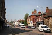
The High Street of Lincoln, England, (road number B1262) is a long shopping high street. The street runs from south to north, starting at St. Catherines, Lincoln roundabout and ending approximately 1.5 miles (2.4 km) north at The Strait (in effect a continuation of the High Street).
Premises
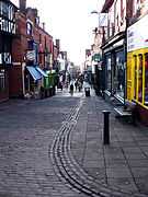
The High Street is punctuated by a number of pubs, restaurants, local shops, private homes, offices, car dealerships, department stores, chain stores, churches, a school, memorials, the River Witham, level crossing and Sincil Bank drains. The street itself forms one of the busiest road access routes into the city centre of Lincoln.
Numbering
The numbering of premises is consecutive, which is slightly unusual compared with most of the UK. Number One, High Street, starts with the first building (Home Start), at the southern end and on the western side of the street, the neighbouring property is Number Two, followed by Number Three and so on. This numbering pattern continues northwards and uphill until the High Street meets The Strait. The sequential numbering system then continues southward, back down the High Street on the eastern side, until reaching a car dealership at Number 471-480, which has the highest number, and is opposite Number One, High Street.
Highlights
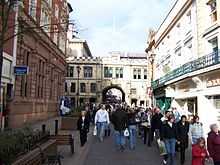
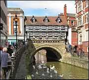
The Stonebow and Guildhall. Town gate with Guildhall above, dating from the 15th century and restored in 1885-7. The figures in the niches are (left) the Archangel Gabriel and (right) the Virgin Mary, patron saint of the city and cathedral. In the centre are the royal coat of arms of James I, dated 1605. It replaced an earlier gate, possibly Norman, but conceivably the south gate of the Roman city.
| Views of Lincoln High Street | ||||||||||||||||
|---|---|---|---|---|---|---|---|---|---|---|---|---|---|---|---|---|
|
See also
References
- ↑ "Google maps walking route". Retrieved 2011-02-17.
External links
- Chamber of Commerce
- Lincolnshire Echo, the county's best known newspaper is based in Lincoln

.jpg)

