High Halden
| High Halden | |
 High Halden |
|
| Area | 15.18 km2 (5.86 sq mi) |
|---|---|
| Population | 1,584 (Civil Parish)[1] |
| – density | 104/km2 (270/sq mi) |
| OS grid reference | TQ899373 |
| Civil parish | High Halden |
| District | Ashford |
| Shire county | Kent |
| Region | South East |
| Country | England |
| Sovereign state | United Kingdom |
| Post town | Ashford |
| Postcode district | TN26 |
| Dialling code | 01233 |
| Police | Kent |
| Fire | Kent |
| Ambulance | South East Coast |
| EU Parliament | South East England |
| UK Parliament | Ashford |
Coordinates: 51°06′11″N 0°42′47″E / 51.103°N 0.713°E
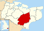
High Halden is a village and civil parish in the Ashford District of Kent, England. The village is on the A28 road between Ashford and Tenterden, 3 miles (5 km) north of the latter town.
History
A very large quantity, fifty tons, of oak was used as the material to build the tower and spire of the 10th–14th-century church, St Mary the Virgin, in 1470–1490. The church was restored in 1835 through funds donated by Mrs. Amy Kynaston Sutton, widow of the former vicar Evelyn Levett Sutton and sister and sole heiress of her brother Sir John Roger Kynaston, Bart.[2] The large pub The Chequers on the Green, circa 1620, is known to have been used by smugglers and the various gangs such as the "Hawkhurst and Cranbrook gangs" that were active in the mid-18th century. The parish is recorded in the Domesday Book and parts of a Norman manor house can be seen at Tiffenden Farm.[3]
References
External links
| Wikimedia Commons has media related to High Halden. |
- St Mary's church
- Friends of the Parish Church of St Mary the Virgin
- High Halden Village (includes Civil Parish Council pages)
- Statistical civil parish overview - map
 |
Headcorn | Smarden | Bethersden | |
| Woolpack Corner | |
Shadoxhurst | ||
| ||||
| | ||||
| St Michaels | Leigh Green | Woodchurch |