Higashi-Oiwake Station
Higashi-Oiwake Station Station 東追分駅 | |
 | |
|---|---|
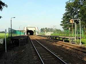
| General view of the station, July 2004 | |
| Location | |
| Prefecture | Hokkaido (See other stations in Hokkaido) |
| District | Yūfutsu |
| Town | Abira |
| Rail services | |
| Station number(s) | K16 |
| Operator(s) | JR Hokkaido |
| Line(s) | Sekishō Line |
Higashi-Oiwake Station (東追分駅 Higashi-Oiwake-eki) is a railway station in Abira, Hokkaidō, Japan, operated by the Hokkaido Railway Company (JR Hokkaido).
Lines
Higashi-Oiwake Station is served by the Sekishō Line, and is numbered K16.
Station layout
The station consists of two side platforms serving two tracks.
Adjacent stations
| « | Service | » | ||
|---|---|---|---|---|
| Sekisho Line | ||||
| Oiwake | - | Kawabata | ||
February 2012 freight train derailment
At around 20:50 on 16 February 2012, a freight train derailed at the station after passing a signal at red and colliding with the wall of a snow shelter close to the station.[1][2]
The up container freight train from Kushiro Freight Terminal to Sapporo Freight Terminal was normally scheduled to pass the station non-stop, but on this occasion faced a red signal to allow it to pass the delayed down Super Ōzora 13 service in the opposite direction. The driver reportedly applied the brakes, but the train failed to stop and was derailed by the catch points protecting the single-track line, hitting the wall of a snow shelter protecting the junction. The JR Freight Class DF200 diesel locomotive and four of the container wagons in the train were derailed, but the lone 25-year-old driver was uninjured. Six train services were cancelled as a result.[2]
References
- ↑ JR石勝線:貨物列車が壁に衝突 4両が脱線 けが人なし [JR Sekisho Line: Freight train hits wall - 4 wagons derailed, no injuries]. Mainichi.jp (in Japanese). Japan: The Mainichi Newspapers. 16 February 2012. Retrieved 17 February 2012.
- ↑ 2.0 2.1 ブレーキ利かず?貨物列車が脱線…北海道 [Brake failure? Freight train derails in Hokkaido]. Yomiuri Online (in Japanese). Japan: The Yomiuri Shimbun. 17 February 2012. Retrieved 17 February 2012.
External links
| Wikimedia Commons has media related to Stations of Sekishō Line. |
| ||||||||||
Coordinates: 42°54′09″N 141°49′57″E / 42.9024°N 141.8325°E