Hickman, Nebraska
| Hickman, Nebraska | |
|---|---|
| City | |
|
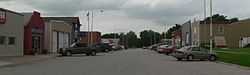
Downtown Hickman: Locust Street | |
 Location of Hickman, Nebraska | |
| Coordinates: 40°37′17″N 96°37′54″W / 40.62139°N 96.63167°WCoordinates: 40°37′17″N 96°37′54″W / 40.62139°N 96.63167°W | |
| Country | United States |
| State | Nebraska |
| County | Lancaster |
| Area[1] | |
| • Total | 0.72 sq mi (1.86 km2) |
| • Land | 0.72 sq mi (1.86 km2) |
| • Water | 0 sq mi (0 km2) |
| Elevation | 1,266 ft (386 m) |
| Population (2010)[2] | |
| • Total | 1,657 |
| • Estimate (2013[3]) | 1,840 |
| • Density | 2,301.4/sq mi (888.6/km2) |
| Time zone | Central (CST) (UTC-6) |
| • Summer (DST) | CDT (UTC-5) |
| ZIP code | 68372 |
| Area code(s) | 402 |
| FIPS code | 31-22325 |
| GNIS feature ID | 0829946[4] |
| Website | http://www.hickman.ne.gov/ |
Hickman is a city in Lancaster County, Nebraska, United States. It is part of the Lincoln, Nebraska Metropolitan Statistical Area. The population was 1,657 at the 2010 census.
History
Hickman was platted in 1872 when the Atchison and Nebraska Railroad was extended to that point.[5] The community adopted the name of its founder, C. H. Hickman.[6][7] Hickman was incorporated in 1885.[8]
Geography
Hickman is located at 40°37′17″N 96°37′54″W / 40.62139°N 96.63167°W (40.621488, -96.631780).[9]
According to the United States Census Bureau, the city has a total area of 0.72 square miles (1.86 km2), all of it land.[1]
Demographics
| Historical population | |||
|---|---|---|---|
| Census | Pop. | %± | |
| 1890 | 341 | — | |
| 1900 | 382 | 12.0% | |
| 1910 | 388 | 1.6% | |
| 1920 | 380 | −2.1% | |
| 1930 | 302 | −20.5% | |
| 1940 | 320 | 6.0% | |
| 1950 | 279 | −12.8% | |
| 1960 | 288 | 3.2% | |
| 1970 | 415 | 44.1% | |
| 1980 | 687 | 65.5% | |
| 1990 | 1,081 | 57.4% | |
| 2000 | 1,084 | 0.3% | |
| 2010 | 1,657 | 52.9% | |
| Est. 2013 | 1,840 | 11.0% | |
| U.S. Decennial Census[10] 2013 Estimate[3] | |||
2010 census
As of the census[2] of 2010, there were 1,657 people, 587 households, and 463 families residing in the city. The population density was 2,301.4 inhabitants per square mile (888.6/km2). There were 609 housing units at an average density of 845.8 per square mile (326.6/km2). The racial makeup of the city was 98.2% White, 0.4% African American, 0.2% Asian, 0.3% from other races, and 0.9% from two or more races. Hispanic or Latino of any race were 1.6% of the population.
There were 587 households of which 46.7% had children under the age of 18 living with them, 65.9% were married couples living together, 8.9% had a female householder with no husband present, 4.1% had a male householder with no wife present, and 21.1% were non-families. 18.1% of all households were made up of individuals and 9% had someone living alone who was 65 years of age or older. The average household size was 2.82 and the average family size was 3.22.
The median age in the city was 31.8 years. 33.2% of residents were under the age of 18; 5.7% were between the ages of 18 and 24; 30.2% were from 25 to 44; 23.1% were from 45 to 64; and 7.7% were 65 years of age or older. The gender makeup of the city was 51.7% male and 48.3% female.
2000 census
As of the census of 2000, there were 1,084 people, 381 households, and 294 families residing in the city. The population density was 2,194.2 people per square mile (854.2/km²). There were 404 housing units at an average density of 817.8 per square mile (318.3/km²). The racial makeup of the city was 98.15% White, 0.65% African American, 0.28% Native American, 0.18% from other races, and 0.74% from two or more races. Hispanic or Latino of any race were 1.01% of the population.
There were 381 households out of which 50.4% had children under the age of 18 living with them, 62.2% were married couples living together, 9.7% had a female householder with no husband present, and 22.8% were non-families. 20.2% of all households were made up of individuals and 7.1% had someone living alone who was 65 years of age or older. The average household size was 2.85 and the average family size was 3.27.
In the city the population was spread out with 34.4% under the age of 18, 6.6% from 18 to 24, 32.3% from 25 to 44, 19.8% from 45 to 64, and 6.8% who were 65 years of age or older. The median age was 32 years. For every 100 females there were 110.5 males. For every 100 females age 18 and over, there were 104.3 males.
As of 2000 the median income for a household in the city was $44,911, and the median income for a family was $49,583. Males had a median income of $32,434 versus $22,321 for females. The per capita income for the city was $16,687. About 4.7% of families and 4.1% of the population were below the poverty line, including 4.2% of those under age 18 and 10.5% of those age 65 or over.
Points of interest
References
- ↑ 1.0 1.1 "US Gazetteer files 2010". United States Census Bureau. Retrieved 2012-06-24.
- ↑ 2.0 2.1 "American FactFinder". United States Census Bureau. Retrieved 2012-06-24.
- ↑ 3.0 3.1 "Population Estimates". United States Census Bureau. Retrieved 2014-07-17.
- ↑ "US Board on Geographic Names". United States Geological Survey. 2007-10-25. Retrieved 2008-01-31.
- ↑ Burr, George L. (1921). History of Hamilton and Clay Counties, Nebraska, Volume 1. S.J. Clarke Publishing Company. p. 126.
- ↑ "Profile for Hickman, NE". ePodunk. Retrieved 19 August 2014.
- ↑ Fitzpatrick, Lillian L. (1960). Nebraska Place-Names. University of Nebraska Press. p. 92. ISBN 0-8032-5060-6. A 1925 edition is available for download at University of Nebraska—Lincoln Digital Commons.
- ↑ "Hickman, Lancaster County". Center for Advanced Land Management Information Technologies. University of Nebraska. Retrieved 19 August 2014.
- ↑ "US Gazetteer files: 2010, 2000, and 1990". United States Census Bureau. 2011-02-12. Retrieved 2011-04-23.
- ↑ United States Census Bureau. "Census of Population and Housing". Retrieved October 18, 2013.
External links
| |||||||||||||||||||||||||||||