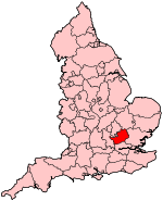
Hertford and Stortford (UK Parliament constituency)
Hertford and Stortford is a constituency[n 1] represented in the House of Commons of the UK Parliament by Mark Prisk of the Conservative Party.[n 2]
Boundaries
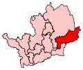
Following their review of parliamentary representation in Hertfordshire the Boundary Commission for England consultation and changed modified the Hertford and Stortford seat for the 2010 general election. The electoral wards are included in the district of East Hertfordshire:
- Bishop’s Stortford All Saints, Bishop’s Stortford Central, Bishop’s Stortford Meads, Bishop’s Stortford Silverleys, Bishop’s Stortford South, Great Amwell, Hertford Bengeo, Hertford Castle, Hertford Heath, Hertford Kingsmead, Hertford Sele, Hunsdon, Much Hadham, Sawbridgeworth, Stanstead Abbotts, Ware Chadwell, Ware Christchurch, Ware St Mary’s and Ware Trinity.
Description
The constituency is semi-rural which includes picturesque villages and farmland separating the county town of Hertford, population 25,000, which is architecturally rich.[2] The rivers Rib, Beane, Mimram, and Lea all meet in Hertford, which is protected from over development by Green Belt land which encircles the town separating it from its neighbour Ware (17,000) in the western part of the constituency. Farms continue between Ware and the ancient market town of Bishop's Stortford with a population of more than 32,000 people in the north east corner of the seat. Bishop's Stortford has developed into a popular area for commuters, with rail links to London's Liverpool Street station. Thorley on the south side of Stortford, contains a huge residential estate of owner occupied houses built mainly in the 1980s. The constituency is affluent, having a majority of professional and managerial workers as it is within commuting distance of London. Stansted Airport, which lies just outside the seat's eastern perimeter has been responsible for bringing jobs and an improved train service to the constituency. The pharmaceutical industry is also an important provider of jobs - GlaxoSmithKline has facilities in Ware and nearby Harlow, and Merck is based at Gilston on the seat's southern border. London is within commuting distance with trains to the City running from all the towns in the constituency.
Members of Parliament
Elections
Elections in the 2010s
| General Election 2010: Hertford and Stortford[9] |
| Party |
Candidate |
Votes |
% |
±% |
|
Conservative |
Mark Prisk |
29,810 |
53.8 |
+3.6 |
|
Liberal Democrat |
Andrew Lewin |
14,373 |
26.0 |
+7.5 |
|
Labour |
Stephen Terry |
7,620 |
13.8 |
-10.5 |
|
UKIP |
David Sodey |
1,716 |
3.1 |
+1.0 |
|
BNP |
Roy Harris |
1,297 |
2.3 |
N/A |
|
Independent |
Loucas Xenophontos |
325 |
0.6 |
N/A |
|
Independent |
Martin Adams |
236 |
0.4 |
N/A |
| Majority |
15,437 |
27.9 |
|
| Turnout |
55,377 |
70.6 |
+4.1 |
|
Conservative hold |
Swing |
-1.9 |
|
Elections in the 2000s
Elections in the 1990s
Elections in the 1980s
See also
- List of Parliamentary constituencies in Hertfordshire
Notes and references
- Notes
- ↑ A county constituency (for the purposes of election expenses and type of returning officer)
- ↑ As with all constituencies, the constituency elects one Member of Parliament (MP) by the first past the post system of election at least every five years.
- References
Coordinates: 51°49′N 0°01′E / 51.817°N 0.017°E / 51.817; 0.017