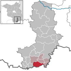
Hermsdorf, Brandenburg
Hermsdorf is a municipality in the Oberspreewald-Lausitz district, in southern Brandenburg, Germany.
Demography
.pdf.jpg)
Development of Population since 1875 within the Current Boundaries (Blue Line: Population; Dotted Line: Comparison to Population Development of Brandenburg state; Grey Background: Time of Nazi rule; Red Background: Time of Communist rule)
Hermsdorf:
Population development within the current boundaries[2]
| Year |
Population |
|
|
|---|
| 1875 | 400 |
| 1890 | 400 |
| 1910 | 550 |
| 1925 | 593 |
| 1933 | 575 |
| 1939 | 836 |
| 1946 | 1 122 |
| 1950 | 1 236 |
| 1964 | 1 263 |
| 1971 | 1 210 |
|
|
| Year |
Population |
|
|
|---|
| 1981 | 1 091 |
| 1985 | 1 043 |
| 1989 | 1 045 |
| 1990 | 1 040 |
| 1991 | 1 034 |
| 1992 | 1 020 |
| 1993 | 1 010 |
| 1994 | 1 023 |
| 1995 | 1 007 |
| 1996 | 1 010 |
|
|
| Year |
Population |
|
|
|---|
| 1997 | 1 019 |
| 1998 | 1 013 |
| 1999 | 1 014 |
| 2000 | 1 020 |
| 2001 | 1 029 |
| 2002 | 952 |
| 2003 | 942 |
| 2004 | 930 |
| 2005 | 924 |
| 2006 | 908 |
|
|
| Year |
Population |
|
|
|---|
| 2007 | 893 |
| 2008 | 874 |
| 2009 | 856 |
| 2010 | 839 |
| 2011 | 813 |
| 2012 | 808 |
| 2013 | 803 |
|
|
References