Heritage Range
| Heritage Range | |
|---|---|
|
Location of Heritage Range in Western Antarctica | |
| Dimensions | |
| Length | 160 km (99 mi) |
| Width | 48 km (30 mi) |
| Geography | |
| Continent | Antarctica |
| State/Province | Ellsworth Land |
| Range coordinates | 79°45′S 83°00′W / 79.75°S 83°WCoordinates: 79°45′S 83°00′W / 79.75°S 83°W |
| Parent range | Ellsworth Mountains |
| Borders on | Sentinel Range |
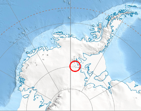
The Heritage Range is a major mountain range, 160 km (99 mi) long and 48 km (30 mi) wide, situated southward of Minnesota Glacier and forming the southern half of the Ellsworth Mountains in Antarctica. The range is complex, consisting of scattered ridges and peaks of moderate height, escarpments, hills and nunataks, the various units of relief set off by numerous intervening glaciers.[1]
The northern portion of the range was probably first sighted by Lincoln Ellsworth in the course of his trans-Antarctic flight of November 23, 1935. On December 14, 1959, the southern range was seen for the first time in a reconnaissance flight from Byrd Station, made by Edward C. Thiel, J.C. Craddock and E.S. Robinson. The team landed at a glacier on Pipe Peak on December 26, in the northwestern part of the range.[1][2]
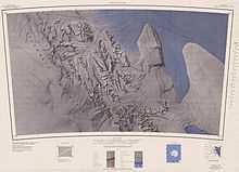
During the 1962-63 and 1963-64 seasons, the University of Minnesota expeditions made geologic and cartographic surveys of the range. The entire range was mapped by USGS from aerial photographs taken by the U.S. Navy, 1961-66.[1]
So named by US-ACAN because topographic units within the range have received names relating to the theme of American heritage.[1]
See also
References
- ↑ 1.0 1.1 1.2 1.3 "Heritage Range". Geographic Names Information System. United States Geological Survey. Retrieved Nov 11, 2004.
- ↑ Gerald F. Webers, et al., Geology and Paleontology of the Ellsworth Mountains, West Antarctica (Geological Society of America, 1992), p. xi