Hendersonville, Mississippi
| Hendersonville | |
|---|---|
| Ghost town | |
 Hendersonville | |
| Coordinates: 33°56′15″N 89°43′43″W / 33.93750°N 89.72861°WCoordinates: 33°56′15″N 89°43′43″W / 33.93750°N 89.72861°W | |
| Country | United States |
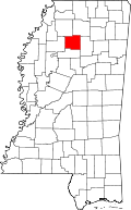
| State | Mississippi |
| County | Yalobusha |
| Elevation | 467 ft (112 m) |
| Time zone | Central (CST) (UTC-6) |
| • Summer (DST) | CDT (UTC-5) |
| GNIS feature ID | 705923[1] |
Hendersonville is a ghost town located in Yalobusha County, Mississippi.[1]
Once the largest town in Yalobusha County, the former settlement is today covered by forest.
History
John Henderson, a Presbyterian missionary and the town's namesake, settled in the area in 1798.[2]
In 1833, the Mississippi Legislature authorized the formation of 17 counties, including Yalobusha. Yalobusha County's first elected officials, called the "Board of Police", met in 1834 at Hendersonville. A county seat had not yet been selected, and the Board of Police solicited land donations. At the second meeting, a nearby location more centrally located in the county, later named Coffeeville, was selected for the county seat.[2][3] A local resident, Capt. L. Lake, wrote in 1834: "Hendersonville then went down and ultimately lost its name, being absorbed in a farm known as 'Oakchickamau,'" owned by Franklin E. Plummer.
An early resident of county named Mr. E. Percy, appeared to dislike both Hendersonville and Coffeeville. He left a poem behind after moving away:
Upon a hill near Derden's Mill
There is a place called Coffeeville;
The meanest town I ever saw
Save Plummer's town, 'Oakchickamau.'[3]
References
- ↑ 1.0 1.1 "Hendersonville (historical)". Geographic Names Information System. United States Geological Survey.
- ↑ 2.0 2.1 "Welcome to Yalobusha County!". Mississippi Genealogy & History Network. Retrieved April 2014.
- ↑ 3.0 3.1 Rowland, Dunbar (1907). Mississippi: Comprising Sketches of Counties, Towns, Events, Institutions, and Persons, Arranged in Cyclopedic Form 2. Southern Historical Publishing Association. p. 466.
| |||||||||||||||||||||||||