Helsa
| Helsa | ||
|---|---|---|
| ||
 Helsa | ||
Location of Helsa within Kassel district 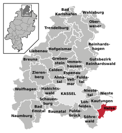 | ||
| Coordinates: 51°16′N 09°41′E / 51.267°N 9.683°ECoordinates: 51°16′N 09°41′E / 51.267°N 9.683°E | ||
| Country | Germany | |
| State | Hesse | |
| Admin. region | Kassel | |
| District | Kassel | |
| Government | ||
| • Mayor | Tilo Küthe | |
| Area | ||
| • Total | 25.77 km2 (9.95 sq mi) | |
| Population (2013-12-31)[1] | ||
| • Total | 5,552 | |
| • Density | 220/km2 (560/sq mi) | |
| Time zone | CET/CEST (UTC+1/+2) | |
| Postal codes | 34298 | |
| Dialling codes |
05605 (Helsa), 05602 (Eschenstruth, St. Ottilien), 05604 (Wickenrode) | |
| Vehicle registration | KS | |
| Website | www.gemeinde-helsa.de | |

Helsa is a municipality and village in the district of Kassel, in Hesse, Germany. The municipality is situated in the Losse valley amongst the hills of the Kaufunger Wald, approx. 15 km east of Kassel.
Division of the municipality
The municipality consists of the villages, Eschenstruth (including Settlement Waldhof), Helsa, St. Ottilien and Wickenrode.
References
- ↑ "Die Bevölkerung der hessischen Gemeinden". Hessisches Statistisches Landesamt (in German). September 2014.
External links
- Official site (German)
| ||||||||