Heiss Island
| Russian: Остров Хейса | |
|---|---|
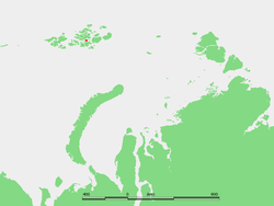 Location of Heiss Island in the Franz Josef Archipelago | |
| Geography | |
| Location | Arctic Ocean |
| Coordinates | 80°27′N 58°03′E / 80.450°N 58.050°ECoordinates: 80°27′N 58°03′E / 80.450°N 58.050°E |
| Archipelago | Franz Josef Land |
| Area | 132 km2 (51 sq mi) |
| Highest point | 242 metres (794 ft) |
| Country | |
Heiss Island (Russian: Остров Хейса; Ostrov Kheysa) is an island in Franz Josef Land, Russia. It is located in the central area of the archipelago, north of Hall Island, between Champ Island and Wilczek Land. Its area is 132 km².
Heiss island is almost unglacierized, having only a small ice-cap off its centre by its northern shore. Highest point 242 m.
The strait to the south of Heiss Island is known as Proliv Markama, which narrows down to only 5 km at this point. On the east lies a strait known as Proliv Austrisky, beyond which lie the smaller Komsomol Islands. 7 km wide Proliv Yermak in the north, separates Heiss Island from the Zichy Land subgroup of the Franz Josef Archipelago.
The cape on the southwestern shore of Heiss island is called Mys Ostantsovyy.
History
Kheysa, a now abandoned Soviet rocket launching site, was located on this island.
Now Heiss Island is home to the Krenkel hydrometeorological station (80°37′ N, 58°03′ E).
This island (including the Komsomol Islands) was originally named after veteran Arctic explorer Isaac Hayes, who undertook a historical Polar expedition in 1850. The island's name in English should have been Hayes Island, but German cartographers Germanized its name after transliterating from the Russian and the corrupted name "Heiss" (meaning "hot" in German) has stuck.
Adjacent islands
- 7 km to the east of Heiss Island's eastern shore lie the Komsomol Islands (Острова Комсомольские; Ostrova Komsomolskiye). They consist of a 7 km-long triangular island and two very small islets off its northern cape. This island group was named after the Soviet time Komsomols.
- There is a 1.2 km long islet located off a small bay west of Heiss Island's northeastern cape.
Climate
| Climate data for Heiss Island | |||||||||||||
|---|---|---|---|---|---|---|---|---|---|---|---|---|---|
| Month | Jan | Feb | Mar | Apr | May | Jun | Jul | Aug | Sep | Oct | Nov | Dec | Year |
| Record high °C (°F) | 1.9 (35.4) |
0.0 (32) |
1.6 (34.9) |
0.7 (33.3) |
2.6 (36.7) |
8.0 (46.4) |
10.3 (50.5) |
8.4 (47.1) |
5.6 (42.1) |
3.8 (38.8) |
1.3 (34.3) |
1.7 (35.1) |
10.3 (50.5) |
| Average high °C (°F) | −19.4 (−2.9) |
−19.8 (−3.6) |
−19.7 (−3.5) |
−15.9 (3.4) |
−6.7 (19.9) |
0.0 (32) |
1.9 (35.4) |
1.3 (34.3) |
−1.3 (29.7) |
−8.3 (17.1) |
−14.0 (6.8) |
−19.0 (−2.2) |
−10.1 (13.8) |
| Daily mean °C (°F) | −22.7 (−8.9) |
−23.1 (−9.6) |
−23.0 (−9.4) |
−18.8 (−1.8) |
−8.8 (16.2) |
−1.4 (29.5) |
0.7 (33.3) |
0.1 (32.2) |
−2.7 (27.1) |
−10.3 (13.5) |
−17.0 (1.4) |
−22.1 (−7.8) |
−12.4 (9.7) |
| Average low °C (°F) | −26.0 (−14.8) |
−26.4 (−15.5) |
−26.7 (−16.1) |
−21.8 (−7.2) |
−10.9 (12.4) |
−2.8 (27) |
−0.3 (31.5) |
−0.9 (30.4) |
−4.1 (24.6) |
−12.6 (9.3) |
−20.0 (−4) |
−25.2 (−13.4) |
−14.8 (5.4) |
| Record low °C (°F) | −42.1 (−43.8) |
−44.4 (−47.9) |
−43.5 (−46.3) |
−39.6 (−39.3) |
−27.7 (−17.9) |
−12.3 (9.9) |
−4.3 (24.3) |
−8.5 (16.7) |
−23.2 (−9.8) |
−32.3 (−26.1) |
−39.5 (−39.1) |
−41.5 (−42.7) |
−44.4 (−47.9) |
| Average precipitation mm (inches) | 30 (1.18) |
28 (1.1) |
19 (0.75) |
16 (0.63) |
12 (0.47) |
10 (0.39) |
17 (0.67) |
21 (0.83) |
25 (0.98) |
21 (0.83) |
21 (0.83) |
18 (0.71) |
238 (9.37) |
| Avg. rainy days | 0 | 0 | 0 | 0.1 | 1 | 3 | 12 | 11 | 7 | 1 | 0.1 | 0 | 35 |
| Avg. snowy days | 20 | 20 | 19 | 16 | 23 | 17 | 11 | 13 | 22 | 24 | 21 | 19 | 225 |
| Average relative humidity (%) | 83 | 82 | 80 | 81 | 85 | 88 | 91 | 92 | 90 | 86 | 84 | 83 | 85 |
| Mean monthly sunshine hours | 0.0 | 0.0 | 70.6 | 250.9 | 230.3 | 189.5 | 162.9 | 96.6 | 34.4 | 5.8 | 0.0 | 0.0 | 1,040.9 |
| Source #1: Pogoda.ru.net[1] | |||||||||||||
| Source #2: Weatherbase (sun only)[2] | |||||||||||||
References
- ↑ "Weather and Climate-The Climate of Hayes Island" (in Russian). Weather and Climate. Retrieved November 12, 2012.
- ↑ "Weatherbase: Historical Weather for Zemlya Vil'cheka, Russia". Weatherbase. Retrieved November 12, 2012.
- Location:
- Meteorology:
- On the (sometimes bewildering) spelling of Russian geographical names:
- Hayes Island on Fridtjof Nansen's map:
- Arctic Expeditions:
External links
- Location: & Kheysa
- Pictures of Heiss Island:
- Polar Marine Geosurveys:
- Ages and types of rocks in Hole Heiss-1 drilled in Heiss Island: -
| Wikimedia Commons has media related to Heiss Island. |