Hector and Ngakawau
| Hector and Ngakawau | |
|---|---|
 Hector and Ngakawau | |
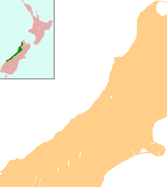
| Coordinates: 41°36′23″S 171°52′50″E / 41.60639°S 171.88056°E | |
| Country | New Zealand |
| Region | West Coast |
| District | Buller District |
Hector and Ngakawau are two lightly populated settlements located at the mouth of the Ngakawau River in the West Coast region of New Zealand. Both settlements are situated on State Highway 67 between Westport and Karamea. The 2001 New Zealand Census of Population and Dwellings found that Hector and Ngakawau have a combined population of 300, a drop of 16% or 57 people since the 1996 census.[1] This has dropped further in 2006 to 234 people.[2] Despite a low population, many of the workers at New Zealand's largest open-cut coal mine at Stockton choose to live at these places and shuttles frequently operate between the two places.
Hector
Hector sits on the northern side of the Ngakawau River's mouth, and is the more populous of the two settlements.
Hector has adopted the endangered Hector's Dolphin as a town icon and is involved in Department of Conservation projects to protect the dolphin.[3] The dolphins often play just offshore from Hector and attract visitors. Another local attraction is a country music museum.[4]
Ngakawau
Ngakawau sits on the southern side of the Ngakawau River's mouth, and is the more economically important of the two settlements.
Ngakawau is also the current terminus of the Ngakawau Branch, which transports significant tonnages of coal from an aerial ropeway connecting Ngakawau to the Stockton Mine to the port town of Lyttelton on the east coast of New Zealand. The line was opened to Ngakawau on 12 September 1877 and an extension across the river through Hector to Mokihinui was opened on 8 August 1893. The line ultimately opened to Seddonville on 23 February 1895 and was known as the Seddonville Branch. Passenger services through both settlements were provided by mixed trains and they ceased to operate from 14 October 1946. Coal was almost the sole traffic from that stage, and as output from mines to the north declined, the line's maintenance costs outweighed revenue and it was closed beyond Ngakawau.[5][6]
References
- ↑ Statistics New Zealand, "Hector-Ngakawau Community Profile", accessed 24 June 2007.
- ↑ http://www.stats.govt.nz/Census/2006CensusHomePage/QuickStats/AboutAPlace/SnapShot.aspx?ParentID=&type=&p=y&printall=true&tab=Families&id=3584403 QuickStats about Hector-Ngakawau
- ↑ Mike Copeland, "Conservation with West Coast Communities", accessed 24 June 2007.
- ↑ Tourism West Coast, "Granity / Ngakawau / Hector", accessed 24 June 2007.
- ↑ David Leitch and Brian Scott, Exploring New Zealand's Ghost Railways, rev. ed. (Wellington: Grantham House, 1998), 52-3.
- ↑ Geoffrey B. Churchman and Tony Hurst, The Railways of New Zealand: A Journey Through History (Auckland: HarperCollins, 1991), 192.
Coordinates: 41°36′S 171°53′E / 41.600°S 171.883°E
| ||||||||||