Hauhungatahi
| Hauhungatahi | |
|---|---|
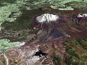 Composite satellite image of snow-covered Ruapehu, with Hauhungatahi visible behind it. | |
| Elevation | 1,521 m (4,990 ft)[1] |
| Prominence | approx 400 m (1,300 ft)[1] |
| Location | |
 Hauhungatahi | |
| Coordinates | 39°13′46″S 175°26′39″E / 39.22944°S 175.44417°ECoordinates: 39°13′46″S 175°26′39″E / 39.22944°S 175.44417°E |
| Topo map | NZTopo50-BJ34[1] |
| Geology | |
| Volcanic arc/belt | Taupo Volcanic Zone |
| Climbing | |
| Easiest route | Tramping from the west, starting near Erua |
Hauhungatahi is an eroded volcano at the southern end of the Taupo Volcanic Zone in New Zealand, located about 11 km (7 mi) WNW of Mount Ruapehu. Although relatively little-known, at 1,521 m (4,990 ft) Hauhungatahi is one of the highest volcanoes in New Zealand, exceeded in elevation by only Ruapehu, Taranaki/Egmont (including Fanthams Peak), and the Tongariro massif (including Ngauruhoe). The volcano is constructed atop an upfaulted block of Mesozoic marine sediments. The age of the erupted andesite lava is about 900,000 years, making Hauhungatahi more than three times as old as the neighboring Ruapehu.[2]
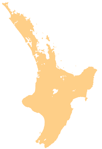
The volcano is located in the western part of Tongariro National Park. The terrain surrounding Hauhungatahi and covering an area of 8,498 ha (33 sq mi) has been managed as a Wilderness Area since 1966, one of two such officially-designated areas within the park.[3]
The standard ascent route on Hauhungatahi is a tramp from the west side starting near Erua, following remnants of an old track in places, and bush-bashing through several overgrown and boggy areas to reach the bush line near 1,200 m (3,900 ft) on the summit plateau.[4] Slightly easier travel continues eastward to the true summit, which provides panoramic views of neighboring peaks throughout the park including Ruapehu, Ngauruhoe, and Tongariro.
See also
- List of volcanoes in New Zealand
- List of mountains of New Zealand by height
- Volcanism in New Zealand
References
- ↑ 1.0 1.1 1.2 "Topographic map, NZTopo50-BJ34". Retrieved 30 December 2009.
- ↑ Cameron, Errol et al. (2009). "The petrology, geochronology and geochemistry of Hauhungatahi volcano, S.W. Taupo Volcanic Zone". Journal of Volcanology and Geothermal Research: in press. Bibcode:2010JVGR..190..179C. doi:10.1016/j.jvolgeores.2009.07.002.
- ↑ "Tongariro National Park Management Plan 2006–2016". pp. 117–126. Retrieved 30 December 2009.
- ↑ "Hauhungatahi - Old Baldy". Route description with maps and photos. Taupo Tramping Club. Retrieved 30 December 2009.