Hattarvík
| Hattarvík | |
|---|---|
| Village | |
|
Hattarvík | |
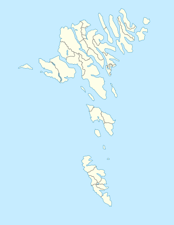 Hattarvík Location of Hattarvík in the out-most north-east of the Faroe Islands | |
| Coordinates: 62°19′51″N 6°16′25″W / 62.33083°N 6.27361°WCoordinates: 62°19′51″N 6°16′25″W / 62.33083°N 6.27361°W | |
| State |
|
| Constituent country |
|
| Island | Fugloy |
| Municipality | Fugloyar kommuna |
| Population (1 January 2006) | |
| • Total | 17 |
| Time zone | GMT |
| • Summer (DST) | EST (UTC+1) |
| Postal code | FO 767 |
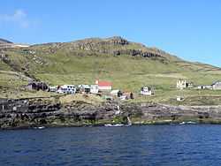
Hattarvík is a small village on the east-side of the island Fugloy, Faroe Islands, and the most eastern place in the country.
The village is encircled by high mountains on 3 sides.
History
Hattarvik was founded in 900. The stonechurch was built in 1899. Some old stone-houses are being restored these days. These houses are said to relate to "Flokksmenn". These were three strong men who wanted to seize the power of the Faroe Islands in the 15th century.
Transportation
Hattarvik is reachable by a ferry 1-2 times a day from Hvannasund and also by a helicopter 3 times a week from Klaksvík and Tórshavn. A road leads to the other village on Fugloy, Kirkja in the south.
Population
Population estimates range from 5 to 44. According to There were 17 people in the village as of 2006.
See also
External links
- Faroeislands.dk: Hattarvík Images and description of all cities on the Faroe Islands.