Harveysburg, Ohio
| Harveysburg, Ohio | |
|---|---|
| Village | |
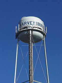 | |
| Nickname(s): Village on the lake | |
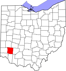
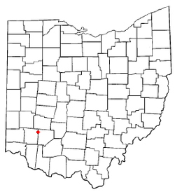 Location of Harveysburg, Ohio | |
| Coordinates: 39°30′0″N 84°0′14″W / 39.50000°N 84.00389°WCoordinates: 39°30′0″N 84°0′14″W / 39.50000°N 84.00389°W | |
| Country | United States |
| State | Ohio |
| County | Warren |
| Founded | 1829 |
| Established | 1831 |
| Village | 1844 |
| Government | |
| • Type | Council-city manager |
| • Mayor | Dick Verga |
| Area[1] | |
| • Total | 1.01 sq mi (2.62 km2) |
| • Land | 0.99 sq mi (2.56 km2) |
| • Water | 0.02 sq mi (0.05 km2) |
| Elevation[2] | 928 ft (283 m) |
| Population (2010)[3] | |
| • Total | 546 |
| • Estimate (2012[4]) | 545 |
| • Density | 551.5/sq mi (212.9/km2) |
| Time zone | Eastern (EST) (UTC-5) |
| • Summer (DST) | EDT (UTC-4) |
| ZIP code | 45032 |
| Area code(s) | 513 |
| FIPS code | 39-34384[5] |
| GNIS feature ID | 1064810[2] |
Harveysburg is a village in Massie Township, Warren County, Ohio, United States. The population was 546 at the 2010 census. It is best known as the home of the Ohio Renaissance Festival.
History
Harveysburg was laid out in 1830.[6]
Established in 1831 in Hariveysburg, the Harveysburg Free Black School was the first free school for African-American children in Ohio.
Quakers Kylar and Nathaniel Harvey founded the school. Like most Quakers, the Harveys believed strongly in education. They also believed in equal opportunity for African Americans with whites. Elizabeth Harvey was especially concerned about the lack of free education for Ohio's African-American children and convinced her husband to construct a one-room schoolhouse to assist black children in attaining an education. While the institution is now known as the Harveysburg Free Black School, the school permitted any children of color to attend. Constructed of brick, the Harveysburg Free Black School remained in operation as a school until the early 1900s, when African-Americans were finally permitted to attend historically white schools in the community. The school relied on donations, principally from the Grove Monthly Meeting of Friends in Harveysburg, to remain open. In addition to opening the Harveysburg Free Black School, the couple also established a seminary for white children in the community
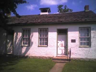
Upon the school's closing, the building became a private home. In 1976, the Harveysburg Bicentennial Committee acquired the building and restored it to its original appearance. The Harveysburg Free Black School now serves as the Harveysburg Community Historical Society's headquarters
Information from Ohio historical marker at building site: Side A of Historical Marker: "Harveysburg" The Quaker village of Harveysburg was founded in 1829 on land originally a part of Colonel Abraham Buford's Revolutionary War Land Grant. Levi Lukens, a Virginia Quaker, purchased the 1000 – acre survey in 1812 and sold a portion to Rhoden Ham in 1815. Ham then sold a portion of his holdings to William Harvey, a Quaker originally from North Carolina, who developed 47 lots for a village which thrived from its beginnings. Early businesses included grist mills, a tin shop, hardware store, blacksmith shop, a large pork packing plant, a bank, and a dry goods store owned by William Harvey. Its first post office opened in 1839. Harveysburg was incorporated in 1844. The village received its name from a merchant in Cincinnati who told William Harvey that he should add burg to his name and call the place Harveysburg.
Side B of historical marker: "The Harveysburg School" In Harveysburg's early years Elizabeth Harvey, wife of Dr. Jesse Harvey, recognized the need to educate African American and Native American children in the area. The Harveys built the Harverysburg School in 1831, which was one of the first schools for such minority children in Ohio and the Northwest Territory. It was supported by the Harveys and members of the Grove Monthly Meeting of Friends. Stephen Wall, a wealthy North Carolina plantation owner, provided funding to relocate eight slave children and their families to Harveysburg for their education at this school. Orindatus S.B. Wall, oldest son of Steven became the first regular commissioned African American captain in the U.S. Army during the Civil War. This school closed in 1909 when classes became too small to continue. In 1976 the Harveysburg Bicentennial Committee purchased the building, restored it, and opened it to the public as a symbol of freedom through education.
Geography
Harveysburg is located at 39°30′0″N 84°0′14″W / 39.50000°N 84.00389°W (39.500100, −84.003915).[7]
According to the United States Census Bureau, the village has a total area of 1.01 square miles (2.62 km2), of which 0.99 square miles (2.56 km2) is land and 0.02 square miles (0.05 km2) is water.[1]
Demographics
2010 census
As of the census[3] of 2010, there were 546 people, 204 households, and 147 families residing in the village. The population density was 551.5 inhabitants per square mile (212.9/km2). There were 237 housing units at an average density of 239.4 per square mile (92.4/km2). The racial makeup of the village was 95.1% White, 1.5% African American, 0.4% Asian, 0.2% from other races, and 2.9% from two or more races. Hispanic or Latino of any race were 0.2% of the population.
There were 204 households of which 37.3% had children under the age of 18 living with them, 57.8% were married couples living together, 7.4% had a female householder with no husband present, 6.9% had a male householder with no wife present, and 27.9% were non-families. 20.6% of all households were made up of individuals and 5.9% had someone living alone who was 65 years of age or older. The average household size was 2.68 and the average family size was 3.08.
The median age in the village was 37.3 years. 26.4% of residents were under the age of 18; 5.9% were between the ages of 18 and 24; 27.1% were from 25 to 44; 31.4% were from 45 to 64; and 9.3% were 65 years of age or older. The gender makeup of the village was 51.1% male and 48.9% female.
2000 census
As of the census[5] of 2000, there were 563 people, 191 households, and 152 families residing in the village. The population density was 857.1 people per square mile (329.4/km²). There were 208 housing units at an average density of 316.7 per square mile (121.7/km²). The racial makeup of the village was 96.45% White, 2.13% African American, 0.18% Asian, 0.18% from other races, and 1.07% from two or more races. Hispanic or Latino of any race were 1.95% of the population.
There were 191 households out of which 45.5% had children under the age of 18 living with them, 62.8% were married couples living together, 13.1% had a female householder with no husband present, and 19.9% were non-families. 14.7% of all households were made up of individuals and 4.7% had someone living alone who was 65 years of age or older. The average household size was 2.95 and the average family size was 3.29.
In the village the population was spread out with 32.3% under the age of 18, 7.8% from 18 to 24, 32.7% from 25 to 44, 19.4% from 45 to 64, and 7.8% who were 65 years of age or older. The median age was 31 years. For every 100 females there were 94.1 males. For every 100 females age 18 and over, there were 92.4 males.
The median income for a household in the village was $44,750, and the median income for a family was $49,063. Males had a median income of $31,923 versus $23,333 for females. The per capita income for the village was $16,918. About 7.7% of families and 8.6% of the population were below the poverty line, including 8.4% of those under age 18 and none of those age 65 or over.
Notable people
- Rev. Larry Davis, a Baptist minister who pled guilty to charges stemming from misappropriation of church funds
- Kersey Graves, a skeptic, atheist, spiritualist, theological reformist, and writer
- Donald Edgar "Buz" Lukens, a Republican member of the U.S. House of Representatives from Ohio
Other
The entire village is in the Clinton Massie Local School District. Mail is delivered through the Harveysburg post office while telephone service is supplied through the Waynesville exchanges.
References
- ↑ 1.0 1.1 "US Gazetteer files 2010". United States Census Bureau. Retrieved January 6, 2013.
- ↑ 2.0 2.1 "US Board on Geographic Names". United States Geological Survey. 2007-10-25. Retrieved 2008-01-31.
- ↑ 3.0 3.1 "American FactFinder". United States Census Bureau. Retrieved January 6, 2013.
- ↑ "Population Estimates". United States Census Bureau. Retrieved June 17, 2013.
- ↑ 5.0 5.1 "American FactFinder". United States Census Bureau. Retrieved 2008-01-31.
- ↑ Kilbourn, John (1833). "The Ohio Gazetteer, or, a Topographical Dictionary". Scott and Wright. p. 237. Retrieved December 12, 2013.
- ↑ "US Gazetteer files: 2010, 2000, and 1990". United States Census Bureau. 2011-02-12. Retrieved 2011-04-23.
- Elva R. Adams. Warren County Revisited. [Lebanon, Ohio]: Warren County Historical Society, 1989.
- The Centennial Atlas of Warren County, Ohio. Lebanon, Ohio: The Centennial Atlas Association, 1903.
- Josiah Morrow. The History of Warren County, Ohio. Chicago: W.H. Beers, 1883. (Reprinted several times)
- Ohio Atlas & Gazetteer. 6th ed. Yarmouth, Maine: DeLorme, 2001. ISBN 0-89933-281-1
- William E. Smith. History of Southwestern Ohio: The Miami Valleys. New York: Lewis Historical Publishing, 1964. 3 vols.
- Warren County Engineer's Office. Official Highway Map 2003. Lebanon, Ohio: The Office, 2003.
External links
Gallery
-
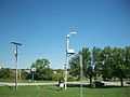
Federal Thunderbolt 1003 Tornado siren located at the Massie Township fire department in Harveysburg, Ohio.
See also
- list of cities with Thunderbolt sirens.
- Thunderbolt siren
| |||||||||||||||||||||||||||||||||