Hart Township, Warrick County, Indiana
| Hart Township Warrick County | |
|---|---|
| Township | |
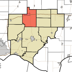 Location in Warrick County | |
| Coordinates: 38°10′21″N 87°17′49″W / 38.17250°N 87.29694°WCoordinates: 38°10′21″N 87°17′49″W / 38.17250°N 87.29694°W | |
| Country | United States |
| State | Indiana |
| County | Warrick |
| Government | |
| • Type | Indiana township |
| Area | |
| • Total | 41.99 sq mi (108.8 km2) |
| • Land | 41.24 sq mi (106.8 km2) |
| • Water | 0.75 sq mi (1.9 km2) 1.79% |
| Elevation | 440 ft (134 m) |
| Population (2010) | |
| • Total | 1,626 |
| • Density | 39.4/sq mi (15.2/km2) |
| ZIP codes | 47601, 47619 |
| GNIS feature ID | 0453401 |
Hart Township is one of ten townships in Warrick County, Indiana, United States. As of the 2010 census, its population was 1,626 and it contained 691 housing units.[1]
Geography
According to the 2010 census, the township has a total area of 41.99 square miles (108.8 km2), of which 41.24 square miles (106.8 km2) (or 98.21%) is land and 0.75 square miles (1.9 km2) (or 1.79%) is water.[1]
History
Hart Township was created, along with Ohio Township, in September 1826.
Cities, towns, villages
Unincorporated towns
- Eby at 38°08′31″N 87°15′41″W / 38.141992°N 87.261395°W
- Graham Valley at 38°08′58″N 87°17′26″W / 38.149492°N 87.290563°W
- Greenbrier at 38°07′14″N 87°17′01″W / 38.120603°N 87.283618°W
- Stanley at 38°09′52″N 87°21′18″W / 38.164491°N 87.355011°W
- Turpin Hill at 38°08′32″N 87°17′25″W / 38.14227°N 87.290285°W
(This list is based on USGS data and may include former settlements.)
Adjacent townships
- Monroe Township, Pike County (north)
- Lane Township (east)
- Owen Township (east)
- Boon Township (south)
- Campbell Township (southwest)
- Greer Township (west)
- Barton Township, Gibson County (northwest)
Cemeteries
Hart township contains these six cemeteries: Lynnville, Massey, Morrison, Mount Olive, Mt. Zion, and Turpin Hill Cemetery
School districts
- Warrick County School Corporation
Political districts
- Indiana's 8th congressional district
- State House District 74
- State Senate District 50
References
- United States Census Bureau 2007 TIGER/Line Shapefiles
- United States Board on Geographic Names (GNIS)
- IndianaMap
- ↑ 1.0 1.1 "Population, Housing Units, Area, and Density: 2010 - County -- County Subdivision and Place -- 2010 Census Summary File 1". United States Census. Retrieved 2013-05-10.
External links
| |||||||||||||||||||||||||