Harrisville, Queensland
| Harrisville Queensland | |||||||||||||
|---|---|---|---|---|---|---|---|---|---|---|---|---|---|
|
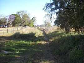
Former Dugandan railway line, 2009 | |||||||||||||
 Harrisville | |||||||||||||
| Coordinates | 27°48′42″S 152°40′8″E / 27.81167°S 152.66889°ECoordinates: 27°48′42″S 152°40′8″E / 27.81167°S 152.66889°E | ||||||||||||
| Population | 427 (2011)[1] | ||||||||||||
| Postcode(s) | 4307 | ||||||||||||
| LGA(s) | Scenic Rim Region | ||||||||||||
| State electorate(s) | Lockyer | ||||||||||||
| Federal Division(s) | Wright | ||||||||||||
| |||||||||||||
Harrisville is a town in the Scenic Rim Region of Queensland, Australia.[2] At the 2011 Australian Census Harrisville recorded a population of 427.[1] Warrill Creek, a tributary of the Bremer River, passes through the western parts of the town.
History
The town is believed to be named after John Harris (1819-1895) and George Harris (1831-1891) who had a store and cotton ginnery in the area.[2] Cotton was a valuable crop at that time as the American Civil War had created a worldwide shortage.[3]
Harrisville Post Office opened on 1 August 1873 (a receiving office had been open from 1871).[4]
Queensland's first branch railway line reached Harrisville in 1882. A private hospital operated from 1911 until 1973.[5]
Heritage listings
Harrisville has the following heritage sites:
- 13 Church Street: Courthouse and Police Lock-up [6]
- 5 Hall Street: School of Arts [6]
- 16 Hall Street: Masonic Hall [6]
- 34 Queen Street: Commercial Hotel [6]
- 35 Queen Street: Former Royal Bank [6]
- 43-47 Queen Street: Memorial Park [6]
- 54-58 Queen Street: Sacred Heart Catholic Church [6]
- 1-5 Wholey Drive: Royal Hotel [6]
References
- ↑ 1.0 1.1 Australian Bureau of Statistics (31 October 2012). "Harrisville (State Suburb)". 2011 Census QuickStats. Retrieved 2 September 2014.
- ↑ 2.0 2.1 "Harrisville (entry 15450)". Queensland Place Names. Queensland Government. Retrieved 15 September 2013.
- ↑ "Scenic Rim Stories and Communities". Visit Scenic Rim. Scenic Rim Regional Council. Retrieved 15 September 2013.
- ↑ Premier Postal History. "Post Office List". Premier Postal Auctions. Retrieved 10 May 2014.
- ↑ "Harrisville and Normanby Shire". Queensland Places. Centre for the Government of Queensland, University of Queensland. Retrieved 2 September 2014.
- ↑ 6.0 6.1 6.2 6.3 6.4 6.5 6.6 6.7 "Local Heritage Register" (PDF). Scenic Rim Regional Council. Retrieved 9 February 2015.
| ||||||||||