Harrington, New South Wales
| Harrington New South Wales | |||||||
|---|---|---|---|---|---|---|---|
|
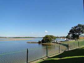
Manning River at Harrington | |||||||
|
Harrington | |||||||
| Coordinates | 31°52′S 152°41′E / 31.867°S 152.683°ECoordinates: 31°52′S 152°41′E / 31.867°S 152.683°E | ||||||
| Population | 1,753 (2006 census)[1] | ||||||
| Postcode(s) | 2427 | ||||||
| Elevation | 6 m (20 ft)[2] | ||||||
| Location | |||||||
| LGA(s) | City of Greater Taree | ||||||
| State electorate(s) | Port Macquarie | ||||||
| Federal Division(s) | Lyne | ||||||
| |||||||
Harrington is a small fishing village located at the mouth of the Manning River in New South Wales, Australia. It is 15 km north-east of Taree[3] on the Mid North Coast, and 335 kilometres (208 mi) north east of the state capital, Sydney. At the 2006 census, Harrington had a population of 1,753.[1] It was named after the Earl of Harrington by the explorer, John Oxley.[3]
Schools
References
- ↑ 1.0 1.1 Australian Bureau of Statistics (25 October 2007). "Harrington (Urban Centre/Locality)". 2006 Census QuickStats. Retrieved 2007-11-12.
- ↑ Bureau of Meteorology. Retrieved on 2007-11-12.
- ↑ 3.0 3.1 "Harrington, New South Wales". Geographical Names Register (GNR) of NSW. Geographical Names Board of New South Wales. Retrieved 1 August 2013.