Harlem Avenue
| 7200 West | |
| Location | Chicago |
|---|---|
| North end | Lehigh Avenue at Glenview Road in Glenview |
| South end | W County Line Road (328th South) in Peotone |

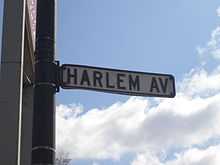
A street sign
Harlem Avenue is a major north-south street in Chicago, Illinois, United States and the west/southwest/northwest suburbs. It stretches from Glenview Road in Glenview to W County Line Road (328th st) in Peotone. At 54.1 miles it is the second-longest street in America to O Street in Nebraska. For most of its length it carries Illinois Route 43. There is a stop along the Metra BNSF Line at Harlem Avenue and Windsor Avenue in Berwyn, Illinois.
North of Glenview Road, Harlem Avenue is known as Lehigh Avenue.
Chicago neighborhoods and suburbs
From north to south:
- Glenview (Suburb)
- Morton Grove (Suburb)
- Niles (Suburb)
- Edison Park (City of Chicago)
- Norwood Park (City of Chicago)
- Harwood Heights (Suburb)
- Norridge (Suburb)
- Dunning (City of Chicago)
- Montclare (City of Chicago)
- Elmwood Park (Suburb)
- Austin (City of Chicago)
- River Forest (Suburb)
- Oak Park (Suburb)
- Forest Park (Suburb)
- Berwyn (Suburb)
- North Riverside (Suburb)
- Riverside (Suburb)
- Lyons (Suburb)
- Stickney (Suburb)
- Forest View (Suburb)
- Garfield Ridge (City of Chicago)
- Clearing (City of Chicago)
- Summit (Suburb)
- Bedford Park (Suburb)
- Bridgeview (Suburb)
- Burbank (Suburb)
- Oak Lawn (Suburb)
- Chicago Ridge (Suburb)
- Worth (Suburb)
- Palos Heights (Suburb)
- Orland Park (Suburb)
- Tinley Park (Suburb)
- Matteson (Suburb)
- Frankfort (Suburb)
- Monee (Suburb)
- Peotone (Suburb)
See also
- Chicago portal
- U.S. Roads portal