Hardinge County

Hardinge
New South Wales

Location in New South Wales
Lands administrative divisions around Hardinge:
Murchison Arrawatta Gough
Murchison Hardinge Clarke
Darling Inglis Sandon

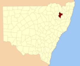
Hardinge County is one of the 141 Cadastral divisions of New South Wales.

Hardinge County was named in honour of Field Marshal, Sir Henry Hardinge (1785-1856.[1]

Parishes

A full list of parishes found within this county; their current LGA and mapping coordinates to the approximate centre of each location is as follows:

Parish LGA Coordinates
Abington Uralla Shire 30°14′54″S 151°16′04″E / 30.24833°S 151.26778°E
Aconite Inverell Shire 29°52′54″S 150°56′04″E / 29.88167°S 150.93444°E
Aston Guyra Shire 29°59′54″S 151°03′04″E / 29.99833°S 151.05111°E
Auburn Vale Inverell Shire 29°48′54″S 151°00′04″E / 29.81500°S 151.00111°E
Baker Uralla Shire 30°21′54″S 150°58′04″E / 30.36500°S 150.96778°E
Balala Uralla Shire 30°39′54″S 151°22′04″E / 30.66500°S 151.36778°E
Baldwin Uralla Shire 30°31′54″S 151°05′04″E / 30.53167°S 151.08444°E
Barlow Uralla Shire 30°19′54″S 151°13′04″E / 30.33167°S 151.21778°E
Buchanan Guyra Shire 30°08′54″S 151°17′04″E / 30.14833°S 151.28444°E
Bundarra Uralla Shire 30°06′54″S 151°05′04″E / 30.11500°S 151.08444°E
Cameron Uralla Shire 30°18′54″S 150°59′04″E / 30.31500°S 150.98444°E
Chapman Uralla Shire 30°21′54″S 151°08′04″E / 30.36500°S 151.13444°E
Chigwell Guyra Shire 30°03′54″S 151°08′04″E / 30.06500°S 151.13444°E
Clare Inverell Shire 29°52′54″S 151°00′04″E / 29.88167°S 151.00111°E
Clerk Guyra Shire 30°00′54″S 151°26′04″E / 30.01500°S 151.43444°E
Clerkness Uralla Shire 30°08′54″S 151°10′04″E / 30.14833°S 151.16778°E
Cooper Uralla Shire 30°03′54″S 150°58′04″E / 30.06500°S 150.96778°E
Copes Creek Guyra Shire 29°59′54″S 151°16′04″E / 29.99833°S 151.26778°E
Darby Guyra Shire 29°59′54″S 151°09′04″E / 29.99833°S 151.15111°E
Darbysleigh Uralla Shire 30°12′54″S 151°03′04″E / 30.21500°S 151.05111°E
Drummond Uralla Shire 30°14′54″S 151°00′04″E / 30.24833°S 151.00111°E
Elderbury Guyra Shire 30°13′54″S 151°37′04″E / 30.23167°S 151.61778°E
Everett Guyra Shire 30°06′54″S 151°33′04″E / 30.11500°S 151.55111°E
Honeysuckle Uralla Shire 30°33′54″S 151°16′04″E / 30.56500°S 151.26778°E
Laura Uralla Shire 30°12′54″S 151°10′04″E / 30.21500°S 151.16778°E
Mackenzie Guyra Shire 30°04′54″S 151°35′04″E / 30.08167°S 151.58444°E
Mayo Guyra Shire 29°56′54″S 151°00′04″E / 29.94833°S 151.00111°E
Moredun Guyra Shire 29°59′54″S 151°30′04″E / 29.99833°S 151.50111°E
Morse Uralla Shire 30°32′54″S 151°22′04″E / 30.54833°S 151.36778°E
New Valley Guyra Shire 30°02′54″S 151°20′04″E / 30.04833°S 151.33444°E
Nuandle Uralla Shire 30°31′54″S 151°10′04″E / 30.53167°S 151.16778°E
Ollera Guyra Shire 30°04′54″S 151°28′04″E / 30.08167°S 151.46778°E
Roumalla Uralla Shire 30°35′54″S 151°13′04″E / 30.59833°S 151.21778°E
Russell Armidale Dumaresq Shire 30°17′54″S 151°21′04″E / 30.29833°S 151.35111°E
Sandy Creek Armidale Dumaresq Shire 30°17′54″S 151°28′04″E / 30.29833°S 151.46778°E
Single Guyra Shire 29°59′54″S 151°21′04″E / 29.99833°S 151.35111°E
Skinner Guyra Shire 30°09′54″S 151°28′04″E / 30.16500°S 151.46778°E
St George Guyra Shire 30°10′54″S 151°22′04″E / 30.18167°S 151.36778°E
Stonybatter Uralla Shire 30°26′54″S 151°05′04″E / 30.44833°S 151.08444°E
Swinton Guyra Shire 29°55′54″S 151°16′04″E / 29.93167°S 151.26778°E
Tenterden Guyra Shire 30°05′54″S 151°24′04″E / 30.09833°S 151.40111°E
Tienga Guyra Shire 30°02′54″S 150°01′04″E / 30.04833°S 150.01778°E
Torryburn Uralla Shire 30°24′54″S 151°15′04″E / 30.41500°S 151.25111°E
Williams Guyra Shire 30°13′54″S 151°27′04″E / 30.23167°S 151.45111°E
Yarrowick Uralla Shire 30°23′54″S 151°22′04″E / 30.39833°S 151.36778°E

References

  1. "Hardinge County". Geographical Names Register (GNR) of NSW. Geographical Names Board of New South Wales.