Harbison Township, Dubois County, Indiana
| Harbison Township | |
|---|---|
| Township | |
|
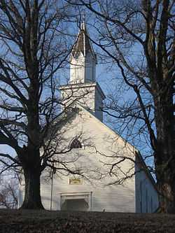
Evangelische Lutherische Emanuels Kirche, a historic site in the township | |
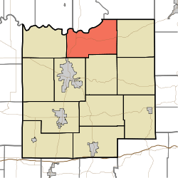 Location of Harbison Township in Dubois County | |
| Coordinates: 38°28′15″N 86°51′30″W / 38.47083°N 86.85833°WCoordinates: 38°28′15″N 86°51′30″W / 38.47083°N 86.85833°W | |
| Country | United States |
| State | Indiana |
| County | Dubois |
| Government | |
| • Type | Indiana township |
| Area | |
| • Total | 38.21 sq mi (99.0 km2) |
| • Land | 37.55 sq mi (97.3 km2) |
| • Water | 0.66 sq mi (1.7 km2) |
| Elevation[1] | 535 ft (163 m) |
| Population (2010) | |
| • Total | 1,588 |
| • Density | 42.3/sq mi (16.3/km2) |
| FIPS code | 18-31324[2] |
| GNIS feature ID | 453373 |
Harbison Township is one of twelve townships in Dubois County, Indiana. As of the 2010 census, its population was 1,588 and it contained 690 housing units.[3]
History
Harbison Township was named for Arthur Harbison, a pioneer settler and judge.[4]
Geography
According to the 2010 census, the township has a total area of 38.21 square miles (99.0 km2), of which 37.55 square miles (97.3 km2) (or 98.27%) is land and 0.66 square miles (1.7 km2) (or 1.73%) is water.[3]
Unincorporated towns
(This list is based on USGS data and may include former settlements.)
Adjacent townships
- Rutherford Township, Martin County (north)
- Lost River Township, Martin County (northeast)
- Columbia Township (east)
- Marion Township (south)
- Bainbridge Township (southwest)
- Boone Township (west)
- Reeve Township, Daviess County (northwest)
Major highways
Cemeteries
The township contains ten cemeteries: Cavender, Chattin, Cooper, Ewing, Gwin, Harbison, Hardin, Hope, Mount Zion and Reed.
References
- "Harbison Township, Dubois County, Indiana". Geographic Names Information System. United States Geological Survey. Retrieved 2009-09-24.
- United States Census Bureau cartographic boundary files
- ↑ "US Board on Geographic Names". United States Geological Survey. 2007-10-25. Retrieved 2008-01-31.
- ↑ "American FactFinder". United States Census Bureau. Retrieved 2008-01-31.
- ↑ 3.0 3.1 "Population, Housing Units, Area, and Density: 2010 - County -- County Subdivision and Place -- 2010 Census Summary File 1". United States Census. Retrieved 2013-05-10.
- ↑ Goodspeed Brothers. History of Pike and Dubois Counties, Indiana. p. 481. ISBN 978-5-87521-222-2.
External links
| |||||||||||||||||||||||||||||