Happō, Akita
| Happō 八峰町 | |||
|---|---|---|---|
| Town | |||
|
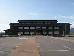
Happō Town Hall | |||
| |||
 Location of Happō in Akita Prefecture | |||
 Happō
| |||
| Coordinates: 40°17′48.6″N 140°2′3.4″E / 40.296833°N 140.034278°ECoordinates: 40°17′48.6″N 140°2′3.4″E / 40.296833°N 140.034278°E | |||
| Country | Japan | ||
| Region | Tōhoku | ||
| Prefecture | Akita | ||
| District | Yamamoto | ||
| Area | |||
| • Total | 224.20 km2 (86.56 sq mi) | ||
| Population (August 2013) | |||
| • Total | 7,741 | ||
| • Density | 33.1/km2 (86/sq mi) | ||
| Time zone | Japan Standard Time (UTC+9) | ||
| City symbols | |||
| - Tree | Fagus crenata | ||
| - Flower | Katakuri | ||
| - Bird | Common gull | ||
| - Fish | Hatahata | ||
| Phone number | 0185-77-2111 | ||
| Address | 118 Menagata, Minehama-Menagata, Happō-chō, Yamamoto-gun, Akita 018-2502 | ||
| Website | Official website | ||


Happō (八峰町 Happō-chō) is a town located in Yamamoto District, Akita, Japan. As of August 2013, the town had an estimated population of 7,741 and a population density of 33.1 persons per km2. The total area was 234.20 km2.
Happō is located at the far northwestern of Akita Prefecture, bordered by the World Heritage Site Shirakami Mountains to the south, and by Aomori Prefecture to the north and the Sea of Japan to the west. Due to its location, the temperature in Happō can get remarkably cold at night, with snowfall tending to be somewhat greater than that in neighboring municipalities
Neighboring municipalities
- Akita Prefecture
- Aomori Prefecture
History
The area of present-day Happō was part of ancient Dewa Province, dominated by the Satake clan during the Edo period, who ruled Kubota Domain under the Tokugawa shogunate. The modern town of Happō was created on March 27, 2006, by merging the village of Minehama, and the town of Hachimori, both from Yamamoto District.
Economy
The economy of Happō is based on agriculture and commercial fishing.
Transportation
Railway
- JR East - Gonō Line
- Sawame – Higashi-Hachimori – Hachimori - Takinoma - Akita-Shirakami - Iwadate - Ōmagoshi
Highway
External links
![]() Media related to Happō, Akita at Wikimedia Commons
Media related to Happō, Akita at Wikimedia Commons
- Official website (Japanese)
| ||||||||||||||||||||||||||||||||