Hanyū, Saitama
| Hanyū 羽生市 | ||
|---|---|---|
| City | ||
| ||
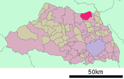 Location of Hanyū in Saitama Prefecture | ||
 Hanyū Location in Japan | ||
| Coordinates: 36°10′N 139°33′E / 36.167°N 139.550°ECoordinates: 36°10′N 139°33′E / 36.167°N 139.550°E | ||
| Country | Japan | |
| Region | Kantō | |
| Prefecture | Saitama Prefecture | |
| Government | ||
| • Mayor | Komei Kawata (since June 2006) | |
| Area | ||
| • Total | 58.55 km2 (22.61 sq mi) | |
| Population (February 1, 2011) | ||
| • Total | 56,712 | |
| • Density | 968.61/km2 (2,508.7/sq mi) | |
| Time zone | Japan Standard Time (UTC+9) | |
| Symbols | ||
| - Tree | Osmanthus fragrans | |
| - Flower | Wisteria floribunda | |
| Address |
6-15 Azuma, Hanyu-shi, Saitama-ken 348-8601 | |
| Phone number | 048-561-1121 | |
| Website |
www | |

Hanyū (羽生市 Hanyū-shi) is a city in Saitama Prefecture, Japan. The city was founded on September 1, 1954.
As of February 1, 2012, the city has an estimated population of 56,712, with 21,417 households, and a population density of 968.61 persons per km². The total area is 58.55 km2 (22.61 sq mi).
The city is located in the most northern part of Saitama Prefecture. Hanyū is served by the privately operated Tobu Isesaki Line and Chichibu Main Line.
Hanyū's northern border is the Tone River (Tonegawa). Before the river was redirected to its current course to control flooding, it used to flow though the city. This river was used as a major shipping route for locally produced textiles and goods from further up river. Hanyū flourished as a stopping point on the long ride toward Tokyo. Today only an irrigation channel remains in the approximate location of the original river path.
International relations
Twin towns and sister cities
Hanyū is twinned with the following municipalities.
-
 Baguio, Philippines (1969)
 -
 Kaneyama, Fukushima, Japan (1982)
 -
.svg.png) Durbuy, Belgium (1994)
Durbuy, Belgium (1994) -
 Milbrae, CA, USA (2014)[1]
References
External links
| Wikimedia Commons has media related to Hanyu, Saitama. |
- Official website (Japanese)
| |||||||||||||||||||||||||