Hang Dong District
| Hang Dong หางดง | |
|---|---|
| Amphoe | |
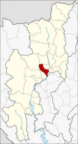
 Amphoe location in Chiang Mai Province | |
| Coordinates: 18°41′13″N 98°55′8″E / 18.68694°N 98.91889°ECoordinates: 18°41′13″N 98°55′8″E / 18.68694°N 98.91889°E | |
| Country |
|
| Province | Chiang Mai |
| Area | |
| • Total | 277.1 km2 (107.0 sq mi) |
| Population (2005) | |
| • Total | 67,570 |
| • Density | 243.8/km2 (631/sq mi) |
| Time zone | THA (UTC+7) |
| Postal code | 50230 |
| Geocode | 5015 |
Hang Dong (Thai: หางดง) is a district (amphoe) of Chiang Mai Province in northern Thailand. It is not to be confused with Hang-dong neighborhood in Seoul, South Korea.
Geography
Neighboring districts are (from the southwest clockwise) San Pa Tong, Mae Wang, Samoeng, Mae Rim, Mueang Chiang Mai, Saraphi of Chiang Mai Province, and Mueang Lamphun of Lamphun Province.
To reach Baan Tawaii. (famous handicraft center) you turn left just after Hang Dong market if you are driving from Chiang Mai. Hang Dong has a 9 hole golf course on the canal road.
Administration
The district is subdivided into 11 subdistricts (tambon), which are further subdivided into 113 villages (muban). Nong Thong Phattana is a township (thesaban tambon), which covers parts of tambon Nong Thong. There are further 10 Tambon administrative organizations (TAO).
| No. | Name | Thai name | Villages | Inh. | |
|---|---|---|---|---|---|
| 1. | Hang Dong | หางดง | 13 | 2,531 | |
| 2. | Nong Kaeo | หนองแก๋ว | 9 | 5,276 | |
| 3. | Han Kaeo | หารแก้ว | 9 | 5,767 | |
| 4. | Nong Tong | หนองตอง | 14 | 9,152 | |
| 5. | Khun Khong | ขุนคง | 9 | 4,772 | |
| 6. | Sop Mae Kha | สบแม่ข่า | 5 | 2,405 | |
| 7. | Ban Waen | บ้านแหวน | 13 | 9,537 | |
| 8. | San Phak Wan | สันผักหวาน | 7 | 8,928 | |
| 9. | Nong Khwai | หนองควาย | 12 | 8,344 | |
| 10. | Ban Pong | บ้านปง | 11 | 4,827 | |
| 11. | Nam Phrae | น้ำแพร่ | 11 | 6,031 |
Gallery
-

Wat Ton Kwaen, Hang Dong, (from 1858 CE), 8 km SW of Chiang Mai's city walls
-

Wihan, Wat Ton Kwaen, showing the wood carving
-

Interior view of the wihan
See also
- Chiang Mai Metropolitan Area
- "Wat Ton Kwen and Wat Hang Dong: Two Hidden Gems of Lan Na Architecture", in: Forbes, Andrew, and Henley, David, Ancient Chiang Mai v 4. Chiang Mai, Cognoscenti Books, 2012. ASIN: B006J541LE
External links
| Wikimedia Commons has media related to Amphoe Hang Dong. |
| ||||||