Hancock Township, Hancock County, Illinois
| Hancock Township | |
|---|---|
| Township | |
 Location in Hancock County | |
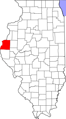 Hancock County's location in Illinois | |
| Coordinates: 40°24′59″N 90°57′58″W / 40.41639°N 90.96611°WCoordinates: 40°24′59″N 90°57′58″W / 40.41639°N 90.96611°W | |
| Country |
|
| State |
|
| County | Hancock |
| Established | April 27, 1855 |
| Area | |
| • Total | 38.17 sq mi (98.9 km2) |
| • Land | 38.17 sq mi (98.9 km2) |
| • Water | 0 sq mi (0 km2) 0% |
| Elevation | 554 ft (169 m) |
| Population (2010) | |
| • Total | 255 |
| • Density | 6.7/sq mi (2.6/km2) |
| Time zone | CST (UTC-6) |
| • Summer (DST) | CDT (UTC-5) |
| ZIP codes | 61420, 62321, 62326, 62367, 62374 |
| GNIS feature ID | 0429103 |
Hancock Township is one of twenty-five townships in Hancock County, Illinois, USA. As of the 2010 census, its population was 255 and it contained 129 housing units.[1] It was formed from Fountain Green and St. Mary's townships on April 27, 1855.
Geography
According to the 2010 census, the township has a total area of 38.17 square miles (98.9 km2), all land.[1]
Unincorporated towns
(This list is based on USGS data and may include former settlements.)
Cemeteries
The township contains these five cemeteries: Liberty, Majorville, Oak Grove, Spangler and Yetter.
Major highways
School districts
- Southeastern Community Unit School District 337
- West Prairie Community Unit School District 103
Political districts
- Illinois's 17th congressional district
- State House District 94
- State Senate District 47
References
- United States Census Bureau 2008 TIGER/Line Shapefiles
- "Hancock Township". Geographic Names Information System. United States Geological Survey. Retrieved 2009-09-20.
- United States National Atlas
- ↑ 1.0 1.1 "Population, Housing Units, Area, and Density: 2010 - County -- County Subdivision and Place -- 2010 Census Summary File 1". United States Census. Retrieved 2013-05-28.
External links

| |||||||||||||||||||||||||||||||||