Half Moon Bay Airport
| Half Moon Bay Airport Half Moon Bay Flight Strip | |||||||||||
|---|---|---|---|---|---|---|---|---|---|---|---|
|
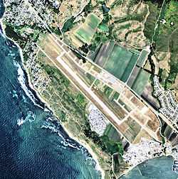
2006 USGS airphoto | |||||||||||
| IATA: HAF – ICAO: KHAF – FAA LID: HAF | |||||||||||
| Summary | |||||||||||
| Airport type | Public | ||||||||||
| Owner | San Mateo County | ||||||||||
| Location | Moss Beach, near Half Moon Bay, California | ||||||||||
| Elevation AMSL | 66 ft / 20 m | ||||||||||
| Coordinates | 37°30′48″N 122°30′04″W / 37.51333°N 122.50111°WCoordinates: 37°30′48″N 122°30′04″W / 37.51333°N 122.50111°W | ||||||||||
| Map | |||||||||||
 KHAF Location of Half Moon Bay Airport | |||||||||||
| Runways | |||||||||||
| |||||||||||
| Statistics (2008) | |||||||||||
| |||||||||||
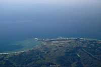
Half Moon Bay Airport (IATA: HAF, ICAO: KHAF, FAA LID: HAF) is a county-owned public use airport in San Mateo County, California, United States. It is located five nautical miles (9 km) northwest of the central business district of Half Moon Bay, California.[1][2] The airport is on the Pacific Coast, south of San Francisco.
History
The Half Moon Bay Airport is located approximately 20 miles south of San Francisco. It was constructed by the California State Highway Department for the U.S. Army in 1942 as an auxiliary airfield for Salinas Army Air Base.
Known as Half Moon Bay Flight Strip, the airport supported Salinas AAF's ground support mission to train light observation and reconnaissance squadrons. These would have been light aircraft and fighters modified with camera equipment. Salinas Army Air base also had the mission of conducting coastal patrols. As such, the airfield would have been garrisoned by a detachment of the 301st Base Headquarters and Air Base Squadron. With the reorganization of the Army Air Forces that took place in the first quarter of 1944, the Site was transferred to Air Technical Service Command and garrisoned by its own unit, the 4159th Army Air Forces Base Unit (Air Base). The mission of this unit was to operate the airfield for emergency landings, transient aircraft, and training missions. Other than refueling aircraft, no aircraft services would have been available.
On 1 June 1945, the War Department issued a five-year permit to the U.S. Navy to operate the Site as "Outlying Field, Half Moon Bay". Half Moon Bay field became an outlying field for Naval Air Station Moffett Field, to furnish facilities for utility aircraft providing target towing service for the Anti-Aircraft Training Center, Point Montara, California.
Following the end of World War II, San Mateo County acquired the airport from the Navy in 1947. The airport has served a variety of roles over the years and is currently an important business, transportation and emergency service asset to the community.
Facilities and aircraft

Half Moon Bay Airport covers an area of 325 acres (132 ha) at an elevation of 66 feet (20 m) above mean sea level. It has one runway designated 12/30 with an asphalt/concrete surface measuring 5,000 by 150 feet (1,524 x 46 m).[1]
Half Moon Bay Airport provides a variety of emergency service and response functions including: Air ambulance and Medevac flights; law enforcement and homeland security patrols; Coast Guard sea-rescue operations; and use as a disaster relief staging site for the airlifting of emergency supplies in the event that roads are closed during a disaster or emergency.
The Half Moon Bay Airport is home to approximately 80 aircraft and several aviation related businesses. The airport is self-funded through airport user and business fees and receives no money from the county’s General Fund.
For the 12-month period ending September 11, 2008, the airport had 60,150 aircraft operations, an average of 164 per day: 99.8% general aviation and 0.2% air taxi. At that time there were 40 aircraft based at this airport: 93% single-engine, 5% multi-engine and 3% helicopter.[1]
Pacific Coast Dream Machines
The airport hosts an annual benefit event in April, Pacific Coast Dream Machines, which features aircraft and automobiles.[3]
See also
- List of airports in the San Francisco Bay area
References
![]() This article incorporates public domain material from websites or documents of the Air Force Historical Research Agency.
This article incorporates public domain material from websites or documents of the Air Force Historical Research Agency.
- ↑ 1.0 1.1 1.2 1.3 FAA Airport Master Record for HAF (Form 5010 PDF), effective 2009-07-02.
- ↑ "Half Moon Bay Airport". Geographic Names Information System. United States Geological Survey. Retrieved 2009-05-04.
- ↑
External links
- Half Moon Bay Airport page at San Mateo County Public Works website
- FAA Terminal Procedures for HAF, effective April 2, 2015
- Resources for this airport:
- FAA airport information for HAF
- AirNav airport information for HAF
- ASN accident history for HAF
- FlightAware airport information and live flight tracker
- SkyVector aeronautical chart for HAF
| ||||||||||||||||||||||
| |||||||||||||||||||||||||||||||||||||||||

.svg.png)