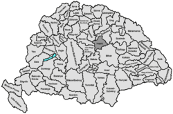
Hajdú County
| Hajdú County | |||||
| County of the Kingdom of Hungary | |||||
| |||||
|
Coat of arms | |||||
 | |||||
| Capital | Debrecen 47°32′N 21°38′E / 47.533°N 21.633°ECoordinates: 47°32′N 21°38′E / 47.533°N 21.633°E | ||||
| History | |||||
| - | Established | 1876 | |||
| - | Disestablished | 1950 | |||
| Area | |||||
| - | 1910 | 3,343 km2 (1,291 sq mi) | |||
| Population | |||||
| - | 1910 | 253,900 | |||
| Density | 75.9 /km2 (196.7 /sq mi) | ||||
| Today part of | Hungary | ||||
Hajdú, formerly known as Hajdúság, was an administrative county (comitatus) of the Kingdom of Hungary in present-day eastern Hungary. The capital of the county was Debrecen. The territory of the county is now part of the Hungarian county Hajdú-Bihar.
Geography
Hajdú county shared borders with the counties Heves, Borsod, Szabolcs, Bihar, Békés and Jász-Nagykun-Szolnok. The river Tisza touched its western border. The Hortobágy National Park steppe lies in the county. Its area was 3343 km² around 1910.
History
The Hajdúság region had a special status in the Kingdom of Hungary, but was turned into the proper county Hajdú in the 19th century. After World War II, it was merged with Bihar county (the Hungarian part of pre-Trianon Bihar county) and some smaller parts of the former Szabolcs county to form Hajdú-Bihar county, with its capital at Debrecen.
Demographics
In 1900, the county had a population of 223,612 people and was composed of the following linguistic communities:[1]
Total:
- Hungarian: 221,798 (99,2%)
- German: 972 (0,4%)
- Romanian: 288 (0,1%)
- Slovak: 164 (0,0%)
- Ruthenian: 26 (0,0%)
- Croatian: 24 (0,0%)
- Serbian: 16 (0,0%)
- Other or unknown: 324 (0,2%)
According to the census of 1900, the county was composed of the following religious communities:[2]
Total:
- Calvinist: 166,063 (74,3%)
- Roman Catholic: 29,549 (13,2%)
- Greek Catholic: 13,509 (6,0%)
- Jewish: 12,806 (5,7%)
- Lutheran: 1,220 (0,6%)
- Greek Orthodox: 298 (0,1%)
- Unitarian: 43 (0,0%)
- Other or unknown: 124 (0,0%)
Subdivisions
In the early 20th century, the subdivisions of Hajdú county were:
| Districts (járás) | |
|---|---|
| District | Capital |
| Hajdúböszörmény | Hajdúböszörmény |
| Hajdúszoboszló | Hajdúszoboszló |
| Központ | Debrecen |
| Urban counties (törvényhatósági jogú város) | |
| Debrecen | |
| Urban districts (rendezett tanácsú város) | |
| Hajdúböszörmény | |
| Hajdúszoboszló | |
| Hajdúnánás | |
- ↑ "KlimoTheca :: Könyvtár". Kt.lib.pte.hu. Retrieved 2012-12-06.
- ↑ "KlimoTheca :: Könyvtár". Kt.lib.pte.hu. Retrieved 2012-12-06.
.svg.png)
