Hafar Al-Batin
| Hafar Al Batin | |||
|---|---|---|---|
| |||
| Nickname(s): The Capital of the Spring | |||
 Hafar Al Batin | |||
| Coordinates: 28°26′3″N 45°57′49″E / 28.43417°N 45.96361°ECoordinates: 28°26′3″N 45°57′49″E / 28.43417°N 45.96361°E | |||
| Country |
| ||
| Province | Eastern Province | ||
| Established | 17 AH - 638 CE | ||
| Joint Saudi Arabia | 1925 | ||
| Government | |||
| • Manager of Municipality | Muhammad Hmoud AlShaie’a | ||
| • City Governor | Abdulmuhsen Al-Otaishan | ||
| • Deputy Governor | Musliet Abdulaziz AlZugaibi | ||
| • Provincial Governor | Muhammad bin Fahd | ||
| Population (2010) | |||
| • City | 271,642 | ||
| • Urban | 600,000 | ||
| • Metro | 49,457 | ||
| Hafar Al-Batin Municipality estimate | |||
| Time zone | AST (UTC+3) | ||
| • Summer (DST) | AST (UTC+3) | ||
| Postal Code | 31991 | ||
| Area code(s) | +966-3-7 | ||

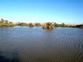
Hafar Al-Batin (Arabic: حفر الباطن Ḥafar al-Bāṭin) is a Saudi Arabian city in the Eastern Province and located in the Northeastern region. It is located 430 km the north of Riyadh, 94.2 km from Kuwait border and about 74.3 from the Iraq border. The city lies in the dry valley of the Wadi al-Batin, part of the larger valley of the long, now-dry river Wadi Al-Rummah, which leads inland toward Medina and formerly emptied into the Persian Gulf.
History
In the 1st century after hijrah in 638 CE, Hafar Al-Batin was just a route in the desert that pilgrims passed through from Mecca for Hajj. At that time, there was no water available in this land, the pilgrims travelled from Iraq to Mecca on a long route without water. During Uthman ibn Affan's reign (644 CE - 656 CE), complaints of pilgrims reached Abu-Musa al-Asha'ari, a companion of the Islamic prophet Muhammad, who answered by digging for new wells along this route in the Al-Batin valley. The name of Hafar Al-Batin (Arabic: حفر الباطن) is derived from this which means "the hole of Al-Batin Valley".
Population
In 2010, Hafar Al-Batin, had more than 35 villages in its suburban area and the population reached 389,993 to 600,000
- Hafar Al-Batin about +271,642 28°26′3″N 45°57′49″E / 28.43417°N 45.96361°E
- Qaisumah about +22,538 28°18′32″N 46°08′00″E / 28.30889°N 46.13333°E
- Al-Theebiyah about +14,442 28°07′30″N 45°40′03″E / 28.12500°N 45.66750°E
- Ar Raqa'i +5,665 29°01′00″N 46°33′00″E / 29.01667°N 46.55000°E
- As Su'ayerah about +3,607
- As Sufayri about +2,481 28°31′25″N 45°48′09″E / 28.52361°N 45.80250°E
- Al-Qalt - Ibn Tuwalah about +1,128 28°37′48″N 45°19′48″E / 28.63000°N 45.33000°E
- Samoudah about +914
- As Sadawi about +822
- Um Qulaib about +612 27°49′50″N 45°58′55″E / 27.83056°N 45.98194°E
- An Nazim about +585 28°39′00″N 45°13′12″E / 28.65000°N 45.22000°E
- Dhabhah about +267
- Um Ashar about +73 27°43′12″N 45°03′36″E / 27.72000°N 45.06000°E
- Al-Metiahah Al-Janobiyah about +61
- Al-Hamatiyat about +17
Communications
All the downtown and roads of Hafar Al-Batin are paved. It is connected with an international network of roads, connecting Saudi Arabia with Kuwait in the East and connecting the North with the Eastern Province. Hafar Al-Batin has two airports, Qaisumah (IATA: AQI, ICAO: OEPA) airport about 10 km in the east, and King Khalid Military City Airport (IATA: HBT, ICAO: OEKK) about 60 km in the south.
Districts
- Abu-Musa al-Asha'ari
- Al-Aziziah A
- Al-Aziziah B
- Al-Khalediyah
- Al-Rabwah
- Al-Muhammadiyah
- Al-Baladiyah
- Al-Rawdhah
- Al-Nayefiyah
- Al-Sulaimaniyah
- Al-Faisaliyah
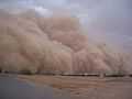
Climate
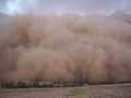
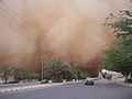
The weather in Hafar Al-Batin ranges from 4–8 °C (39–46 °F) in winter nights to 40–45 °C (104–113 °F) during summer days. The climate in general is hot and dry, and rains only during winter months.
Köppen-Geiger climate classification system classifies its climate as hot desert (BWh).[1]
| Climate data for Hafar Al-Batin | |||||||||||||
|---|---|---|---|---|---|---|---|---|---|---|---|---|---|
| Month | Jan | Feb | Mar | Apr | May | Jun | Jul | Aug | Sep | Oct | Nov | Dec | Year |
| Average high °C (°F) | 18.4 (65.1) |
20.9 (69.6) |
25.6 (78.1) |
32.1 (89.8) |
38.7 (101.7) |
42.5 (108.5) |
43.9 (111) |
43.4 (110.1) |
41.9 (107.4) |
35.1 (95.2) |
25.4 (77.7) |
19.9 (67.8) |
32.32 (90.17) |
| Daily mean °C (°F) | 12.4 (54.3) |
14.5 (58.1) |
18.9 (66) |
24.8 (76.6) |
30.9 (87.6) |
34 (93) |
35.6 (96.1) |
34.6 (94.3) |
33.1 (91.6) |
27.2 (81) |
18.5 (65.3) |
13.6 (56.5) |
24.84 (76.7) |
| Average low °C (°F) | 6.5 (43.7) |
8.1 (46.6) |
12.2 (54) |
17.6 (63.7) |
23.1 (73.6) |
25.5 (77.9) |
27.4 (81.3) |
25.9 (78.6) |
24.3 (75.7) |
19.4 (66.9) |
11.6 (52.9) |
7.3 (45.1) |
17.41 (63.33) |
| Average precipitation mm (inches) | 32 (1.26) |
37 (1.46) |
42 (1.65) |
29 (1.14) |
22 (0.87) |
0 (0) |
0 (0) |
4 (0.16) |
0 (0) |
9 (0.35) |
37 (1.46) |
29 (1.14) |
241 (9.49) |
| Source: Climate-Data.org (altitude: 310m)[1] | |||||||||||||
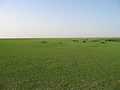
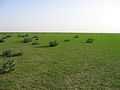
Galleries
Notes
- ↑ 1.0 1.1 "Climate: Hafar Al-Batin - Climate graph, Temperature graph, Climate table". Climate-Data.org. Retrieved 2014-02-23.
References
- Central Department of Statistics and Informations (Arabic)
- The Saudi Arabian Information Resource
- Otaishan assigned governor of Hafr albatin 2011 (Arabic)
External links
| Wikimedia Commons has media related to Hafar Al-Batin. |
| ||||||||||||||
| |||||||||||||||||||||||||||||||||||||||||||||||||||||||