Hadji Muhtamad, Basilan
| Hadji Muhtamad | |
|---|---|
| Municipality | |
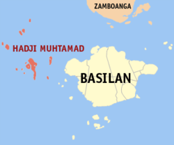 Map of Basilan with Hadji Muhtamad highlighted | |
.svg.png) Hadji Muhtamad Location within the Philippines | |
| Coordinates: 06°38′N 121°37′E / 6.633°N 121.617°ECoordinates: 06°38′N 121°37′E / 6.633°N 121.617°E | |
| Country | Philippines |
| Region | Autonomous Region in Muslim Mindanao (ARMM) |
| Province | Basilan |
| District | Lone district of Basilan |
| Founded | August 25, 2007 |
| Barangays | 10 |
| Government[1] | |
| • Mayor | Jamar A. Mansul |
| Population (2010)[2] | |
| • Total | 12,249, 12,249 |
| Time zone | PST (UTC+8) |
| ZIP code | 7301 |
| Dialing code | 62 |
| Income class | 6th |
Hadji Muhtamad is a sixth class municipality in the province of Basilan, Philippines. According to the 2010 census, it has a population of 12,249, 12,249 people.[2] Its territory includes the Pilas Islands and surrounding islets, west of Basilan Island.
It was created out of the 10 barangays of Lantawan that were not on Basilan Island, by virtue of Muslim Mindanao Autonomy Act No. 200, which was subsequently ratified in a plebiscite held on August 25, 2007.
Barangays
Hadji Muhtamad is politically subdivided into 10 barangays.[2]
- Baluk-Baluk
- Dasalan
- Lubukan
- Luukbungsod
- Mananggal
- Palahangan
- Panducan
- Sangbay Big
- Sangbay Small
- Tausan
Demographics
| Population census of Hadji Muhtamad | ||
|---|---|---|
| Year | Pop. | ±% p.a. |
| 2007 | 20,292 | — |
| 2010 | 12,249 | −16.78% |
| Source: National Statistics Office[2] | ||
References
- ↑ "Official City/Municipal 2013 Election Results". Intramuros, Manila, Philippines: Commission on Elections (COMELEC). 1 July 2013. Retrieved 5 September 2013.
- ↑ 2.0 2.1 2.2 2.3 "Total Population by Province, City, Municipality and Barangay: as of May 1, 2010". 2010 Census of Population and Housing. National Statistics Office. Retrieved 20 August 2014.
External links
- MMA Act No. 200 : An Act Creating the Municipality of Hadji Muhtamad in the Province of Basilan
- Philippine Standard Geographic Code
- Philippine Census Information
- Five (5) New Cities, Two (2) Municipalities and a Barangay created in the Third Quarter of 2007
 |
Sulu Sea | | ||
| Sulu Sea | |
Lantawan | ||
| ||||
| | ||||
| Sulu Sea |
| |||||||||||||||||
