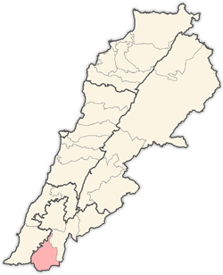
Haddatha
Haddatha[1] is a village in Southern Lebanon.
History
In 1881, the Palestine Exploration Fund's Survey of Western Palestine (SWP) described Haddatha: "A village, built of stone, containing about 150 Metawileh, on hill-top; a few grapes, figs and olives, and arable cultivation; there is a spring near and cisterns in village; a birket for cattle."[2]
References
Bibliography
- Conder, Claude Reignier; Kitchener, H. H. (1881). The Survey of Western Palestine: Memoirs of the Topography, Orography, Hydrography, and Archaeology 1. London: Committee of the Palestine Exploration Fund.
- Hütteroth, Wolf-Dieter; Abdulfattah, Kamal (1977). Historical Geography of Palestine, Transjordan and Southern Syria in the Late 16th Century. Erlanger Geographische Arbeiten, Sonderband 5. Erlangen, Germany: Vorstand der Fränkischen Geographischen Gesellschaft. ISBN 3-920405-41-2. (p. 184)
- Palmer, E. H. (1881). The Survey of Western Palestine: Arabic and English Name Lists Collected During the Survey by Lieutenants Conder and Kitchener, R. E. Transliterated and Explained by E.H. Palmer. Committee of the Palestine Exploration Fund.
- Rhode, Harold (1979). Administration and Population of the Sancak of Safed in the Sixteenth Century. Columbia University.
External links
- SWP map IV, IAA
- SWP map 4, Wikimedia commons
Coordinates: 33°10′N 35°23′E / 33.167°N 35.383°E
| |||||||||||||||||||||
