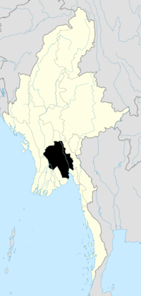
Gyobingauk
Gyobingauk is a small town and seat of Gyobingauk Township, Tharrawaddy District, in the Bago Region of southern-central Burma. It lies approximately 10 kilometres north of Okpho along National Highway 2.[1][2] It is located roughly 185 kilometres north of Yangon. The town has a Roman Catholic history with missionaries.
Notable people
References
External links
|
|---|
| Capital: | |
- Alegon (18°17'0"N 95°45'0"E)
- Alegon (18°17'0"N 95°31'0"E)
- Alegon (18°14'0"N 95°29'0"E)
- Bawbin
- Bigwe
- Bithalun
- Donwe
- Gokmakwin
- Gonnyindangyi
- Gyobingauk
- Gyobintha
- Gyokobin
- Kangyizu
- Kanu
- Kayingon
- Konywa
- Ko Pau Tē
- Kunhnaywa
- Kyakattangyi
- Kyedaw
- Kyundaw
- Kyungon
- Kyungongyi
- Lede
- Leinbingwin
- Le-myethna
- Letpandaw
- Letpangon
- Le-uzu
- Magyibinzu
- Mezalidan
- Migaukpin
- Myetnikwin
- Ngagyi
- Nyaunggon
- Obogon
- Okpo (18°19'0"N 95°41'0"E)
- Okpo (18°18'0"N 95°35'0"E)
- Onhnegyawdan
- Pandin
- Paukkon
- Payagyigon
- Ponnayeik
- Sandwin
- Shabinda
- Shazibo
- Singu
- Taukkyandaw
- Tawtanigon
- Thabyeyon
- Thahlapinzi
- Thakutkon
- Thayagon
- Theingyiyo
- Thetkegyingon
- Thitchogon
- Thitnapa
- Tumyaung
- Uyingyi
- Yeda
- Yindaikkon
- Yindaikkwin
- Yonbin
- Yongyaung
- Ywathagon
- Ywathaya
- Ywathit
|
|


