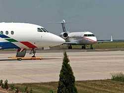
Győr-Pér International Airport
Coordinates: 47°37′28″N 017°48′49″E / 47.62444°N 17.81361°E
| Győr-Pér Airport Győr-Pér repülőtér | |||||||||||||||
|---|---|---|---|---|---|---|---|---|---|---|---|---|---|---|---|
 | |||||||||||||||
| IATA: QGY – ICAO: LHPR | |||||||||||||||
| Summary | |||||||||||||||
| Airport type | Public | ||||||||||||||
| Operator | Győr-Pér Repülőtér Kft. | ||||||||||||||
| Serves | Győr, Hungary | ||||||||||||||
| Location | Pér | ||||||||||||||
| Elevation AMSL | 424 ft / 129 m | ||||||||||||||
| Website | gyor-perairport.hu | ||||||||||||||
| Runways | |||||||||||||||
| |||||||||||||||
Győr-Pér Airport (Hungarian: Győr-Pér repülőtér) (IATA: QGY, ICAO: LHPR) is a public commercial airport near Győr, Hungary.
History
Győr-Pér Airport Development Ltd. was founded in 1994 with the aim of utilizing a former military grass airfield and development to an international regional airport. The airport is currently operated by Győr-Pér Airport Ltd.
Airlines and destinations
Effective January 2015, there are no regular passenger flights.
Negotiations have taken place with Wizzair on new routes.[3]
Ground transportation
The airport is located on highway 81, about 15 km from Győr city centre. It lies next to route 81 towards Székesfehérvár, easily accessible from the M1 highway. The direction of the airport is shown by traffic signs in the village of Pér. Ground travel times to nearby major cities depend on the density of traffic, and are approximately the following:
- To Győr approx. 10 min.
- To Vienna approx. 50-70 min.
- To Budapest approx. 50-60 min.
- To Bratislava approx.40-60 min.
References
- ↑ Airport data for Győr-Pér Airport, from official website
- ↑ Airport information for LHPR at World Aero Data. Data current as of October 2006.Source: DAFIF.
- ↑ "Győr mellől is repül majd a Wizz Air?". origo.hu. 3 July 2014. Retrieved 3 July 2014.
External links
- Official website
- Current weather for LHPR at NOAA/NWS
- Accident history for QGY at Aviation Safety Network
| ||||||||||||||