Gwadabawa
| Gwadabawa | |
|---|---|
| LGA and town | |
 Gwadabawa | |
| Coordinates: 13°22′11″N 5°13′48″E / 13.36972°N 5.23000°ECoordinates: 13°22′11″N 5°13′48″E / 13.36972°N 5.23000°E | |
| Country |
|
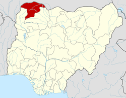
| State | Sokoto State |
| Area | |
| • Total | 991 km2 (383 sq mi) |
| Population (2006) | |
| • Total | 231,358 |
| Time zone | WAT (UTC+1) |
| 3-digit postal code prefix | 843 |
| ISO 3166 code | NG.SO.GW |
Gwadabawa is a Local Government Area in Sokoto State, Nigeria. Its headquarters are in the town of Gwadabawa on the A1 highway.
It has an area of 991 km² and a population of 231,358 at the 2006 census.
The postal code of the area is 843.[1]
References
- ↑ "Post Offices- with map of LGA". NIPOST. Retrieved 2009-10-20.
| |||||||||||||