Gurara
| Gurara | |
|---|---|
| LGA | |
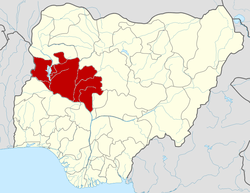
 Gurara Location in Nigeria | |
| Coordinates: 9°21′N 7°05′E / 9.350°N 7.083°ECoordinates: 9°21′N 7°05′E / 9.350°N 7.083°E | |
| Country |
|
| State | Niger State |
| Area | |
| • Total | 954 km2 (368 sq mi) |
| Population (2006 census) | |
| • Total | 90,974 |
| Time zone | WAT (UTC+1) |
| 3-digit postal code prefix | 910 |
| ISO 3166 code | NG.NI.GU |
Gurara is a Local Government Area in Niger State, Nigeria, adjoining the Federal Capital Territory. Its headquarters are in the town of Gawu. Major inhabitants are the Gwari people. The Gurara water falls is found here.
It has an area of 954 km² and a population of 90,974 at the 2006 census.
The postal code of the area is 910.[1]
References
- ↑ "Post Offices- with map of LGA". NIPOST. Retrieved 2009-10-20.
| |||||||||||||