Guna district
| Guna district गुना जिला | |
|---|---|
| District of Madhya Pradesh | |
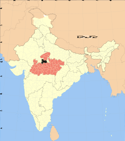 Location of Guna district in Madhya Pradesh | |
| Country | India |
| State | Madhya Pradesh |
| Administrative division | Gwalior |
| Headquarters | Guna, India |
| Tehsils | 1. Guna, 2. Raghogarh, 3. Aron, 4. Kumbhraj and 5. Chanchoda |
| Government | |
| • Lok Sabha constituencies | 1. Guna (shared with Shivpuri and Ashoknagar districts), 2. Rajgarh (shared with Rajgarh district) |
| • Assembly seats | 1. Bamori, 2. Guna, 3. Chachoura and 4. Raghogarh |
| Area | |
| • Total | 6,485 km2 (2,504 sq mi) |
| Population (2011) | |
| • Total | 1,240,938 |
| • Density | 190/km2 (500/sq mi) |
| • Urban | 24.46% |
| Demographics | |
| • Literacy | 65.1 per cent |
| • Sex ratio | 910 |
| Average annual precipitation | 65 mm |
| Website | Official website |
Guna district (Hindi: गुना जिला) is one of the 50 districts of Madhya Pradesh in central India. Its administrative headquarters is Guna. The district has a population of 12,40,938 (2011 census). It has an area of 6485 km², and is bounded on the northeast by Shivpuri District, on the east by Ashoknagar District, on the southeast by Vidisha District, on the southwest by Rajgarh District, on the west and northwest by Jhalawar and Baran districts of Rajasthan state. The Sindh River flows northward along the eastern edge of the district, forming part of the boundary with Ashoknagar District, and the Parbati River flows northwestward through the southern portion of the district, forming part of the boundary with Baran District before flowing into Rajasthan.
On August 15, 2003 Guna District was split in two, with the eastern portion becoming Ashoknagar District.
Divisions
Guna district is divided into 4 sub-divisions: Guna city, Raghogarh, Aron and Chanchoda. These are further divided into 5 tehsils: Guna, Raghogarh, Aron, Kumbhraj and Chanchoda.
There are 4 Madhya Pradesh Vidhan Sabha constituencies located in this district. Two of them, Bamori and Guna are part of Guna Lok Sabha constituency and the other two, Chachoura and Raghogarh are part of Rajgarh Lok Sabha constituency.[1]
Demographics
According to the 2011 census Guna District has a population of 1,240,938,[2] roughly equal to the nation of Trinidad and Tobago[3] or the US state of New Hampshire.[4] This gives it a ranking of 388th in India (out of a total of 640).[2] The district has a population density of 194 inhabitants per square kilometre (500/sq mi) .[2] Its population growth rate over the decade 2001-2011 was 26.91%.[2] Guna has a sex ratio of 910 females for every 1000 males,[2] and a literacy rate of 65.1%.[2]
See also
Bajrangarh Fort, a 16–17th century fort in the Gunar District
References
- ↑ "Delimitation of Parliamentary and Assembly Constituencies Order, 2008 Schedule XVI" (PDF). The Election Commission of India. pp. 228–9, 250–1.
- ↑ 2.0 2.1 2.2 2.3 2.4 2.5 "District Census 2011". Census2011.co.in. 2011. Retrieved 2011-09-30.
- ↑ US Directorate of Intelligence. "Country Comparison:Population". Retrieved 2011-10-01.
Trinidad and Tobago 1,227,505 July 2011 est.
- ↑ "2010 Resident Population Data". U. S. Census Bureau. Retrieved 2011-09-30.
New Hampshire 1,316,470
External links
- Guna District website
- List of places in Guna
 |
Baran district, Rajasthan | Shivpuri district | | |
| Jhalawar district, Rajasthan | |
Ashoknagar district | ||
| ||||
| | ||||
| Rajgarh district | Bhopal district | Vidisha district |
| ||||||||||||||||||||||||||
| ||||||||||||||||||||||||||||||
Coordinates: 24°38′24″N 77°19′12″E / 24.64000°N 77.32000°E