Guitalens-L'Albarède
| Guitalens | ||
|---|---|---|
| ||
 Guitalens | ||
|
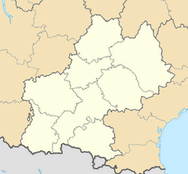
Location within Midi-Pyrénées region  Guitalens | ||
| Coordinates: 43°38′38″N 2°02′17″E / 43.6439°N 2.0381°ECoordinates: 43°38′38″N 2°02′17″E / 43.6439°N 2.0381°E | ||
| Country | France | |
| Region | Midi-Pyrénées | |
| Department | Tarn | |
| Arrondissement | Castres | |
| Canton | Vielmur-sur-Agout | |
| Intercommunality | Pays d'Agout | |
| Area1 | 5.65 km2 (2.18 sq mi) | |
| Population (2006)2 | 716 | |
| • Density | 130/km2 (330/sq mi) | |
| INSEE/Postal code | 81107 / 81220 | |
| Elevation |
139–290 m (456–951 ft) (avg. 145 m or 476 ft) | |
|
1 French Land Register data, which excludes lakes, ponds, glaciers > 1 km² (0.386 sq mi or 247 acres) and river estuaries. 2 Population without double counting: residents of multiple communes (e.g., students and military personnel) only counted once. | ||
Guitalens-L'Albarède is a commune in the Tarn department in southern France.
On 29 June 2007, the commune was formed by the amalgamation of Guitalens and Lalbarède[1]
See also
References
| Wikimedia Commons has media related to Guitalens-L'Albarède. |
.svg.png)