Grovedale, Victoria
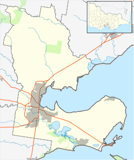
| Grovedale Geelong, Victoria | |||||||||||||
|---|---|---|---|---|---|---|---|---|---|---|---|---|---|
|
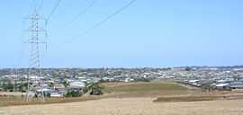
Looking south towards Grovedale from Highton | |||||||||||||
 Grovedale | |||||||||||||
| Coordinates | 38°12′0″S 144°21′0″E / 38.20000°S 144.35000°ECoordinates: 38°12′0″S 144°21′0″E / 38.20000°S 144.35000°E | ||||||||||||
| Population | 13,186 (2006)[1] | ||||||||||||
| LGA(s) | City of Greater Geelong | ||||||||||||
| State electorate(s) | South Barwon | ||||||||||||
| Federal Division(s) | Corangamite | ||||||||||||
| |||||||||||||
Grovedale is a mainly residential southern suburb of Geelong, Victoria, Australia.
History
Toponomy
It was originally named Germantown due to several families of Lutheran German origin who arrived in 1849 and the community expanded during the 1860s. German Cottage, a house from this period located on Torquay Road, is listed on the Victorian Heritage Register.[2]
In September 1915, after the outbreak of the first world war, the South Barwon Council changed the named to Grovedale - the name of a nearby property bought by Alexander Pennell in 1847.[3] The Post Office was renamed on 1 March 1916.[4]
Settlement
A Post Office had opened on 21 January 1860.[4] There were also two hotels, two flour mills, two tanneries and four wool-washing businesses.
The hilly country and volcanic soil were ideal for orchards and vineyards. The area earned a significant reputation for its bad smell and was Victoria's largest wine-producing region, thanks to the efforts of Prussian(German) migrants.
Postwar housing boom
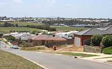
Residential expansion commenced in Grovedale in the late 1960s, the first housing estates branching off the Surfcoast Highway. Later expansion throughout the 1970s to the 1990s moved to the west along Church Street, Pioneer Road, and Heyers Road.
A Grovedale East Post Office opened in 1996 near the Surf Coast Highway.[4]
Grovedale was formerly the southern suburban boundary for Geelong prior to the development of the Armstrong Creek Growth Area.[5] The suburb previously included land south of the Warrnambool railway line; however, on 23 February 2012, the state government made significant changes to the suburban boundaries in the area, creating two new suburbs (Armstrong Creek and Charlemont) on the east side of the Surf Coast Highway, and extending the boundaries of Mount Duneed to the railway on the east side of the highway. The southern boundary of the suburb now ends at the railway line.[6]
Transport
Grovedale is located on the Surfcoast Highway that links the suburb the centre of Geelong, as well as to the coastal town of Torquay. Pioneer Road runs east west though Grovedale, the road not being completed eastward across the Waurn Ponds Creek until the late 1980s.[7]
Public transport to the area is provided by buses operated by Benders Buslines and McHarrys Buslines, on routes to the Geelong city centre travelling via Deakin University, Belmont, Highton and Waurn Ponds.
The 2003–04 Victorian State Budget saw funding made available for an extension of rail services on the line between Melbourne and Geelong southwards to Grovedale. A decision was instead made to proceed with a new station at nearby Marshall, with the new Marshall station opened in 2005.[8][9] A subsequent decision to extend the line further was made in the 2010s, with the new Waurn Ponds station opening on October 12 2014.[10]
See also
- Grovedale College
- Australian place names changed from German names
References
- ↑ Australian Bureau of Statistics (25 October 2007). "Grovedale (State Suburb)". 2006 Census QuickStats. Retrieved 2007-10-01.
- ↑ "German Cottage (H0714)". Victorian Heritage Register. Heritage Victoria. Retrieved 2014-03-23.
- ↑ City of Greater Geelong: Grovedale
- ↑ 4.0 4.1 4.2 Premier Postal History, Post Office List, retrieved 2008-04-11
- ↑ City of Greater Geelong: Armstrong Creek Urban Growth Plan
- ↑ "General Gazette Number G8" (PDF). Victoria Government Gazette. Government of Victoria. 23 February 2012. p. 36. Retrieved 4 July 2014.
- ↑ Gregory's 1982-83 Melbourne Street Directory
- ↑ Department of Infrastructure: Marshall Railway Station
- ↑
- ↑ "Waurn Ponds Station". Public Transport Victoria. Retrieved 23 October 2014.