Großer Beerberg
| Grosser Beerberg | |
|---|---|
|
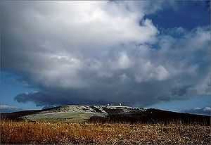
View of Großer Beerberg from the south; in the foreground is Suhl-Goldlauter | |
| Elevation | 982 m (3,222 ft) |
| Pronunciation | German: [ˈɡʁoːsɐ ˈbeːɐ̯bɛɐ̯k] |
| Location | |
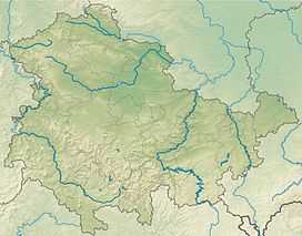 Grosser Beerberg The location within Thuringia | |
| Location | Thuringia, Germany |
| Range | Thuringian Forest |
| Coordinates | 50°39′34″N 10°44′46″E / 50.65944°N 10.74611°ECoordinates: 50°39′34″N 10°44′46″E / 50.65944°N 10.74611°E |
The Grosser Beerberg is a mountain located in the Thuringian Forest, Germany and the highest point in Thuringia. The nearest town is Suhl, in Ilm-Kreis.
Between Beerberg's summit and that of its eastern neighbor, Schneekopf (978 m), the second highest mountain of Thuringia, is a 60 m deep col. To the west is Sommerbachskopf (941 m).
On the summit of Beerberg is one of the few moorlands of the Thüringer Wald. Until the end of the 1980s there was an observation tower on the mountain. A few years ago a small platform was again established below the summit at Plänckners Aussicht, which offers an outstanding view to the south and southwest.
The section of the Rennsteig walkway between Oberhof and Schmücke runs across the mountain.
See also
- List of mountains in Thuringia
- List of mountain and hill ranges in Germany
External links
- "Beerberg, Germany". Peakbagger.com.
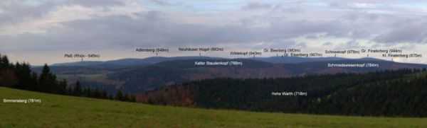
Adlersberg (849 m) with Neuhäuser Hügel (891 m), Großer Beerberg (partly obscured, 982 m), Wildekopf (943 m), Großer Eisenberg (907 m), Schneekopf (978 m), Großer Finsterberg (944 m) and Kleiner Finsterberg (875 m); in the foreground, Kalter Staudenkopf (768 m), Schmiedswiesenkopf (784 m) and Hohe Warth (718 m); in the left background is Pleß (645 m), 52 km away in the Rhön Mountains.

| ||||||||