Greysouthen
| Greysouthen | |
 Greysouthen |
|
| Population | 643 |
|---|---|
| OS grid reference | NY07086 29077 |
| – London | 250 mi (400 km) S |
| Civil parish | Allerdale |
| Shire county | Cumbria |
| Region | North West |
| Country | England |
| Sovereign state | United Kingdom |
| Post town | CARLISLE |
| Postcode district | CA13 |
| Dialling code | 019000 |
| Police | Cumbria |
| Fire | Cumbria |
| Ambulance | North West |
| EU Parliament | North West England |
| UK Parliament | Workington |
Coordinates: 54°38′53″N 3°26′28″W / 54.648°N 3.441°W
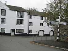
Greysouthen (Pronounced: "Grey-soon") is a village and civil parish between the towns of Workington and Cockermouth, in Cumbria, North West England. The village has an historic association with coal mining.
History
John Marius Wilson's 1870 Imperial Gazetteer described Greysouthen as a settlement of 136 houses, an agricultural implement factory, a Quakers' chapel, a Wesleyan chapel and a flex mill. In 1901 Greysouthen civil parish had an area of 1,558 acres[1]
Mining
Evidence of settlers digging for coal across west Cumbria can be dated back to the 13th century.[2] This was the source of developing tools and weaponry in order to survive.[2] Evidence of mining for coal within the Greysouthen area can be seen from the late 16th century.[3]
The largest portion of Greysouthen's Coal lease was sold to William Walker & Company in 1787. The business continued to remain profitable for the next 80 years. In 1800 another firm took claim to a portion of the Greysouthen coal extraction industry. Wilson & Company invested in another Colliery within Greysouthen. The two colliery's distributed coal tokens which represented the success of the mines. Between these two mines a feud broke out over mine space. Wilson & Co was fined £16,000 damages over illegally mining William Walker & Company's land. This was a highly prolific case within the north of England with much public interest.
By the start of the 19th century Greysouthen's thriving mining industry had become the sole employer. To house miners, small rows of cottages were built within the town. In 1823 Joseph Birbeck and J.W. Flecter began mining in Greysouthen. A tax value of £20 was introduced for the annual lease of 400 tons of coal. For every ton mined over this, an additional tax of 1 shilling was applied.[4]
The Melgramfitz pit was closed in 1886, which lead to the end of the Greysouthen as a coal mining community.[1]
Greysouthen's 19th-century miners were known for their ale consumption, which magistrates felt was there prime concern.[5]
Community
Greysouthen is surrounded by farmland through which two streams run. The village is divided into two by the local residents – "up the went" and "down the went". The 'went' is a hill at the centre of Greysouthen.
The village's few services include a village hall which is used as a Post Office on Monday afternoons. St Josephs Roman Catholic Church is approximately 3 miles (5 km) from the centre of the village. Greysouthen has one large playing field with an adventure playground, football pitch, and a garden commemorating the Queen's Silver Jubilee.
Greysouthen receives a bus service about ten times daily, with connections to Workington and Cockermouth. The service is funded by the county council and operated by minor bus companies.
The nearest school is Paddle Primary School in the neighbouring village of Eaglesfield. The nearest secondary school is at Cockermouth, and is Specialist School for Mathematics, Computing and Languages, and teaches over 1400 students,.
The parish council has been supporting Cumbrian rural communities over the introduction of superfast broadband and mobile coverage.
Ecology
There are 7 beaches within 10 miles (16 km) of Greysouthen, Siddick is the closest at about 5 miles (8 km); the second closest is Maryport then Workington, Allonby South, Allonby, Parton and Whitehaven.
The Greysouthen area supports a variety of bird species including northern lapwings, common snipes, Eurasian curlews, common woodpigeons, buzzards, Eurasian oystercatchers, common pheasants, Eurasian sparrowhawks, and quail. Red squirrels are also found. Orange tips, red admirals, and painted lady butterflies occur within the area.[6]
Locally growing west Cumbrian wild plants include the greater butterfly orchid, early purple orchid and yellow rattle.
Population
| Year of Census | Total Population[7] |
|---|---|
| 1880 | 700 |
| 1890 | 550 |
| 1900 | 490 |
| 1910 | 525 |
| 1920 | 514 |
| 1930 | 506 |
| 1950 | 502 |
| 1960 | 500 |
The population of Greysouthen between 1880 and 1900 fell by about 210 people in a 20-year period, this a period after the closure of the local mines. The sphere of influence and pull factors keeping residents in the village must have been removed. It is most likely many migrated in search of work. The population increased by about 35 to approximately 525 in 1910, before steadily decreasing to about 500 in 1960.[7] The population of Greysouthen has remained between 500 and 700 since 1960.
References
- ↑ 1.0 1.1 "The Flectchers". Bulmer's History & Directory Of Cumberland, 1901. Retrieved 2 May. Check date values in:
|accessdate=(help) - ↑ 2.0 2.1 "Visit Cumbria". VisitCumbria. Retrieved 2 May. Check date values in:
|accessdate=(help) - ↑ "Cumbria's Past History". Cumbria past. Retrieved 2 May. Check date values in:
|accessdate=(help) - ↑ Cumbria mining history explained "Details of Cumbria". Retrieved 2 May. Check date values in:
|accessdate=(help) - ↑ "Greysouthen", Visitoruk.com
- ↑ "Villages in Cumbria". The Cumbria Directory. Retrieved 2 May. Check date values in:
|accessdate=(help) - ↑ 7.0 7.1 "Greysouthen Tn/CP" A Vision of Britain through Time
External links
![]() Media related to Greysouthen at Wikimedia Commons
Media related to Greysouthen at Wikimedia Commons