Great Chart with Singleton
| Great Chart with Singleton | |
 Great Chart with Singleton |
|
| Population | 4,206 [1] |
|---|---|
| OS grid reference | TQ984418 |
| Civil parish | Great Chart with Singleton |
| District | Ashford |
| Shire county | Kent |
| Region | South East |
| Country | England |
| Sovereign state | United Kingdom |
| Post town | TONBRIDGE |
| Postcode district | TN23 |
| Dialling code | 01233 |
| Police | Kent |
| Fire | Kent |
| Ambulance | South East Coast |
| EU Parliament | South East England |
| UK Parliament | Ashford |
| Website | Parish Council |
Coordinates: 51°08′27″N 0°50′14″E / 51.1409°N 0.8372°E
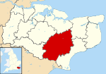
Great Chart with Singleton is a civil parish in the Ashford District of Kent, England. The parish is split between the ancient village of Great Chart and the modern Singleton housing development.
The village of Great Chart is located on western outskirts of Ashford town, about two miles (3.2 km) from the town centre.
The medieval parish church is dedicated to St Mary; there is also Grace Fellowship (an independent evangelical church and member of the FIEC Fellowship of Independent Evangelical Churches) which meets 10:30am on Sunday mornings at the old Methodist church building formally known as St John‘s.
References
- ↑ Ashford Borough Council Census 2001