Great Chart
| Great Chart | |
 Great Chart |
|
| Area | 13.31 km2 (5.14 sq mi) |
|---|---|
| Population | 6,801 (Civil Parish)[1] |
| – density | 511/km2 (1,320/sq mi) |
| OS grid reference | TQ983422 |
| Civil parish | Great Chart with Singleton |
| District | Ashford |
| Shire county | Kent |
| Region | South East |
| Country | England |
| Sovereign state | United Kingdom |
| Post town | Ashford |
| Postcode district | TN23 |
| Dialling code | 01233 |
| Police | Kent |
| Fire | Kent |
| Ambulance | South East Coast |
| EU Parliament | South East England |
| UK Parliament | Ashford |
Coordinates: 51°08′27″N 0°50′14″E / 51.1409°N 0.8372°E
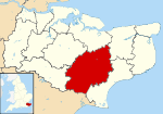
Great Chart is a village in civil parish of Great Chart with Singleton in the Ashford Borough of Kent, England. The parish is split between the ancient village of Great Chart and the modern Singleton neighbourhood on the western outskirts of Ashford. The village centre of Great Chart is 2 miles (3.2 km) from the town centre.
Description
Most of the land is agricultural and the north-east quarter contains most of the housing in alike construction 20th and 21st century neighbourhoods. A cluster of listed buildings is in the old centre of Great Chart. The area drains via many streams and underwater drainage to the West Stour along the northern boundary before its merger into the Great Stour in Ashford.[2]
Amenities
Great Chart has two pubs: A food led pub, The Swan and Dog and The Hoodener's Horse which serves a great pint.
A cricket club with competing elevens (XIs), including colts sides have a ground and pavilion in the village.
The medieval parish church is of an ecclesiastical parish on the same boundaries and is dedicated to St Mary; its community in Singleton is larger than that in the church at meetings in the village hall.
Cross-village sports clubs, gardening clubs and social circles cover the area.
Former residents
Victoria Cross recipient Major William Leet died in Great Chart.
Transport
A short taxi ride or bus journey connects the borough with international rail, with Ashford International railway station in the nearest town centre.
The civil parish is bisected by numerous footpaths and one A road, which veers from heading south into a western direction, the A28 road, which is not dual carriageway. A straight, relatively low speed, railway line marks off the north quarter the parish. The M20 motorway is immediately to the north of the area's boundary.
External links
| Wikimedia Commons has media related to Great Chart. |
- Parish Council notes Ashford Borough Council.
- St Mary's, Great Chart
- Village history academic blog from 762 AD
- Great Chart Cricket Club
- Geograph accepted photographs
- Statistical overview of civil parish - map
References
- ↑ Key Statistics; Quick Statistics: Population Density United Kingdom Census 2011 Office for National Statistics Retrieved 10 May 2014
- ↑ OS Map with Listed Buildings and Parks marked
 |
Little Chart | Godinton | Ashford | |
| Smarden | |
South Ashford | ||
| ||||
| | ||||
| Bethersden | Chilmington Green | Singleton |