Grayrigg Forest
| Grayrigg Forest | |
|---|---|
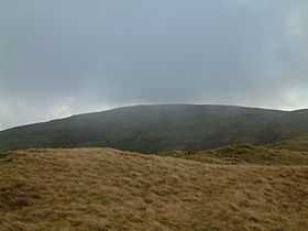 Grayrigg Forest from further west on Grayrigg Common | |
| Elevation | 494 m (1,621 ft) |
| Prominence | 190 m (620 ft) |
| Parent peak | High Street |
| Listing | Marilyn |
| Location | |
 Grayrigg Forest | |
| OS grid | SD598998 |
| Coordinates | 54°23′31″N 2°37′14″W / 54.39208°N 2.6206°WCoordinates: 54°23′31″N 2°37′14″W / 54.39208°N 2.6206°W |
| Topo map | OS Landranger 97 |
Grayrigg Forest is a hill in England, located on the eastern edge of what might be considered the Lake District, though lying outside the national park. Reaching 494 metres above sea level, it is attainable from the less well-known Borrowdale valley.
From near the summit, there are impressive views down into the gorge of the Lune valley, where road, West Coast Main Line railway, M6 motorway and River Lune crowd between the outliers of the Lake District and the Howgill Fells.
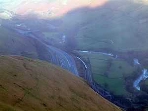
The Lune valley with M6 motorway and West Coast Main Line railway from near the summit of Grayrigg Forest
| ||||||||||||||||||||||||||||||||||||||||||||