Grand Falls, Minnesota
| Grand Falls, Minnesota | |
|---|---|
| Unincorporated community | |
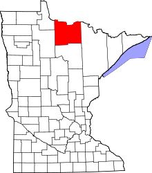
 Grand Falls, Minnesota Location of the community of Grand Falls | |
| Coordinates: 48°11′55″N 93°47′34″W / 48.19861°N 93.79278°WCoordinates: 48°11′55″N 93°47′34″W / 48.19861°N 93.79278°W | |
| Country | United States |
| State | Minnesota |
| County | Koochiching |
| Elevation | 1,227 ft (374 m) |
| Population | |
| • Total | 30 |
| Time zone | Central (CST) (UTC-6) |
| • Summer (DST) | CDT (UTC-5) |
| ZIP code | 56627 |
| Area code(s) | 218 |
| GNIS feature ID | 654732[1] |
Grand Falls is an unincorporated community in Koochiching County, Minnesota, United States.
The community is located immediately north of Big Falls at the junction of County Roads 13 and 31; and U.S. Highway 71.
Grand Falls is located within ZIP code 56627 based in Big Falls.
Geography
Grand Falls is located within South Koochiching Unorganized Territory.
Big Falls Municipal Airport is nearby.
The community of Grand Falls is located across the Big Fork River from the city of Big Falls. Grand Falls is also located 38 miles southwest of International Falls.
References
- Rand McNally Road Atlas – 2007 edition – Minnesota entry
- Official State of Minnesota Highway Map – 2011/2012 edition
- Mn/DOT map of Koochiching County – Sheet 1 – 2011 edition
| |||||||||||||||||||||||||||||
