Grade I listed buildings in Hampshire
Hampshire shown in England
There are over 6000 Grade I listed buildings in England. This page is a list of these buildings in the county of Hampshire.
Basingstoke and Deane
.jpg)

.jpg)


City of Portsmouth
| Name | Location | Type | Completed [note 1] | Date designated | Grid ref.[note 2] Geo-coordinates |
Entry number [note 3] | Image |
|---|---|---|---|---|---|---|---|
| 18 Gun Battery and Flanking Battery, Kings Stairs, Sallyport, Pointbarracks | The Point, City of Portsmouth | Gate | Late 17th century | 30 October 1969 | SZ6301599308 50°47′24″N 1°06′27″W / 50.789925°N 1.107378°W |
1386892 | 
|
| Block Mill and Numbers 35 and 36 Stores (building Number 1/53) | Her Majestys Naval Base, City of Portsmouth | Wall | 17th century | 13 August 1999 | SU6285800814 50°48′13″N 1°06′34″W / 50.803483°N 1.109348°W |
1078288 |
|
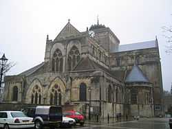
| Cathedral Church of St Thomas | City of Portsmouth | Cathedral | 1927 | 10 January 1953 | SZ6323299381 50°47′26″N 1°06′15″W / 50.790558°N 1.104288°W |
1333198 | 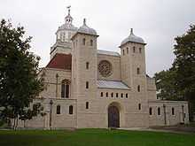 |
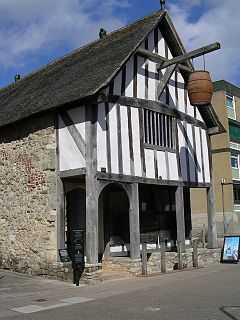
| Charles Dickens Birthplace Museum | Landport, City of Portsmouth | House | Late 18th century | 10 January 1953 | SU6440801230 50°48′25″N 1°05′14″W / 50.807053°N 1.087282°W |
1103850 |  |
| Docks 1 to 6 (consecutive) Quay Walls and Bollards (including North and South Camber Mast Pond and Tunnel to Same) | Her Majestys Naval Base, City of Portsmouth | Bollard | Mid 19th century | 13 August 1999 | SU6284300724 50°48′10″N 1°06′34″W / 50.802675°N 1.109576°W |
1272267 |
|
| Fort Southwick, That Part in Portsmouth Civil Parish | City of Portsmouth | Fort | c. 1860 | 30 October 1969 | SU6282306838 50°51′28″N 1°06′32″W / 50.857651°N 1.108814°W |
1104368 | 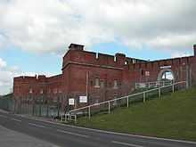 |
| Landport Gate | Portsea, Portsmouth | Town Gate | 1760 | 18 March 1999 | SZ6346399717 50°47′37″N 1°06′03″W / 50.793553°N 1.100953°W |
1387159 |
|
| Number 10 Store (building Number 1/58) | Her Majestys Naval Base, City of Portsmouth | Museum | c. 1991 | 13 August 1999 | SU6284700479 50°48′02″N 1°06′34″W / 50.800472°N 1.109561°W |
1272284 | 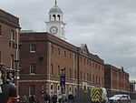 |
| Number 11 Store (building Number 1/59) | Her Majestys Naval Base, City of Portsmouth | Library | 1999 | 13 August 1999 | SU6280700540 50°48′04″N 1°06′36″W / 50.801025°N 1.110118°W |
1272285 |
|
| Number 9 Store (building Number 1/35) | Her Majesty's Naval Base, City of Portsmouth | Naval Storehouse | 1782 | 13 August 1999 | SU6288900409 50°47′59″N 1°06′32″W / 50.799838°N 1.108977°W |
1272283 | 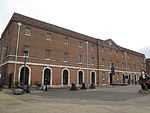 |
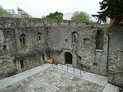
| The Round Tower | The Point, City of Portsmouth | Artillery Tower | c. 1415 | 30 October 1969 | SZ6291199373 50°47′26″N 1°06′32″W / 50.79052°N 1.108842°W |
1386901 | 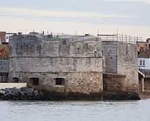 |
| The Square Tower | The Point, City of Portsmouth | Powder Magazine | c. 1580 | 30 October 1969 | SZ6307699247 50°47′22″N 1°06′23″W / 50.78937°N 1.106523°W |
1386904 | 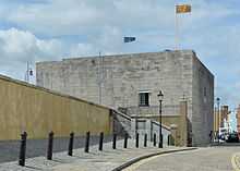 |
City of Southampton
Main article: Listed buildings in Southampton
.jpg)
.jpg)
.jpg)
.jpg)
.jpg)
.jpg)
.jpg)
.jpg)
.jpg)
East Hampshire
| Name | Location | Type | Completed [note 1] | Date designated | Grid ref.[note 2] Geo-coordinates |
Entry number [note 3] | Image |
|---|---|---|---|---|---|---|---|
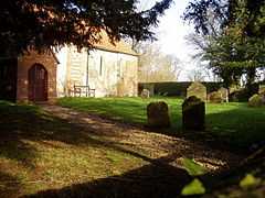
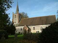
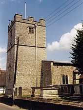
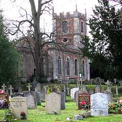
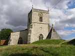
| Parish Church of St Lawrence | Alton, East Hampshire | Parish Church | Norman | 13 March 1951 | SU7172239602 51°09′04″N 0°58′33″W / 51.151192°N 0.975938°W |
1338903 | 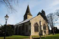 |
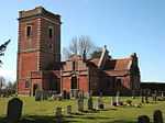
| Church of the Holy Cross | Binsted, Binsted, East Hampshire | Parish Church | Early 12th century | 31 July 1963 | SU7714240938 51°09′45″N 0°53′53″W / 51.162499°N 0.898175°W |
1302151 | 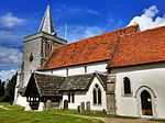 |
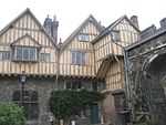
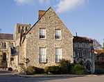
| Jane Austen's House | Chawton, East Hampshire | House | 18th century | 31 July 1963 | SU7083437579 51°07′59″N 0°59′21″W / 51.133115°N 0.989029°W |
1178917 | .jpg) |
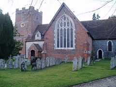
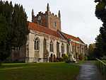
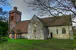
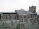
| Church of All Saints | East Meon, East Hampshire | Parish Church | Early 12th century | 16 March 1985 | SU6806222283 50°59′45″N 1°01′53″W / 50.995926°N 1.031514°W |
1351116 | 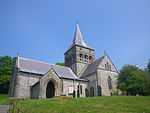 |
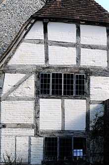
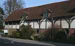
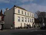
| The Court House | East Meon, East Hampshire | Farmhouse | Late 16th century | 16 March 1954 | SU6813122228 50°59′44″N 1°01′50″W / 50.995423°N 1.030541°W |
1094584 | .jpg) |
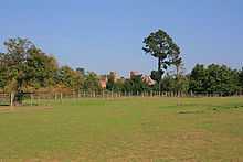
| Rotherfield Park | Rotherfield Park, East Tisted, East Hampshire | Country House | 1815-21 | 18 July 1986 | SU6947732305 51°05′09″N 1°00′34″W / 51.085863°N 1.009434°W |
1351139 | 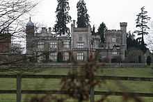 |
| Church of St Mary of the Assumption | Upper Froyle, Froyle, East Hampshire | Parish Church | Early 14th century | 31 July 1963 | SU7556842870 51°10′48″N 0°55′13″W / 51.180079°N 0.920275°W |
1094095 | 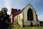 |
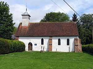
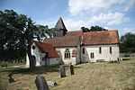
| Church of the Holy Rood | Empshott, Hawkley, East Hampshire | Parish Church | 13th century | 16 March 1954 | SU7532831244 51°04′32″N 0°55′34″W / 51.075587°N 0.926134°W |
1094477 | 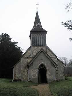 |
| Church of St Peter | Petersfield, East Hampshire | Church | 2nd quarter of 12th century | 29 July 1949 | SU7464823187 51°00′12″N 0°56′15″W / 51.003238°N 0.937496°W |
1157381 | 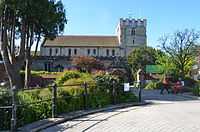 |
| Statue of William III | Petersfield, East Hampshire | Statue | 18th century | 29 July 1949 | SU7465123247 51°00′14″N 0°56′15″W / 51.003777°N 0.937441°W |
1093567 | 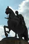 |
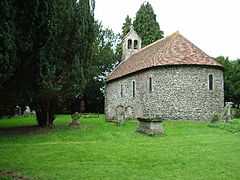
| St Huberts Chapel | Idsworth, Rowlands Castle, East Hampshire | Parish Church | 1053 | 16 March 1954 | SU7427914068 50°55′17″N 0°56′41″W / 50.921299°N 0.944613°W |
1094540 |  |
| Church of St Mary | The Plestor, Selborne, East Hampshire | Parish Church | c. 1180 | 3 July 1963 | SU7411933780 51°05′55″N 0°56′34″W / 51.098544°N 0.942869°W |
1351131 |  |
| The Wakes (including Museum Flat and the Flat) | Selborne, Selborne, East Hampshire | Apartment | 17th century | 31 July 1963 | SU7408333677 51°05′51″N 0°56′36″W / 51.097623°N 0.943404°W |
1174798 |
|
| Bedales Memorial Library, Lupton Hall and Corridor | Steep, East Hampshire | Public Library | 1922 | 16 March 1954 | SU7428925132 51°01′15″N 0°56′32″W / 51.020772°N 0.942214°W |
1278033 |
|
| Church of St James | Upper Wield, Wield, East Hampshire | Cross | c. 1150 | 31 July 1963 | SU6284138753 51°08′41″N 1°06′11″W / 51.144601°N 1.103044°W |
1094078 | 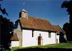 |
Fareham
| Name | Location | Type | Completed [note 1] | Date designated | Grid ref.[note 2] Geo-coordinates |
Entry number [note 3] | Image |
|---|---|---|---|---|---|---|---|
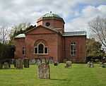
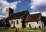
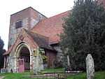
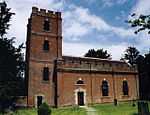
| Church of St Mary | Portchester, Fareham | Church | 1710 | 18 October 1955 | SU6253004495 50°50′12″N 1°06′48″W / 50.836616°N 1.113376°W |
1339235 | .JPG) |
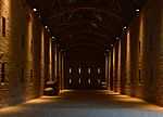
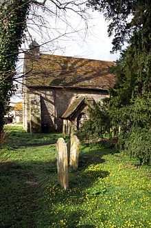
| Monastic Barn of Titchfield Abbey at Fern Hill Farm | Titchfield, Fareham | Tithe Barn | 15th century | 18 October 1955 | SU5395106489 50°51′19″N 1°14′06″W / 50.855407°N 1.234901°W |
1094235 |
|
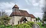
| Parish Church of St Peter | Titchfield, Fareham | Parish Church | Possible C8 origins | 18 October 1955 | SU5409305785 50°50′57″N 1°13′59″W / 50.849064°N 1.232988°W |
1351279 | _-_geograph.org.uk_-_1564629.jpg) |
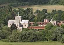
| Portchester Castle | Portchester, Fareham | Castle | During reign of Henry II | 18 October 1955 | SU6241104667 50°50′17″N 1°06′54″W / 50.838175°N 1.115036°W |
1229190 | 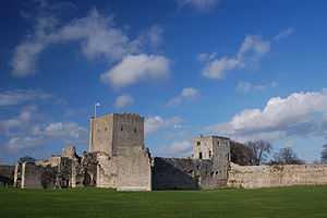 |
Gosport
| Name | Location | Type | Completed [note 1] | Date designated | Grid ref.[note 2] Geo-coordinates |
Entry number [note 3] | Image |
|---|---|---|---|---|---|---|---|
| 'A' Magazine, Museum Buildings | Gosport | Boundary Wall | 1770 to 1776 | 19 January 1990 | SU6164101237 50°48′27″N 1°07′36″W / 50.807417°N 1.126545°W |
1276026 | 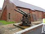 |
| 'B' Magazine (north and south Stores) and attached Passage and Boundary Wall, and Main Rolling Way and Attached Foreman's Office | Gosport | Cooperage | 1773 | 19 January 1990 | SU6165501256 50°48′27″N 1°07′35″W / 50.807586°N 1.126344°W |
1393247 |
|
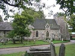
| Church of St Mary | Rowner, Gosport | Church | 13th century | 20 April 1983 | SU5840801634 50°48′41″N 1°10′20″W / 50.811321°N 1.172361°W |
1276419 | 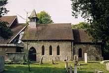 |
Hart
| Name | Location | Type | Completed [note 1] | Date designated | Grid ref.[note 2] Geo-coordinates |
Entry number [note 3] | Image |
|---|---|---|---|---|---|---|---|
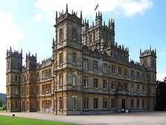
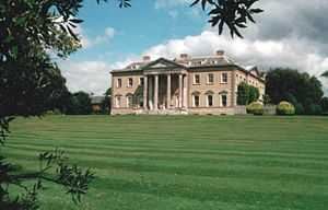
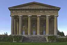
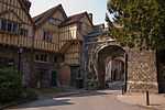
| Bramshill House | Bramshill, Hart | Steps | 1605-1612 | 8 July 1952 | SU7587659630 51°19′51″N 0°54′44″W / 51.330714°N 0.91232°W |
1340025 | Jun2006.jpg) |
| Garden Walls and Gateways North of Bramshill House | Bramshill House, Bramshill, Hart | Garden Walls | Early 17th century | 8 July 1952 | SU7595859597 51°19′49″N 0°54′40″W / 51.330406°N 0.91115°W |
1340026 | 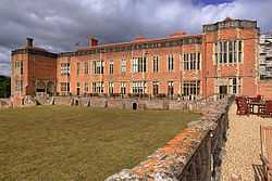 |
| Gateway to Bramshill House | Bramshill House, Bramshill, Hart | Gate | Early 17th century | 8 July 1952 | SU7597059697 51°19′53″N 0°54′39″W / 51.331304°N 0.910957°W |
1091938 |
|
| High Bridge | Bramshill House, Bramshill, Hart | Bridge | Early 19th century | 8 July 1952 | SU7538659347 51°19′42″N 0°55′10″W / 51.328235°N 0.919412°W |
1091941 |
|
| Walls and Turrets South of Bramshill House | Bramshill House, Bramshill, Hart | Tower | Early 17th century | 26 June 1987 | SU7580559566 51°19′49″N 0°54′48″W / 51.330148°N 0.913353°W |
1091939 |
|
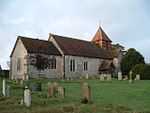
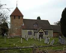
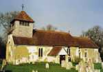
| Church of All Saints | Crondall, Hart | Church | before 1200 | 24 November 1961 | SU7947848483 51°13′48″N 0°51′47″W / 51.230011°N 0.863107°W |
1091946 | 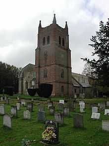 |
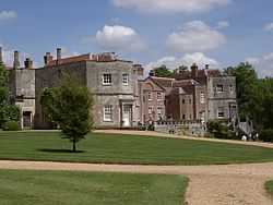
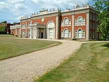
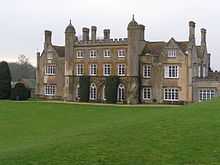
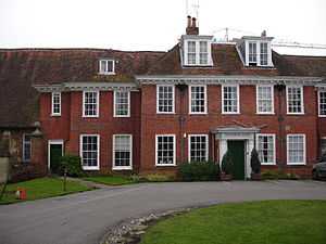
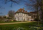
| Dogmersfield Park (house) | Dogmersfield Park, Dogmersfield, Hart | Bishops Palace | Medieval site of | 8 July 1952 | SU7713251599 51°15′30″N 0°53′46″W / 51.258346°N 0.896029°W |
1092357 | 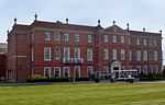 |
| Church of St Mary | Eversley, Hart | Church | Medieval | 24 November 1961 | SU7791060917 51°20′31″N 0°52′58″W / 51.342009°N 0.88285°W |
1092339 | 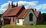 |
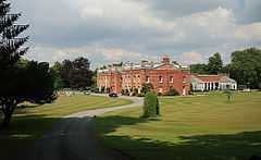
| Warbrook House | Eversley, Hart | House | 1727 | 8 July 1952 | SU7739561829 51°21′01″N 0°53′24″W / 51.350279°N 0.890045°W |
1260096 | 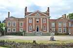 |
| Mattingley Church | Mattingley Green, Mattingley, Hart | Church | 15th century | 24 November 1961 | SU7363958024 51°19′00″N 0°56′41″W / 51.316569°N 0.944754°W |
1272800 |  |
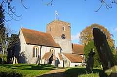
| Church of All Saints | Odiham, Hart | Church | 13th century | 24 November 1961 | SU7403950923 51°15′10″N 0°56′26″W / 51.252678°N 0.940485°W |
1092160 | 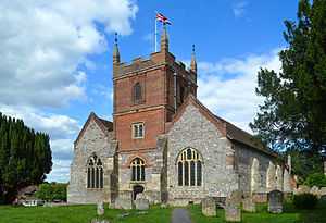 |
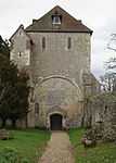
| Odiham Castle | Odiham, Hart | Keep | 1207–1214 | 24 November 1961 | SU7255751873 51°15′41″N 0°57′41″W / 51.261409°N 0.961524°W |
1092165 | 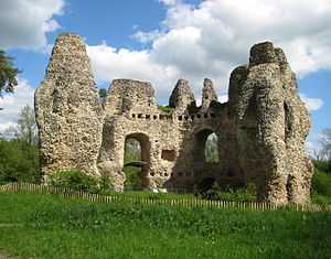 |
| Church of St Mary | Winchfield, Hart | Church | Norman | 24 November 1961 | SU7679853603 51°16′35″N 0°54′01″W / 51.276407°N 0.900384°W |
1244705 | 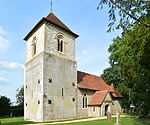 |
Havant
| Name | Location | Type | Completed [note 1] | Date designated | Grid ref.[note 2] Geo-coordinates |
Entry number [note 3] | Image |
|---|---|---|---|---|---|---|---|
| Church of St Peter | Hayling Island, Havant | Parish Church | Transitional | 16 May 1952 | SU7308703201 50°49′25″N 0°57′49″W / 50.823747°N 0.963737°W |
1155352 | 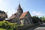 |
| Church of St Thomas-a-becket | Warblington, Havant | Parish Church | Saxon | 16 May 1952 | SU7290005418 50°50′37″N 0°57′57″W / 50.843703°N 0.965951°W |
1154443 | 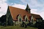 |
New Forest
| Name | Location | Type | Completed [note 1] | Date designated | Grid ref.[note 2] Geo-coordinates |
Entry number [note 3] | Image |
|---|---|---|---|---|---|---|---|
| Church of the Blessed Virgin and Child | Beaulieu, Hampshire | Church | Early/Mid 13th century | 8 October 1959 | SU3883202548 50°49′16″N 1°27′00″W / 50.821179°N 1.450097°W |
1156943 | 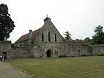 |
| Domus and Ruins of Lay Frater | Beaulieu Manor Estate, Beaulieu, New Forest | Abbey | Late 13th century | 8 October 1959 | SU3879602579 50°49′17″N 1°27′02″W / 50.82146°N 1.450604°W |
1156631 | 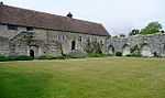 |
| Palace House | Beaulieu Manor Estate, Beaulieu, New Forest | Abbey | Mid 14th century | 8 October 1959 | SU3873002445 50°49′13″N 1°27′06″W / 50.82026°N 1.451555°W |
1094430 | 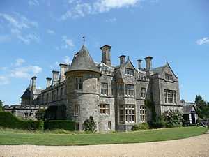 |
| Remains of Outer Wall Around Cloister and Foundations of Abbey Church | Beaulieu Manor Estate, Beaulieu, New Forest | Abbey | Late 13th century | 8 October 1959 | SU3883002591 50°49′18″N 1°27′00″W / 50.821566°N 1.45012°W |
1094429 |  |
| Remains of St Leonard's Chapel | St Leonard's, Beaulieu, New Forest | Chapel | 14th century | 8 October 1959 | SZ4052798207 50°46′55″N 1°25′35″W / 50.782029°N 1.426513°W |
1094415 | 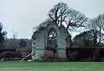 |
| St Leonard's Barn | St Leonard's, Beaulieu, New Forest | Barn | 14th century | 8 October 1959 | SZ4064898164 50°46′54″N 1°25′29″W / 50.781633°N 1.424801°W |
1157008 |  |
| Hinton Admiral House | Hinton Park, Bransgore, New Forest | Country House | 1720 | 30 September 1964 | SZ2085395944 50°45′46″N 1°42′21″W / 50.762716°N 1.7057°W |
1095030 | 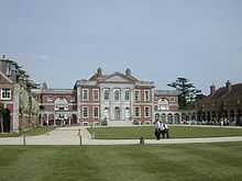 |
| Church of St Mary | Breamore Park, Breamore, New Forest | Parish Church | Late 10th century | 30 September 1964 | SU1532818896 50°58′09″N 1°46′59″W / 50.96928°N 1.783081°W |
1094934 | 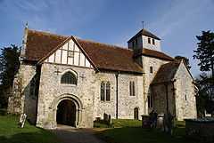 |
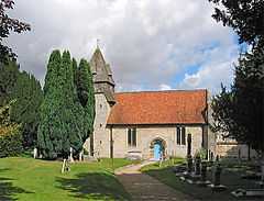
| Church of St George | Damerham, New Forest | Parish Church | 12th century | 13 February 1987 | SU1075315809 50°56′30″N 1°50′54″W / 50.941624°N 1.848326°W |
1094925 |  |
| Church of St Mary | Ellingham, Hampshire | Parish Church | 13th century | 30 September 1964 | SU1442508323 50°52′27″N 1°47′47″W / 50.874228°N 1.796356°W |
1156533 | 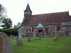 |
| Church of All Saints | Fawley, Hampshire | Tower | c. 1175 | 8 October 1959 | SU4575403553 50°49′47″N 1°21′06″W / 50.829712°N 1.351711°W |
1351239 | 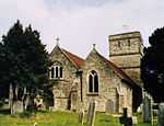 |
| Church of St Mary | Fordingbridge, New Forest | Parish Church | 12th century | 30 September 1964 | SU1451513813 50°55′25″N 1°47′41″W / 50.923594°N 1.79486°W |
1350974 |  |
| Church of St Mary | Hale Park, Hale, Hampshire | Parish Church | Medieval origins | 30 September 1964 | SU1784218655 50°58′01″N 1°44′50″W / 50.967041°N 1.747291°W |
1094881 |  |
| Hale House, Including Quadrant Passages to Pavilions | Hale Park, Hale, New Forest | Country House | 1715 | 30 April 1955 | SU1794718577 50°57′59″N 1°44′45″W / 50.966337°N 1.745799°W |
1301070 |  |
| Church of St Michael and All Angels | Lyndhurst, Hampshire | Parish Church | 1858-68 | 13 May 1987 | SU2980508168 50°52′20″N 1°34′40″W / 50.872249°N 1.577787°W |
1094725 |  |
| Church of All Saints | Martin, Hampshire | Parish Church | 12th century | 30 September 1964 | SU0705019559 50°58′31″N 1°54′03″W / 50.975401°N 1.900958°W |
1094828 |  |
| Church of All Saints | Milford-on-Sea, New Forest | Church | late Norman | 22 December 1973 | SZ2905592109 50°43′40″N 1°35′23″W / 50.727879°N 1.589711°W |
1276161 |  |
| Church of All Saints | Minstead, New Forest | Church | Early 19th century | 8 October 1959 | SU2810510878 50°53′48″N 1°36′06″W / 50.896702°N 1.601739°W |
1094732 | 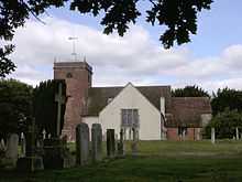 |
| Barn Formerly Chapel 20 Metres East of Manor House | Manor Farm, Rockbourne, New Forest | Chapel | 13th century | 30 September 1964 | SU1156318371 50°57′53″N 1°50′12″W / 50.964647°N 1.836716°W |
1167857 |  |
| Church of St Andrew | Manor Farm, Rockbourne, New Forest | Parish Church | 13th century | 30 September 1964 | SU1155818319 50°57′51″N 1°50′12″W / 50.964179°N 1.836789°W |
1296677 | 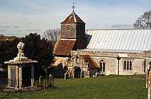 |
| Large Barn 50 Metres North East of Manor House | Manor Farm, Rockbourne, New Forest | House | 15th century | 30 September 1964 | SU1155818395 50°57′54″N 1°50′12″W / 50.964863°N 1.836787°W |
1351003 |  |
| Manor Farm and Wall Running North East | Manor Farm, Rockbourne, New Forest | Hall House | 14th century | 30 September 1964 | SU1153418341 50°57′52″N 1°50′14″W / 50.964377°N 1.83713°W |
1351002 | 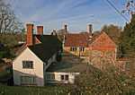 |
| Avon Tyrrell House | Avon Tyrrell, Sopley, New Forest | Country House | 1891 | 12 March 1987 | SU1853100257 50°48′06″N 1°44′18″W / 50.801579°N 1.738406°W |
1350922 |
|
| Church of All Saints | Thorney Hill, Sopley, New Forest | Church | 1906 | 24 September 1985 | SZ1970099724 50°47′48″N 1°43′19″W / 50.796748°N 1.721846°W |
1302198 |  |
Rushmoor
| Name | Location | Type | Completed [note 1] | Date designated | Grid ref.[note 2] Geo-coordinates |
Entry number [note 3] | Image |
|---|---|---|---|---|---|---|---|
| Abbey Church of St Michael | Rushmoor | Church | 1886-7 | 28 January 1959 | SU8727856078 51°17′50″N 0°44′58″W / 51.29715°N 0.749572°W |
1155639 | 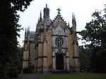 |
| Building Q121 at Former Royal Aircraft Establishment Site | Rushmoor | Workshop | 1934-1935 | 4 December 1996 | SU8678754709 51°17′06″N 0°45′25″W / 51.284918°N 0.756945°W |
1259589 |  |
| Building R133 at Former Royal Aircraft Establishment site | Rushmoor | Test House | 1939-1942 | 4 December 1996 | SU8686154824 51°17′09″N 0°45′21″W / 51.28594°N 0.755856°W |
1259586 |  |
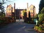
| Main Building to Farnborough Hill Convent | Rushmoor | House | 1863 | 13 November 1975 | SU8718856449 51°18′02″N 0°45′03″W / 51.300498°N 0.750772°W |
1303116 | 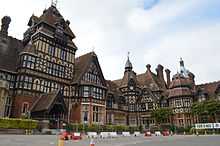 |
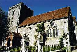
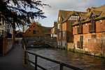
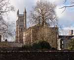
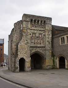
Test Valley

Winchester


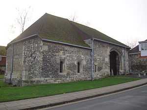
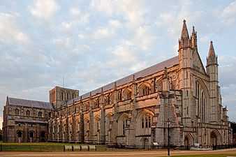

.jpg)

.jpg)

See also
- Category:Grade I listed buildings in Hampshire
Notes
- ↑ 1.0 1.1 1.2 1.3 1.4 1.5 1.6 1.7 1.8 1.9 1.10 1.11 The date given is the date used by Historic England as significant for the initial building or that of an important part in the structure's description.
- ↑ 2.0 2.1 2.2 2.3 2.4 2.5 2.6 2.7 2.8 2.9 2.10 2.11 Sometimes known as OSGB36, the grid reference is based on the British national grid reference system used by the Ordnance Survey.
- ↑ 3.0 3.1 3.2 3.3 3.4 3.5 3.6 3.7 3.8 3.9 3.10 3.11 The "List Entry Number" is a unique number assigned to each listed building/ scheduled monument by Historic England.
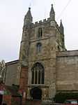
- ↑ Kingsgate is a scheduled monument. The church above the gate is a Grade I listed building.
References
English Heritage Images of England
External links
![]() Media related to Grade I listed buildings in Hampshire at Wikimedia Commons
Media related to Grade I listed buildings in Hampshire at Wikimedia Commons