| Name |
Location |
Type |
Completed | Date designated |
Grid ref.
Geo-coordinates |
Entry number | Image |
|
|
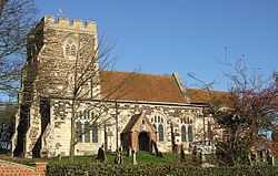
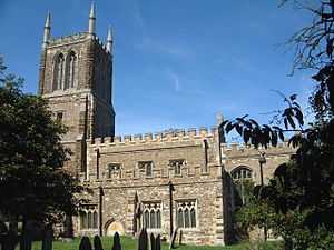
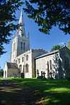
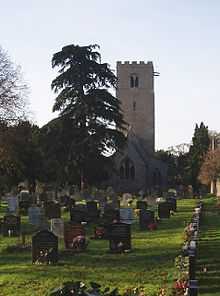
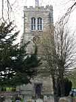
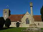
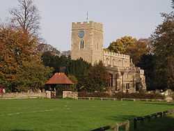
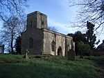
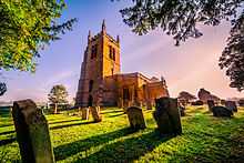
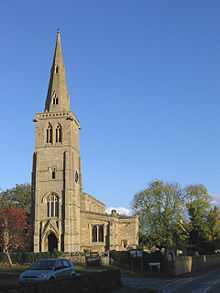
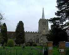
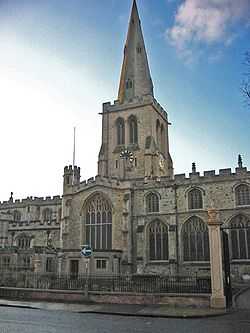
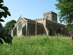
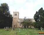
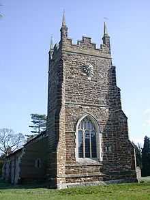
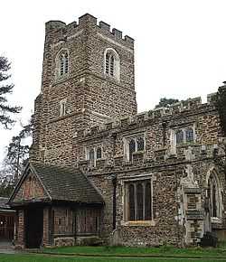
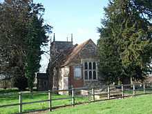
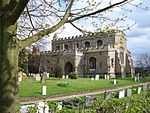
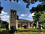
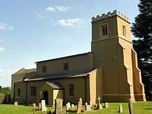
| Parish Church of St Andrew |
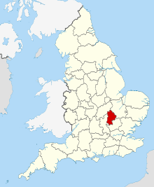
Ampthill, Central Bedfordshire |
Parish Church |
C14-15 |
01971-07-17-000017 July 1971 |
TL0370738264
52°01′59″N 0°29′23″W / 52.033096°N 0.489648°W / 52.033096; -0.489648 (Parish Church of St Andrew) |
1114420 |
More images
|
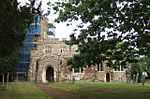
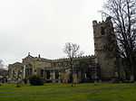
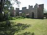
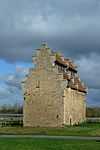
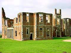
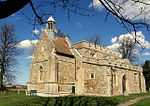
| Ruins of Houghton House, Houghton Park |
Ampthill |
Great House |
c. 1620 |
01972-03-16-000016 March 1972 |
TL0392239484
52°02′38″N 0°29′10″W / 52.044021°N 0.486145°W / 52.044021; -0.486145 (Ruins of Houghton House, Houghton Park) |
1321465 |
More images
|
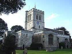
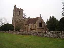
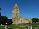
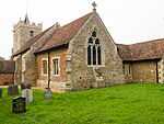
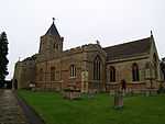
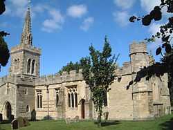
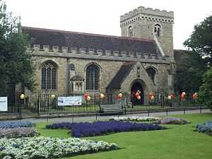
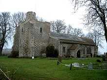
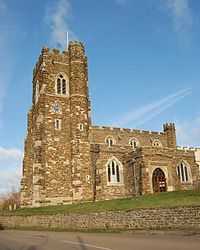
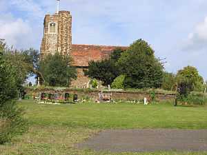
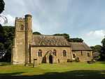
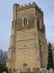
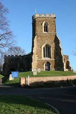
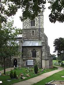
| Church of Saint Peter |
Arlesey |
Parish Church |
12th century |
01966-10-31-000031 October 1966 |
TL1919537539
52°01′24″N 0°15′51″W / 52.023472°N 0.264232°W / 52.023472; -0.264232 (Church of Saint Peter) |
1113817 |
|
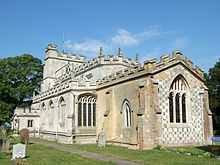
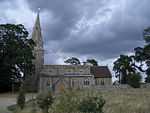
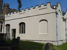
| Church of St Nicholas |
Barton-le-Clay |
Church |
12th to 15th century |
01967-02-03-00003 February 1967 |
TL0854230405
51°57′42″N 0°25′18″W / 51.961541°N 0.421681°W / 51.961541; -0.421681 (Church of St Nicholas) |
1321346 |
|
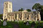
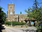
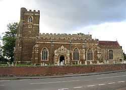
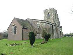
| Church of Saint Peter and All Saints |
Battlesden |
Parish Church |
13th century |
01961-01-23-000023 January 1961 |
SP9590429095
51°57′08″N 0°36′21″W / 51.952088°N 0.605918°W / 51.952088; -0.605918 (Church of Saint Peter and All Saints) |
1311979 |
More images
|
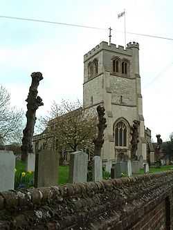
| Parish Church of St Edmund or St James |
Blunham |
Parish Church |
Early 12th century |
01966-10-31-000031 October 1966 |
TL1530851104
52°08′46″N 0°18′59″W / 52.146197°N 0.316274°W / 52.146197; -0.316274 (Parish Church of St Edmund or St James) |
1321759 |
|
| Chicksands Priory |
Chicksands, Campton and Chicksands |
Country House |
Dissolved 1539 |
01985-01-10-000010 January 1985 |
TL1216539294
52°02′27″N 0°21′58″W / 52.040709°N 0.366068°W / 52.040709; -0.366068 (Chicksands Priory) |
1137590 |
|
| Church of All Saints |
Chalgrave |
Tower |
1889 |
01967-02-03-00003 February 1967 |
TL0086027430
51°56′10″N 0°32′04″W / 51.936247°N 0.534316°W / 51.936247; -0.534316 (Church of All Saints) |
1321351 |
More images
|
| Church of Saint Peter and Saint Paul |
Cranfield |
Parish Church |
12th century |
01961-01-23-000023 January 1961 |
SP9557641980
52°04′05″N 0°36′26″W / 52.067955°N 0.607098°W / 52.067955; -0.607098 (Church of Saint Peter and Saint Paul) |
1114029 |
|
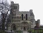
| Dunstable Priory |
Dunstable |
Priory |
Norman |
01951-10-25-000025 October 1951 |
TL0212821870
51°53′10″N 0°31′03″W / 51.886044°N 0.517525°W / 51.886044; -0.517525 (Dunstable Priory) |
1114581 |
More images
|
| Priory House Gateway |
Dunstable |
Gate |
15th century |
01976-03-04-00004 March 1976 |
TL0208521860
51°53′09″N 0°31′05″W / 51.885962°N 0.518153°W / 51.885962; -0.518153 (Priory House Gateway) |
1321391 |
|
| Church of St Mary |
Eaton Bray |
Church |
Early English |
01967-02-03-00003 February 1967 |
SP9698520733
51°52′36″N 0°35′33″W / 51.876742°N 0.592545°W / 51.876742; -0.592545 (Church of St Mary) |
1321356 |
More images
|
| Church of St George |
Edworth |
Parish Church |
Earlier origins |
01966-10-31-000031 October 1966 |
TL2223340680
52°03′04″N 0°13′08″W / 52.051038°N 0.218857°W / 52.051038; -0.218857 (Church of St George) |
1113833 |
More images
|
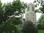
| Church of St Mary |
Everton |
Parish Church |
Mid-12th century |
01986-11-26-000026 November 1986 |
TL2032751294
52°08′49″N 0°14′34″W / 52.146835°N 0.242894°W / 52.146835; -0.242894 (Church of St Mary) |
1114064 |
|
| Church of All Saints |
Eyeworth |
Parish Church |
14th and 15th century |
01966-10-31-000031 October 1966 |
TL2497745596
52°05′41″N 0°10′37″W / 52.094602°N 0.177064°W / 52.094602; -0.177064 (Church of All Saints) |
1137817 |
More images
|
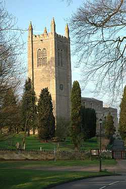
| Church of Saint John the Baptist |
Flitton and Greenfield |
Parish Church |
15th century |
01961-01-23-000023 January 1961 |
TL0593635850
52°00′40″N 0°27′28″W / 52.01098°N 0.457914°W / 52.01098; -0.457914 (Church of Saint John the Baptist) |
1113903 |
|
| The De Grey Mausoleum adjoining Church of St John the Baptist |
Flitton and Greenfield |
Commemorative Monument |
1614 |
01961-01-23-000023 January 1961 |
TL0595335864
52°00′40″N 0°27′28″W / 52.011102°N 0.457662°W / 52.011102; -0.457662 (The De Grey Mausoleum adjoining Church of St John the Baptist) |
1113904 |
More images
|
| Church of St Peter and St Paul |
Flitwick |
Chapter House |
1983 |
01961-01-23-000023 January 1961 |
TL0292634226
51°59′49″N 0°30′08″W / 51.99695°N 0.502241°W / 51.99695; -0.502241 (Church of St Peter and St Paul) |
1137705 |
More images
|
| Church of St Mary the Virgin |
Lower Gravenhurst, Gravenhurst |
Parish Church |
Earlier |
01961-01-23-000023 January 1961 |
TL1107535247
52°00′16″N 0°23′00″W / 52.004557°N 0.383265°W / 52.004557; -0.383265 (Church of St Mary the Virgin) |
1311911 |
|
| Church of Saint Mary the Virgin |
Harlington |
Parish Church |
14th century |
01961-01-23-000023 January 1961 |
TL0378730551
51°57′50″N 0°29′27″W / 51.96376°N 0.490815°W / 51.96376; -0.490815 (Church of Saint Mary the Virgin) |
1321734 |
|
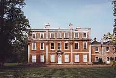
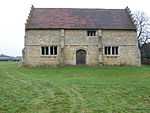
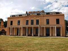
| Clarendon School |
Church End, Haynes |
Country House |
c. 1725 |
01952-10-22-000022 October 1952 |
TL0798941715
52°03′48″N 0°25′34″W / 52.063295°N 0.426164°W / 52.063295; -0.426164 (Clarendon School) |
1321815 |
|
| Church of St Mary the Virgin |
Henlow |
Parish Church |
12th century |
01966-10-31-000031 October 1966 |
TL1781238759
52°02′05″N 0°17′02″W / 52.034731°N 0.283959°W / 52.034731; -0.283959 (Church of St Mary the Virgin) |
1312654 |
|
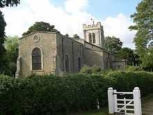
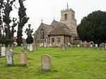
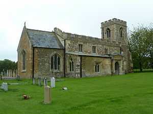
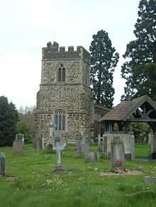
| Church of All Saints |
Houghton Conquest |
Parish Church |
Early 14th century |
01961-01-23-000023 January 1961 |
TL0435741425
52°03′41″N 0°28′45″W / 52.061384°N 0.479212°W / 52.061384; -0.479212 (Church of All Saints) |
1113919 |
More images
|
| Church of All Saints |
Houghton Regis |
Church |
14th century |
01967-02-03-00003 February 1967 |
TL0183623958
51°54′18″N 0°31′16″W / 51.904864°N 0.52115°W / 51.904864; -0.52115 (Church of All Saints) |
1114707 |
More images
|
| Church of Saint Mary the Virgin |
Salford, Hulcote and Salford |
Bell Tower |
19th century |
01961-01-23-000023 January 1961 |
SP9359239099
52°02′33″N 0°38′13″W / 52.042399°N 0.636821°W / 52.042399; -0.636821 (Church of Saint Mary the Virgin) |
1114035 |
|
| Church of St Nicholas |
Hulcote, Hulcote and Salford |
Parish Church |
c. 1590 |
01961-01-23-000023 January 1961 |
SP9443438833
52°02′24″N 0°37′29″W / 52.039865°N 0.624622°W / 52.039865; -0.624622 (Church of St Nicholas) |
1114036 |
|
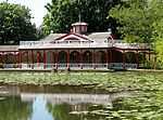
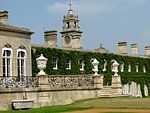
| Garden Houses and Retaining Walls to Terraced Gardens at Luton Hoo |
Luton Hoo Estate, Hyde |
Garden Temple |
|
01980-09-26-000026 September 1980 |
TL1047618446
51°51′13″N 0°23′51″W / 51.853681°N 0.397376°W / 51.853681; -0.397376 (Garden Houses and Retaining Walls to Terraced Gardens at Luton Hoo) |
1158944 |

|
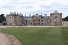
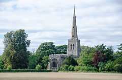
| Luton Hoo |
Luton Hoo Estate, Hyde |
Country House |
1760s |
01952-04-29-000029 April 1952 |
TL1045118552
51°51′17″N 0°23′52″W / 51.854639°N 0.397705°W / 51.854639; -0.397705 (Luton Hoo) |
1321301 |
More images
|
| Church of St Mary |
Church End, Kensworth |
Church |
Norman |
01967-02-03-00003 February 1967 |
TL0312619042
51°51′38″N 0°30′14″W / 51.860443°N 0.503874°W / 51.860443; -0.503874 (Church of St Mary) |
1159080 |
More images
|
| Church of Saint Andrew |
Langford |
Parish Church |
13th century |
01966-10-31-000031 October 1966 |
TL1857441409
52°03′30″N 0°16′19″W / 52.058383°N 0.271938°W / 52.058383; -0.271938 (Church of Saint Andrew) |
1113840 |
|
| Church of St Mary |
Linslade, Leighton-Linslade |
Church |
Norman |
01954-02-20-000020 February 1954 |
SP9102026813
51°55′57″N 0°40′39″W / 51.932396°N 0.677567°W / 51.932396; -0.677567 (Church of St Mary) |
1114528 |
|
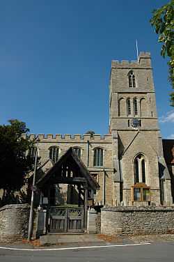
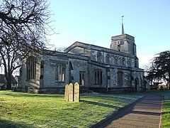
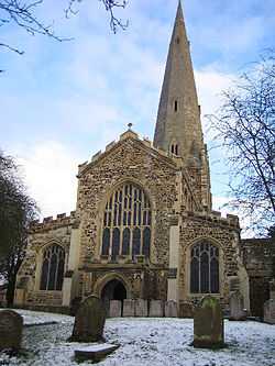
| Leighton Buzzard Church of All Saints |
Leighton Buzzard, Leighton-Linslade |
Parish Church |
Medieval |
01975-05-01-00001 May 1975 |
SP9190024867
51°54′53″N 0°39′55″W / 51.91476°N 0.66529°W / 51.91476; -0.66529 (Leighton Buzzard Church of All Saints) |
1321404 |
|
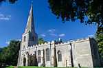
| Parish Church of St Mary the Virgin |
Marston Moretaine |
Parish Church |
Early 14th century |
01961-01-23-000023 January 1961 |
SP9961841153
52°03′35″N 0°32′54″W / 52.059811°N 0.548392°W / 52.059811; -0.548392 (Parish Church of St Mary the Virgin) |
1114047 |
More images
|
| Tower Belonging to Church of St Mary the Virgin |
Marston Moretaine |
Tower |
14th century |
01961-01-23-000023 January 1961 |
SP9962141183
52°03′36″N 0°32′54″W / 52.06008°N 0.54834°W / 52.06008; -0.54834 (Tower Belonging to Church of St Mary the Virgin) |
1311714 |
|
| Church of Saint Peter |
Milton Bryan |
Parish Church |
12th century |
01961-01-23-000023 January 1961 |
SP9711030795
51°58′02″N 0°35′16″W / 51.967158°N 0.587895°W / 51.967158; -0.587895 (Church of Saint Peter) |
1138238 |
More images
|
| Moggerhanger House |
Mogerhanger |
Country House |
18th century |
01966-10-31-000031 October 1966 |
TL1353248665
52°07′29″N 0°20′35″W / 52.124646°N 0.34303°W / 52.124646; -0.34303 (Moggerhanger House) |
1137422 |
More images
|
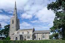
| Parish Church of St Mary the Virgin |
Northill |
Collegiate Church |
1404–1547 |
01966-10-31-000031 October 1966 |
TL1490046551
52°06′19″N 0°19′26″W / 52.105366°N 0.32377°W / 52.105366; -0.32377 (Parish Church of St Mary the Virgin) |
1221856 |
More images
|
| Parish Church of St Leonard |
Old Warden |
Abbey |
12th century |
01966-10-31-000031 October 1966 |
TL1367044321
52°05′08″N 0°20′33″W / 52.085579°N 0.342464°W / 52.085579; -0.342464 (Parish Church of St Leonard) |
1274774 |
More images
|
| Warden Abbey |
Old Warden |
Abbey |
1135 |
01952-01-16-000016 January 1952 |
TL1206243850
52°04′54″N 0°21′58″W / 52.081674°N 0.366076°W / 52.081674; -0.366076 (Warden Abbey) |
1222165 |
|
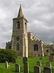
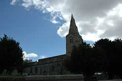
| Church of St Mary |
Potton |
Parish Church |
13th-century origins |
01966-10-31-000031 October 1966 |
TL2286449437
52°07′47″N 0°12′23″W / 52.12959°N 0.206507°W / 52.12959; -0.206507 (Church of St Mary) |
1321657 |
More images
|
| Church of All Saints |
Shillington |
Parish Church |
14th century |
01961-01-23-000023 January 1961 |
TL1237733941
51°59′33″N 0°21′53″W / 51.992558°N 0.364734°W / 51.992558; -0.364734 (Church of All Saints) |
1312508 |
More images
|
| Banqueting House |
Wrest Park, Silsoe |
Banqueting House |
1709–11 |
01985-01-10-000010 January 1985 |
TL0918534742
52°00′01″N 0°24′39″W / 52.000393°N 0.410948°W / 52.000393; -0.410948 (Banqueting House) |
1113807 |
More images
|
| Wrest Park House and Service Block Comprising Pavilions, Clock Tower and the Dairy |
Silsoe |
Country House |
1834–39 |
01985-01-10-000010 January 1985 |
TL0912935583
52°00′29″N 0°24′41″W / 52.007962°N 0.411496°W / 52.007962; -0.411496 (Wrest Park House and Service Block Comprising Pavilions, Clock Tower and the Dairy) |
1311484 |
More images
|
| North Terrace approximately 50 Metres North of House |
Southill Park, Southill |
Balustrade |
1795–1800 |
01966-10-31-000031 October 1966 |
TL1435342117
52°03′56″N 0°20′00″W / 52.065632°N 0.333238°W / 52.065632; -0.333238 (North Terrace approximately 50 Metres North of House) |
1274438 |
|
| Southill Park House |
Southill Park, Southill |
Country House |
17th century |
01952-01-16-000016 January 1952 |
TL1433342066
52°03′55″N 0°20′01″W / 52.065178°N 0.333547°W / 52.065178; -0.333547 (Southill Park House) |
1237988 |
|
| Church of St John the Baptist |
Stanbridge |
Church |
Late 13th century |
01967-02-03-00003 February 1967 |
SP9656824229
51°54′30″N 0°35′51″W / 51.908237°N 0.597623°W / 51.908237; -0.597623 (Church of St John the Baptist) |
1321308 |
|
| Church of St Margaret |
Streatley |
Church |
14th century |
01967-02-03-00003 February 1967 |
TL0701528604
51°56′44″N 0°26′40″W / 51.94565°N 0.444457°W / 51.94565; -0.444457 (Church of St Margaret) |
1321310 |
|
| Church of St Mary |
Studham |
Church |
Early 13th century |
01967-02-03-00003 February 1967 |
TL0159115976
51°49′59″N 0°31′37″W / 51.833167°N 0.527056°W / 51.833167; -0.527056 (Church of St Mary) |
1159252 |
|
| Church of St Mary |
Sundon |
Church |
13th century |
01967-02-03-00003 February 1967 |
TL0481626853
51°55′49″N 0°28′37″W / 51.930331°N 0.47697°W / 51.930331; -0.47697 (Church of St Mary) |
1159488 |
|
| Church of All Saints |
Sutton |
Parish Church |
13th century |
01966-10-31-000031 October 1966 |
TL2190647532
52°06′46″N 0°13′16″W / 52.112683°N 0.221177°W / 52.112683; -0.221177 (Church of All Saints) |
1138081 |
More images
|
| Church of All Saints |
Tilsworth |
Church |
13th century |
01967-02-03-00003 February 1967 |
SP9751424281
51°54′31″N 0°35′02″W / 51.90854°N 0.583861°W / 51.90854; -0.583861 (Church of All Saints) |
1159512 |
More images
|
| Church of Saint Nicholas |
Tingrith |
Parish Church |
15th century |
01961-01-23-000023 January 1961 |
TL0072732436
51°58′53″N 0°32′05″W / 51.981264°N 0.534784°W / 51.981264; -0.534784 (Church of Saint Nicholas) |
1113944 |
More images
|
| Church of St George |
Toddington |
Church |
13th century |
01967-02-03-00003 February 1967 |
TL0100428942
51°56′59″N 0°31′54″W / 51.949811°N 0.531779°W / 51.949811; -0.531779 (Church of St George) |
1159540 |
More images
|
| Church of St Giles |
Church End, Totternhoe |
Church |
14th century |
01967-02-03-00003 February 1967 |
SP9884020885
51°52′40″N 0°33′56″W / 51.877783°N 0.565564°W / 51.877783; -0.565564 (Church of St Giles) |
1159758 |
|
| Woburn Abbey |
Woburn Park, Woburn |
Abbey |
1145–1547 |
01952-10-22-000022 October 1952 |
SP9646332551
51°58′59″N 0°35′49″W / 51.983054°N 0.596817°W / 51.983054; -0.596817 (Woburn Abbey) |
1114006 |
More images
|
| Basin Bridge |
Woburn Park, Woburn |
Bridge |
pre 1813 |
01961-01-23-000023 January 1961 |
SP9620632389
51°58′54″N 0°36′02″W / 51.981642°N 0.600603°W / 51.981642; -0.600603 (Basin Bridge) |
1114019 |
|
| Chinese Dairy and adjoining Covered Ways at Woburn Park |
Woburn Park, Woburn |
Ornamental Pond |
c. 1788 |
01961-01-23-000023 January 1961 |
SP9663732625
51°59′01″N 0°35′39″W / 51.983689°N 0.594263°W / 51.983689; -0.594263 (Chinese Dairy and adjoining Covered Ways at Woburn Park) |
1321667 |
|
| North Stableblock approximately 100 Metres East of Woburn Abbey |
Woburn Park, Woburn |
Stable |
c. 1750 |
01961-01-23-000023 January 1961 |
SP9664432559
51°58′59″N 0°35′39″W / 51.983094°N 0.59418°W / 51.983094; -0.59418 (North Stableblock approximately 100 Metres East of Woburn Abbey) |
1158192 |
|
| Sculpture Gallery, adjoining South Side of South Stableblock |
Woburn Park, Woburn |
Conservatory |
c. 1790 |
01961-01-23-000023 January 1961 |
SP9662032443
51°58′55″N 0°35′40″W / 51.982056°N 0.594562°W / 51.982056; -0.594562 (Sculpture Gallery, adjoining South Side of South Stableblock) |
1158201 |
|
| South Stableblock approx 100 Metres East of Woburn Abbey |
Woburn Park, Woburn |
Stable |
c. 1750 |
01961-01-23-000023 January 1961 |
SP9663432460
51°58′56″N 0°35′40″W / 51.982206°N 0.594353°W / 51.982206; -0.594353 (South Stableblock approx 100 Metres East of Woburn Abbey) |
1114011 |
|
| The Camelia House adjoining East End of Sculpture Gallery |
Woburn Park, Woburn |
Camellia House |
1822 |
01961-01-23-000023 January 1961 |
SP9665232435
51°58′55″N 0°35′39″W / 51.981978°N 0.594098°W / 51.981978; -0.594098 (The Camelia House adjoining East End of Sculpture Gallery) |
1114012 |
|
| Church of Saint John the Baptist |
Cockayne Hatley, Wrestlingworth and Cockayne Hatley |
Parish Church |
13th century |
01966-10-31-000031 October 1966 |
TL2561649653
52°07′51″N 0°09′58″W / 52.130913°N 0.166246°W / 52.130913; -0.166246 (Church of Saint John the Baptist) |
1114107 |
More images
|
| Church of St Peter |
Wrestlingworth, Wrestlingworth and Cockayne Hatley |
Parish Church |
12th-century origins |
01966-10-31-000031 October 1966 |
TL2592347366
52°06′37″N 0°09′45″W / 52.110292°N 0.162609°W / 52.110292; -0.162609 (Church of St Peter) |
1321637 |
More images |
.jpg)


.jpg)


.jpg)
.jpg)


.jpg)
.jpg)
Mar2005.jpg)
.jpg)
.jpg)
.jpg)
.jpg)


.jpg)


.jpg)
.JPG)