| Name |
Location |
Type |
Completed | Date designated |
Grid ref.
Geo-coordinates |
Entry number | Image |
|
|
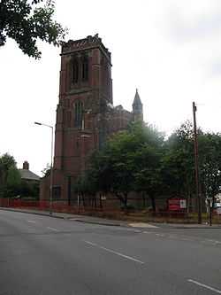
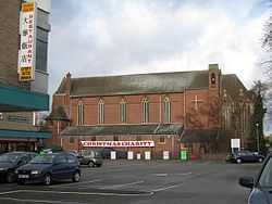
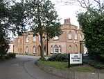
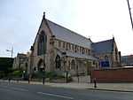
| All Saints Church |
Four Oaks |
Anglican Church |
1907-1909 |
01976-08-26-000026 August 1976 |
SP1091698740
52°35′11″N 1°50′25″W / 52.586358°N 1.840316°W / 52.586358; -1.840316 (All Saints Church) |
1343304 |
More images
|
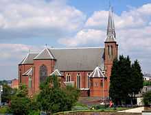
| Anglican Church of All Saints (formerly St Aiden) |
Small Heath |
Anglican Church |
1894 |
01970-01-21-000021 January 1970 |
SP0916485860
52°28′14″N 1°51′59″W / 52.470601°N 1.866525°W / 52.470601; -1.866525 (Anglican Church of All Saints (formerly St Aiden)) |
1343050 |
|
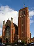
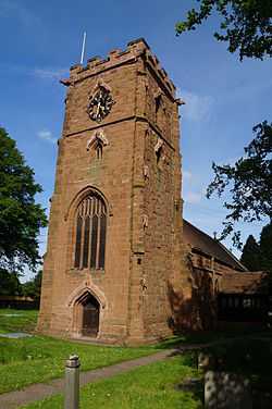
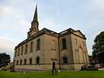
| Anglican Church of SS Peter and Paul |
Witton |
Church |
1400 !15th century |
01952-04-25-000025 April 1952 |
SP0826289910
52°30′25″N 1°52′47″W / 52.507024°N 1.879705°W / 52.507024; -1.879705 (Anglican Church of SS Peter and Paul) |
1290008 |
More images
|
| Anglican Church of St Augustine |
Edgbaston |
Anglican Church |
1868 |
01970-01-21-000021 January 1970 |
SP0377686158
52°28′24″N 1°56′45″W / 52.473342°N 1.945839°W / 52.473342; -1.945839 (Anglican Church of St Augustine) |
1076255 |
More images
|
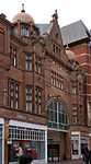
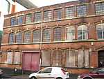
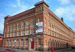
| Aquinas House, 62-64 Warstone Lane |
Jewellery Quarter |
Jewellery Workshop |
1882 |
02004-04-29-000029 April 2004 |
SP0595987646
52°29′12″N 1°54′49″W / 52.4867°N 1.913675°W / 52.4867; -1.913675 (Aquinas House, 62-64 Warstone Lane) |
1392830 |
|
| Ashford and Sons, 16-18 Great Hampton Street, B18 |
Hockley |
Jewellery Workshop |
1912 |
01982-07-08-00008 July 1982 |
SP0637787947
52°29′22″N 1°54′27″W / 52.489402°N 1.907513°W / 52.489402; -1.907513 (Ashford and Sons, 16-18 Great Hampton Street, B18) |
1075540 |

|
| Great Hampton Street Works, 80-82, Great Hampton Street, B18 (Pelican Works) |
Hockley |
Jewellery Workshop |
1880 |
01982-07-08-00008 July 1982 |
SP0615888088
52°29′26″N 1°54′39″W / 52.490672°N 1.910736°W / 52.490672; -1.910736 (Great Hampton Street Works, 80-82, Great Hampton Street, B18 (Pelican Works)) |
1075544 |
More images
|
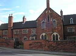
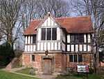
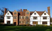
| Ashfurlong Hall |
Sutton Coldfield |
House |
1499 !Early 16th century |
01949-10-18-000018 October 1949 |
SP1350498142
52°34′51″N 1°48′08″W / 52.580925°N 1.802142°W / 52.580925; -1.802142 (Ashfurlong Hall) |
1075807 |
|
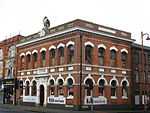
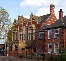
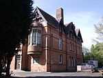
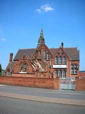
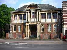
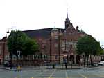
| Balsall Heath Library |
Balsall Heath |
Public Library |
1895 |
01982-07-08-00008 July 1982 |
SP0783984411
52°27′27″N 1°53′10″W / 52.457595°N 1.886064°W / 52.457595; -1.886064 (Balsall Heath Library) |
1076274 |
More images
|
| Barn Range approximately 50 Metres West of New Shipton Farmhouse (not included) |
Sutton Coldfield |
Barn |
1800 !19th century |
01988-10-11-000011 October 1988 |
SP1347794261
52°32′46″N 1°48′10″W / 52.546036°N 1.802697°W / 52.546036; -1.802697 (Barn Range approximately 50 Metres West of New Shipton Farmhouse (not included)) |
1343353 |
|
| Bell's Farmhouse |
Druids Heath |
Farmhouse |
Late 16th to mid 17th century !1595 |
01952-04-25-000025 April 1952 |
SP0636178755
52°24′24″N 1°54′29″W / 52.406766°N 1.907921°W / 52.406766; -1.907921 (Bell's Farmhouse) |
1075751 |
|
| Berrow Court Hotel, Berrow Drive, B15 |
Edgbaston |
House |
1870-5 |
01982-07-08-00008 July 1982 |
SP0423885415
52°28′00″N 1°56′21″W / 52.46666°N 1.939046°W / 52.46666; -1.939046 (Berrow Court Hotel, Berrow Drive, B15) |
1075755 |
|
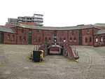
| Birmingham Gun Barrel Proof House |
Digbeth |
Gate Lodge |
1813 |
01970-01-21-000021 January 1970 |
SP0792986942
52°28′49″N 1°53′05″W / 52.480347°N 1.88468°W / 52.480347; -1.88468 (Birmingham Gun Barrel Proof House) |
1291262 |
More images
|
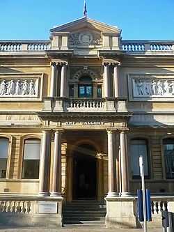
| Art Gallery, Council House & Council House Extension |
City Centre |
Council House |
1874-79 |
01952-04-25-000025 April 1952 |
SP0658387044
52°28′53″N 1°54′16″W / 52.481281°N 1.904497°W / 52.481281; -1.904497 (Art Gallery, Council House & Council House Extension) |
1210333 |
More images
|
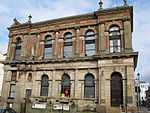
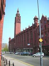
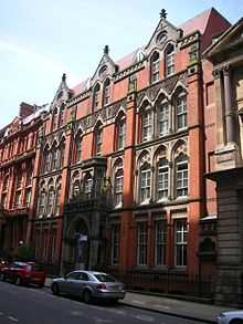
| Birmingham and Midland Institute |
City Centre |
Institute |
1899 |
01970-01-21-000021 January 1970 |
SP0663487055
52°28′53″N 1°54′13″W / 52.48138°N 1.903746°W / 52.48138; -1.903746 (Birmingham and Midland Institute) |
1343095 |
More images
|
| Bishop Latimer Memorial Church of All Saints |
Winson Green |
Church |
1903-4 |
01970-01-21-000021 January 1970 |
SP0418488792
52°29′49″N 1°56′23″W / 52.497019°N 1.9398°W / 52.497019; -1.9398 (Bishop Latimer Memorial Church of All Saints) |
1343061 |
More images
|
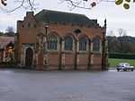
| Blakesley Hall |
Yardley |
Farmhouse |
1575 !Last quarter, 16th century |
01952-04-29-000029 April 1952 |
SP1304286185
52°28′24″N 1°48′34″W / 52.473444°N 1.809425°W / 52.473444; -1.809425 (Blakesley Hall) |
1075711 |
More images
|
| Roman Catholic Cathedral of St Chad |
City Centre |
Roman Catholic Church |
1839-41 |
01952-04-25-000025 April 1952 |
SP0696687522
52°29′08″N 1°53′56″W / 52.485574°N 1.898848°W / 52.485574; -1.898848 (Roman Catholic Cathedral of St Chad) |
1220729 |
More images
|
| Church of St Alban the Martyr |
Highgate |
Church |
1879-81 |
01952-04-25-000025 April 1952 |
SP0766485337
52°27′57″N 1°53′19″W / 52.465922°N 1.888619°W / 52.465922; -1.888619 (Church of St Alban the Martyr) |
1290539 |
More images
|
| Church of St Mary |
Lozells |
Church |
1195 !12th to early 13th century |
01952-04-25-000025 April 1952 |
SP0557190308
52°30′38″N 1°55′10″W / 52.510636°N 1.919345°W / 52.510636; -1.919345 (Church of St Mary) |
1076358 |
More images
|
| Church of St Oswald |
Small Heath |
Church/School |
1892 |
01970-01-21-000021 January 1970 |
SP1016985610
52°28′06″N 1°51′06″W / 52.468336°N 1.851738°W / 52.468336; -1.851738 (Church of St Oswald) |
1343113 |
|
| City Arcade |
City Centre |
Shopping arcade |
1898–1901 |
01982-07-08-00008 July 1982 |
SP0713786877
52°28′47″N 1°53′47″W / 52.479773°N 1.896343°W / 52.479773; -1.896343 (City Arcade) |
1289578 |
More images
|
| Coffin Furniture Works, 13-15, Fleet Street |
City Centre |
Plating Works |
1892 |
02000-04-18-000018 April 2000 |
SP0638487121
52°28′55″N 1°54′27″W / 52.481976°N 1.907426°W / 52.481976; -1.907426 (Coffin Furniture Works, 13-15, Fleet Street) |
1380231 |
More images
|
| Convent of Our Lady of Mercy |
Lozells |
Nunnery |
1840-1 |
01952-04-25-000025 April 1952 |
SP0586488903
52°29′53″N 1°54′54″W / 52.498002°N 1.915052°W / 52.498002; -1.915052 (Convent of Our Lady of Mercy) |
1076306 |
|
| Emmanuel Church |
Wylde Green |
Parish Hall |
1967 |
01976-08-26-000026 August 1976 |
SP1182593352
52°32′16″N 1°49′38″W / 52.537902°N 1.827089°W / 52.537902; -1.827089 (Emmanuel Church) |
1075819 |
More images
|
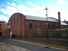
| Former Gas Retort House |
Birmingham |
Retort House |
1822 |
01993-06-30-000030 June 1993 |
SP0624686513
52°28′35″N 1°54′34″W / 52.476512°N 1.909469°W / 52.476512; -1.909469 (Former Gas Retort House) |
1234330 |
More images
|
| Friends' Institute buildings |
Birmingham |
Society of Friends meeting house etc. |
1897 |
02014-09-17-000017 September 2014 |
52°27′56″N 1°52′57″W / 52.465443°N 1.882387°W / 52.465443; -1.882387 (Friends' Institute buildings) |
1418995 |
More images
|
| Garth House, 47, Edgbaston Park Road, B15 |
Edgbaston |
House |
1901 |
01970-01-21-000021 January 1970 |
SP0502784089
52°27′17″N 1°55′39″W / 52.454732°N 1.927452°W / 52.454732; -1.927452 (Garth House, 47, Edgbaston Park Road, B15) |
1075616 |
More images
|
| Giles House, 83 Harborne Road, B15 |
Edgbaston |
House |
1855 |
01982-07-08-00008 July 1982 |
SP0513785845
52°28′14″N 1°55′33″W / 52.470518°N 1.925807°W / 52.470518; -1.925807 (Giles House, 83 Harborne Road, B15) |
1076326 |
|
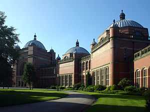
| Great Hall and Quadrant Range (University of Birmingham) |
Edgbaston |
University |
1900-1909 |
01970-01-21-000021 January 1970 |
SP0480183468
52°26′57″N 1°55′51″W / 52.449151°N 1.930786°W / 52.449151; -1.930786 (Great Hall and Quadrant Range (University of Birmingham)) |
1076133 |
More images
|
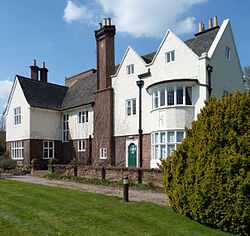
| Highbury Hall |
Moseley |
House |
1879 |
01970-01-21-000021 January 1970 |
SP0682082690
52°26′32″N 1°54′04″W / 52.442136°N 1.901095°W / 52.442136; -1.901095 (Highbury Hall) |
1076076 |
More images
|
| Holy Trinity Church |
Birchfield, Witton |
Anglican Church |
1864 |
01999-01-08-00008 January 1999 |
SP0669490103
52°30′32″N 1°54′10″W / 52.50878°N 1.902802°W / 52.50878; -1.902802 (Holy Trinity Church) |
1272059 |
|
| Horseshoe Shaped Former Stables and Stores (City of Birmingham Engineers Depot) - 23 Sheepcote Street, B16 |
Ladywood |
Local Government Office |
1840 |
01976-11-22-000022 November 1976 |
SP0563586790
52°28′44″N 1°55′06″W / 52.479008°N 1.91846°W / 52.479008; -1.91846 (Horseshoe Shaped Former Stables and Stores (City of Birmingham Engineers Depot) - 23 Sheepcote Street, B16) |
1220997 |
|
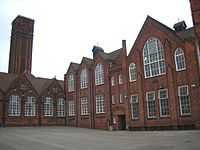
| Former Icknield Street School (a Birmingham board school) |
Hockley |
School |
1883 |
01981-09-16-000016 September 1981 |
SP0582888465
52°29′39″N 1°54′56″W / 52.494065°N 1.91559°W / 52.494065; -1.91559 (Former Icknield Street School (a Birmingham board school)) |
1076315 |
|
| King Edward's School Chapel |
Edgbaston |
School |
1938-40 |
01982-07-08-00008 July 1982 |
SP0542283654
52°27′03″N 1°55′18″W / 52.450818°N 1.921646°W / 52.450818; -1.921646 (King Edward's School Chapel) |
1343402 |
|
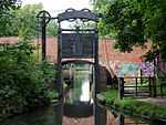
| Kings Norton Guillotine Stop Lock East of Junction of Stratford on Avon Canal with the Worcester and Birmingham Canal |
Kings Norton |
Stop Lock |
1794-1802 |
01982-07-08-00008 July 1982 |
SP0557479470
52°24′48″N 1°55′10″W / 52.413202°N 1.919478°W / 52.413202; -1.919478 (Kings Norton Guillotine Stop Lock East of Junction of Stratford on Avon Canal with the Worcester and Birmingham Canal) |
1076290 |
More images
|
| Knutsford Lodge, 25 Somerset Road, B15 |
Edgbaston |
House |
1875 !Mid to late 19th century |
01982-07-08-00008 July 1982 |
SP0463384533
52°27′31″N 1°56′00″W / 52.458727°N 1.933244°W / 52.458727; -1.933244 (Knutsford Lodge, 25 Somerset Road, B15) |
1076157 |
|
| Ladypool Primary School (a Birmingham board school} |
Sparkbrook |
Elementary School |
1885 |
01982-07-08-00008 July 1982 |
SP0863084816
52°27′40″N 1°52′28″W / 52.461224°N 1.874413°W / 52.461224; -1.874413 (Ladypool Primary School (a Birmingham board school}) |
1343133 |
|
| Lloyd's Farmhouse Farm Park, Sampson Road, B11 |
Sparkhill |
Farmhouse |
1750 !Mid 18th century |
01976-06-30-000030 June 1976 |
SP0873585233
52°27′54″N 1°52′22″W / 52.464971°N 1.872857°W / 52.464971; -1.872857 (Lloyd's Farmhouse Farm Park, Sampson Road, B11) |
1076180 |
|
| Main Block to Oscott College |
New Oscott |
Theological College |
1835-8 |
01952-04-25-000025 April 1952 |
SP0988894038
52°32′39″N 1°51′20″W / 52.544107°N 1.855627°W / 52.544107; -1.855627 (Main Block to Oscott College) |
1075635 |
More images
|
| Maryvale Institute |
Old Oscott |
Bishops Palace |
1752 |
01952-04-25-000025 April 1952 |
SP0741594534
52°32′55″N 1°53′31″W / 52.548605°N 1.892082°W / 52.548605; -1.892082 (Maryvale Institute) |
1076213 |
|
| Metchley Abbey |
Selly Oak |
House |
1799 !Early 19th century |
01952-04-25-000025 April 1952 |
SP0379684364
52°27′26″N 1°56′44″W / 52.457214°N 1.945564°W / 52.457214; -1.945564 (Metchley Abbey) |
1076261 |
|
| Methodist Central Hall |
City Centre |
Methodist Church |
1903-4 |
01970-01-21-000021 January 1970 |
SP0739587311
52°29′01″N 1°53′33″W / 52.483671°N 1.892535°W / 52.483671; -1.892535 (Methodist Central Hall) |
1075607 |
More images
|
| Moat House |
Sutton Coldfield |
House |
1680 |
01949-10-18-000018 October 1949 |
SP1213496698
52°34′05″N 1°49′21″W / 52.567975°N 1.822412°W / 52.567975; -1.822412 (Moat House) |
1343333 |
|
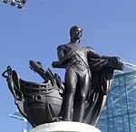
| Monument to Lord Nelson |
City Centre |
Sculpture |
1809 |
01952-04-25-000025 April 1952 |
SP0729886616
52°28′39″N 1°53′38″W / 52.477425°N 1.893978°W / 52.477425; -1.893978 (Monument to Lord Nelson) |
1343362 |
More images
|
| Moor Hall Farmhouse |
Sutton Coldfield |
Farmhouse |
1390 !Late 14th or 15th century |
01949-10-18-000018 October 1949 |
SP1251498117
52°34′51″N 1°49′00″W / 52.580723°N 1.816753°W / 52.580723; -1.816753 (Moor Hall Farmhouse) |
1075803 |
|
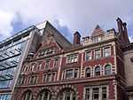
| Murdoch Chambers and Pitman Chambers, 155-161 Corporation Street, B3 |
City Centre |
Shop |
1896-7 |
01970-01-21-000021 January 1970 |
SP0726987214
52°28′58″N 1°53′40″W / 52.482801°N 1.894392°W / 52.482801; -1.894392 (Murdoch Chambers and Pitman Chambers, 155-161 Corporation Street, B3) |
1075604 |
|
| National Westminster Bank |
City Centre |
Bank |
1869 |
01970-01-21-000021 January 1970 |
SP0682986898
52°28′48″N 1°54′03″W / 52.479966°N 1.900878°W / 52.479966; -1.900878 (National Westminster Bank) |
1291206 |
More images
|
| Newhall Mill |
Sutton Coldfield |
Mill House |
1700 !18th century |
01973-12-10-000010 December 1973 |
SP1322294504
52°32′54″N 1°48′23″W / 52.548227°N 1.806447°W / 52.548227; -1.806447 (Newhall Mill) |
1343322 |
|
| Number 20, High St. and Front Railings |
Sutton Coldfield |
House |
1675 |
01949-10-18-000018 October 1949 |
SP1212096432
52°33′56″N 1°49′21″W / 52.565584°N 1.822629°W / 52.565584; -1.822629 (Number 20, High St. and Front Railings) |
1116386 |
|
| Nos 36a and 37, Waterloo St. (Wellesley House) and Screen Cut into Waterloo Court |
City Centre |
House |
1830 |
01952-04-25-000025 April 1952 |
SP0682186927
52°28′49″N 1°54′04″W / 52.480227°N 1.900995°W / 52.480227; -1.900995 (Nos 36a and 37, Waterloo St. (Wellesley House) and Screen Cut into Waterloo Court) |
1343153 |
|
| Old Grammar School on the North Side of the Churchyard to the Church of St Nicolas |
Kings Norton |
Priests House |
1399 !Early 15th century |
01952-04-25-000025 April 1952 |
SP0496378997
52°24′32″N 1°55′42″W / 52.408956°N 1.928468°W / 52.408956; -1.928468 (Old Grammar School on the North Side of the Churchyard to the Church of St Nicolas) |
1211444 |
|
| Parish Church of St Giles |
Sheldon |
Parish Church |
1299 !Early 14th century |
01952-04-25-000025 April 1952 |
SP1520984649
52°27′34″N 1°46′39″W / 52.45958°N 1.777592°W / 52.45958; -1.777592 (Parish Church of St Giles) |
1075659 |
More images
|
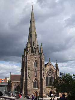
| Parish Church of St Martin |
City Centre |
Church |
1290 !Late 13th century |
01952-04-25-000025 April 1952 |
SP0735286566
52°28′37″N 1°53′35″W / 52.476975°N 1.893184°W / 52.476975; -1.893184 (Parish Church of St Martin) |
1075690 |
More images
|
| Parish Church of the Ascension |
Hall Green |
Parish Church |
1700 !18th century |
01952-04-25-000025 April 1952 |
SP1099481789
52°26′02″N 1°50′23″W / 52.433969°N 1.839719°W / 52.433969; -1.839719 (Parish Church of the Ascension) |
1076183 |
More images
|
| Premises occupied by Gallen Kamp (Argent Works) |
Hockley |
Works |
1862-3 |
01982-07-08-00008 July 1982 |
SP0608587418
52°29′05″N 1°54′43″W / 52.484649°N 1.911823°W / 52.484649; -1.911823 (Premises occupied by Gallen Kamp (Argent Works)) |
1290277 |
|
| Primrose Hill Farmhouse |
Kings Norton |
Farmhouse |
1490 !Late 15th century |
01973-01-22-000022 January 1973 |
SP0499677785
52°23′53″N 1°55′41″W / 52.398059°N 1.928°W / 52.398059; -1.928 (Primrose Hill Farmhouse) |
1076230 |
|
| Spring Hill Library |
Ladywood |
Public Library |
1893 |
01972-05-22-000022 May 1972 |
SP0556487464
52°29′06″N 1°55′10″W / 52.485068°N 1.919495°W / 52.485068; -1.919495 (Spring Hill Library) |
1076161 |
More images
|
| School of Art |
Balsall Heath |
Art School |
1899 |
01982-07-08-00008 July 1982 |
SP0789684370
52°27′26″N 1°53′07″W / 52.457225°N 1.885226°W / 52.457225; -1.885226 (School of Art) |
1343102 |
|
| Sheldon Hall |
Kitts Green |
House |
1499 !Early 16th century |
01952-04-25-000025 April 1952 |
SP1623987443
52°29′05″N 1°45′44″W / 52.484668°N 1.762299°W / 52.484668; -1.762299 (Sheldon Hall) |
1075555 |
More images
|
| Small Heath Lower School (a former Birmingham board school) |
Small Heath |
Board School |
1892 |
01982-07-08-00008 July 1982 |
SP0976585201
52°27′53″N 1°51′28″W / 52.464666°N 1.857697°W / 52.464666; -1.857697 (Small Heath Lower School (a former Birmingham board school)) |
1211189 |
|
| Small Heath Lower School, Learning Zone (a former Birmingham board school) |
Small Heath |
Teachers House |
1892 |
01982-07-08-00008 July 1982 |
SP0972385197
52°27′53″N 1°51′30″W / 52.464631°N 1.858315°W / 52.464631; -1.858315 (Small Heath Lower School, Learning Zone (a former Birmingham board school)) |
1075691 |
|
| Soho House |
Handsworth |
House |
1750 !Mid 18th century |
01952-04-25-000025 April 1952 |
SP0533289078
52°29′58″N 1°55′22″W / 52.49958°N 1.922886°W / 52.49958; -1.922886 (Soho House) |
1076151 |
More images
|
| St Philip's Grammar School |
Edgbaston |
Courtyard |
1859-61 |
01952-04-25-000025 April 1952 |
SP0487786014
52°28′19″N 1°55′47″W / 52.472039°N 1.929632°W / 52.472039; -1.929632 (St Philip's Grammar School) |
1289884 |
|
| Stables to the North East of Number 12 |
Edgbaston |
Stable |
1855 |
01976-04-22-000022 April 1976 |
SP0563985228
52°27′54″N 1°55′06″W / 52.464966°N 1.918427°W / 52.464966; -1.918427 (Stables to the North East of Number 12) |
1075741 |
|
| Statue of the Virgin Mary in Front of the Tower of Oscott College |
New Oscott |
Statue |
1837-40 |
01982-07-08-00008 July 1982 |
SP0987694018
52°32′38″N 1°51′21″W / 52.543928°N 1.855805°W / 52.543928; -1.855805 (Statue of the Virgin Mary in Front of the Tower of Oscott College) |
1075636 |
|
| Stone House |
Sutton Coldfield |
House |
1499 !Early 16th century |
01976-08-26-000026 August 1976 |
SP1308994399
52°32′50″N 1°48′30″W / 52.547286°N 1.808413°W / 52.547286; -1.808413 (Stone House) |
1075773 |
|
| Stratford House |
Highgate |
Manor House |
1601 |
01952-04-25-000025 April 1952 |
SP0818185548
52°28′04″N 1°52′52″W / 52.467811°N 1.881004°W / 52.467811; -1.881004 (Stratford House) |
1076165 |
|
| Summerfield Community Centre and Job Preparation Unit - a former Birmingham board school (Dudley Road) |
Winson Green |
House |
1878 |
01982-07-08-00008 July 1982 |
SP0427687693
52°29′14″N 1°56′18″W / 52.487138°N 1.938458°W / 52.487138; -1.938458 (Summerfield Community Centre and Job Preparation Unit - a former Birmingham board school (Dudley Road)) |
1343401 |
|
| The Anchorage |
Handsworth |
House |
1899 |
01982-07-08-00008 July 1982 |
SP0486291181
52°31′07″N 1°55′47″W / 52.51849°N 1.929779°W / 52.51849; -1.929779 (The Anchorage) |
1076319 |
|
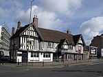
| The Bartons Arms |
Aston |
Public House |
1900-01 |
01976-03-31-000031 March 1976 |
SP0721889042
52°29′57″N 1°53′42″W / 52.499235°N 1.895104°W / 52.499235; -1.895104 (The Bartons Arms) |
1076341 |
More images
|
| The Bellefield Inn Public House |
Winson Green |
Brewery |
1890 !Late 19th century |
01985-01-17-000017 January 1985 |
SP0384087789
52°29′17″N 1°56′42″W / 52.488005°N 1.944878°W / 52.488005; -1.944878 (The Bellefield Inn Public House) |
1276279 |
|
| The Bordesley Centre (former Camp Hill Boys' and Girls' schools) |
Bordesley |
Grammar School |
1883 |
01982-07-08-00008 July 1982 |
SP0839985563
52°28′05″N 1°52′40″W / 52.467943°N 1.877794°W / 52.467943; -1.877794 (The Bordesley Centre (former Camp Hill Boys' and Girls' schools)) |
1210202 |
|
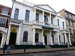
| The Grand Hotel |
City Centre |
Hotel |
1876 |
02004-05-04-00004 May 2004 |
SP0692787116
52°28′55″N 1°53′58″W / 52.481924°N 1.89943°W / 52.481924; -1.89943 (The Grand Hotel) |
1391246 |
|
| The Grove |
Sutton Coldfield |
House |
1685 !17th or early 18th century |
01949-10-18-000018 October 1949 |
SP1665594979
52°33′09″N 1°45′21″W / 52.552403°N 1.755798°W / 52.552403; -1.755798 (The Grove) |
1319945 |
|
| The Listed Building (formerly Floodgate School), Digbeth Campus, South Birmingham College - a former Birmingham board school |
Digbeth |
Technical College |
1982 |
01982-07-08-00008 July 1982 |
SP0785086412
52°28′32″N 1°53′09″W / 52.475583°N 1.885856°W / 52.475583; -1.885856 (The Listed Building (formerly Floodgate School), Digbeth Campus, South Birmingham College - a former Birmingham board school) |
1219510 |
|
| Perrot's Folly - The Monument (observatory) |
Edgbaston |
Folly |
1758 |
01952-04-25-000025 April 1952 |
SP0476886277
52°28′28″N 1°55′52″W / 52.474405°N 1.931233°W / 52.474405; -1.931233 (Perrot's Folly - The Monument (observatory)) |
1076123 |
|
| The Old Crown Public House |
Deritend |
Jettied House |
1368 |
01952-04-25-000025 April 1952 |
SP0801886323
52°28′29″N 1°53′00″W / 52.474781°N 1.883385°W / 52.474781; -1.883385 (The Old Crown Public House) |
1076298 |
|
| The Old Stone House |
Sutton Coldfield |
House |
1499 !Early 16th century |
01949-10-18-000018 October 1949 |
SP1187495270
52°33′19″N 1°49′35″W / 52.555144°N 1.826299°W / 52.555144; -1.826299 (The Old Stone House) |
1075806 |
|
| The Oratory Priests' House |
Edgbaston |
Priests House |
1850-1 |
01952-04-25-000025 April 1952 |
SP0494286037
52°28′20″N 1°55′43″W / 52.472246°N 1.928675°W / 52.472246; -1.928675 (The Oratory Priests' House) |
1343058 |
|
| The Red Lion Public House |
Handsworth |
Public House |
1901-2 |
01985-01-17-000017 January 1985 |
SP0430489589
52°30′15″N 1°56′17″W / 52.504183°N 1.938022°W / 52.504183; -1.938022 (The Red Lion Public House) |
1276278 |
|
| Saracen's Head |
Kings Norton |
Courtyard |
1490 !Late 15th century |
01952-04-25-000025 April 1952 |
SP0491478901
52°24′29″N 1°55′45″W / 52.408093°N 1.929189°W / 52.408093; -1.929189 (Saracen's Head) |
1343450 |
|
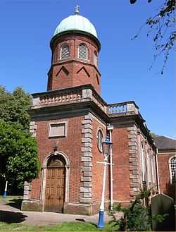
| Singers Hill Synagogue |
City Centre |
Courtyard |
1856 |
01970-01-21-000021 January 1970 |
SP0664386416
52°28′32″N 1°54′13″W / 52.475635°N 1.903626°W / 52.475635; -1.903626 (Singers Hill Synagogue) |
1075712 |
|
| Trust School |
Yardley |
House |
1800 !19th century |
01952-04-25-000025 April 1952 |
SP1350086268
52°28′27″N 1°48′10″W / 52.474179°N 1.802679°W / 52.474179; -1.802679 (Trust School) |
1343388 |
|
| Vesey Cottage |
High Heath |
House |
1499 !Early 16th century |
01949-10-18-000018 October 1949 |
SP1442597760
52°34′39″N 1°47′19″W / 52.577467°N 1.788566°W / 52.577467; -1.788566 (Vesey Cottage) |
1075772 |
|
| Vesey Grange |
High Heath |
House |
1499 !Early 16th century |
01976-08-26-000026 August 1976 |
SP1344499106
52°35′23″N 1°48′11″W / 52.589592°N 1.802989°W / 52.589592; -1.802989 (Vesey Grange) |
1320023 |
|
| Water Orton Bridge (that Part in the City of Birmingham) |
Birmingham |
Bridge |
1520 |
01949-10-18-000018 October 1949 |
SP1740691424
52°31′14″N 1°44′42″W / 52.520421°N 1.744907°W / 52.520421; -1.744907 (Water Orton Bridge (that Part in the City of Birmingham)) |
1075812 |
|
| 54–57, Albion Street B1 |
Hockley |
Terrace |
1837 |
01982-07-08-00008 July 1982 |
SP0603187461
52°29′06″N 1°54′45″W / 52.485036°N 1.912618°W / 52.485036; -1.912618 (54–57, Albion Street B1) |
1075759 |
|
| 12 New Market Street/45 Great Charles Street Queensway B3 |
City Centre |
Building |
1895 |
01970-01-21-000021 January 1970 |
SP0671687198
52°28′58″N 1°54′09″W / 52.482664°N 1.902536°W / 52.482664; -1.902536 (12 New Market Street/45 Great Charles Street Queensway B3) |
1075582 |
|
| 93 Cornwall Street B3 |
City Centre |
House |
1902 |
01970-01-21-000021 January 1970 |
SP0665387072
52°28′54″N 1°54′12″W / 52.481532°N 1.903466°W / 52.481532; -1.903466 (93 Cornwall Street B3) |
1075645 |
|
| 100 Sampson Road B11 |
Sparkhill |
Apartment |
1982 |
01982-07-08-00008 July 1982 |
SP0870585151
52°27′51″N 1°52′24″W / 52.464234°N 1.873301°W / 52.464234; -1.873301 (100 Sampson Road B11) |
1076179 |
|
| 17 & 19, Rotton Park Road B16 |
Edgbaston |
Semi Detached House |
1896 |
01982-07-08-00008 July 1982 |
SP0390986212
52°28′26″N 1°56′38″W / 52.473827°N 1.94388°W / 52.473827; -1.94388 (17 & 19, Rotton Park Road B16) |
1076203 |
|
| 12 Ampton Road B15 |
Edgbaston |
House |
1855 |
01976-04-22-000022 April 1976 |
SP0562285228
52°27′54″N 1°55′07″W / 52.464966°N 1.918677°W / 52.464966; -1.918677 (12 Ampton Road B15) |
1075740 |
|
| 36 Calthorpe Road B15 |
Edgbaston |
Villa |
1835 |
01970-01-21-000021 January 1970 |
SP0541485609
52°28′06″N 1°55′18″W / 52.468393°N 1.921733°W / 52.468393; -1.921733 (36 Calthorpe Road B15) |
1075700 |
|
| 44 Waterloo Street B2 |
City Centre |
House |
1900 |
01981-11-05-00005 November 1981 |
SP0690886973
52°28′50″N 1°53′59″W / 52.480639°N 1.899713°W / 52.480639; -1.899713 (44 Waterloo Street B2) |
1211181 |
|
| 56, 58, & 60 Newhall Street B3 |
City Centre |
House |
1900 !circa 1900 |
01970-01-21-000021 January 1970 |
SP0665887110
52°28′55″N 1°54′12″W / 52.481874°N 1.903391°W / 52.481874; -1.903391 (56, 58, & 60 Newhall Street B3) |
1219711 |
|
| 35 Calthorpe Road B15 |
Edgbaston |
Villa |
1835 !circa 1835 |
01970-01-21-000021 January 1970 |
SP0540585583
52°28′05″N 1°55′19″W / 52.46816°N 1.921866°W / 52.46816; -1.921866 (35 Calthorpe Road B15) |
1220385 |
|
| 57 & 59 Church Street B3 |
City Centre |
Building |
1909 |
01982-07-08-00008 July 1982 |
SP0679587251
52°28′59″N 1°54′05″W / 52.48314°N 1.901371°W / 52.48314; -1.901371 (57 & 59 Church Street B3) |
1221016 |
|
| 85 & 87 Cornwall Street B3 |
City Centre |
House |
1899 |
01970-01-21-000021 January 1970 |
SP0665687093
52°28′54″N 1°54′12″W / 52.481721°N 1.903421°W / 52.481721; -1.903421 (85 & 87 Cornwall Street B3) |
1290474 |
|
| 41 & 43 Church Street B3 |
City Centre |
House |
1900 |
01970-01-21-000021 January 1970 |
SP0683587205
52°28′58″N 1°54′03″W / 52.482726°N 1.900783°W / 52.482726; -1.900783 (41 & 43 Church Street B3) |
1290722 |
|
| Former Icknield Street School, 303 Icknield Street B18 (a former Birmingham board school} |
Hockley |
Teacher's House |
1883 |
01981-09-16-000016 September 1981 |
SP0583588442
52°29′38″N 1°54′56″W / 52.493858°N 1.915487°W / 52.493858; -1.915487 (Former Icknield Street School, 303 Icknield Street B18 (a former Birmingham board school}) |
1291556 |
|
| 6 Bennett's Hill B2 |
City Centre |
Detached House |
1827 |
01970-01-21-000021 January 1970 |
SP0683686951
52°28′50″N 1°54′03″W / 52.480442°N 1.900774°W / 52.480442; -1.900774 (6 Bennett's Hill B2) |
1343350 |
|
| 89 & 91 Cornwall Street B3 |
City Centre |
House |
1904 |
01970-01-21-000021 January 1970 |
SP0665287088
52°28′54″N 1°54′13″W / 52.481676°N 1.90348°W / 52.481676; -1.90348 (89 & 91 Cornwall Street B3) |
1343379 |
|
| 9, 10, & 11 Legge Lane |
Jewellery Quarter |
Jewellery Workshop |
1891-2 |
02004-04-29-000029 April 2004 |
SP0596887389
52°29′04″N 1°54′49″W / 52.48439°N 1.913547°W / 52.48439; -1.913547 (9, 10, & 11 Legge Lane) |
1391290 |
|
| 95 Cornwall Street B3 |
City Centre |
House |
1901 |
01970-01-21-000021 January 1970 |
SP0665087067
52°28′53″N 1°54′13″W / 52.481487°N 1.90351°W / 52.481487; -1.90351 (95 Cornwall Street B3) |
1210401 |
|
| 98 Edmund Street B3 |
City Centre |
Office |
1875 |
01970-01-21-000021 January 1970 |
SP0670387038
52°28′52″N 1°54′10″W / 52.481226°N 1.90273°W / 52.481226; -1.90273 (98 Edmund Street B3) |
1210578 |
|
.jpg)

.jpg)
.jpg)
.jpg)
.jpg)
.jpg)
.jpg)
.jpg)
.jpg)
.jpg)
.jpg)
.jpg)
.jpg)
.jpg)

.jpg)
.jpg)

%2C_Kings_Norton.jpg)

.jpg)
.jpg)
.jpg)
.jpg)
.jpg)
.jpg)

_(2).jpg)
.jpg)
.jpg)
.jpg)

.jpg)
.jpg)
.jpg)