Grade II* listed buildings in Waltham Forest

There are over 20,000 Grade II* listed buildings in England. This page is a list of these buildings in the London Borough of Waltham Forest.
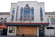
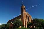
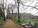
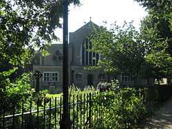
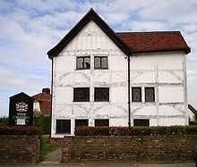
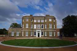
Buildings

Name Location Type Completed [note 1]Date designated Grid ref.[note 2]
Geo-coordinates
Entry number [note 3]Image
ABC Cinema Waltham Forest Shop Late C20 24 February 1987 TQ3724389311
51°35′09″N 0°01′14″W / 51.585949°N 0.020434°W
1065590
More images
Chestnuts House Waltham Forest House 1745-7 19 October 1951 TQ3747988447
51°34′41″N 0°01′03″W / 51.578127°N 0.017368°W
1191062
Church of All Saints Waltham Forest Parish Church 12th century 28 June 1954 TQ3737293382
51°37′21″N 0°01′01″W / 51.622499°N 0.01698°W
1065596
More images
Church of St Barnabas and St James the Greater Waltham Forest Church 1902 24 February 1981 TQ3722488298
51°34′37″N 0°01′16″W / 51.576851°N 0.021103°W
1065600
More images
Church of St Peter and St Paul Waltham Forest Church 1844 28 June 1954 TQ3860494383
51°37′52″N 0°00′04″E / 51.631192°N 0.001201°E
1065582
More images
Parish Church of St Mary the Virgin Waltham Forest Parish Church 1658 27 May 1954 TQ3768186857
51°33′50″N 0°00′54″W / 51.563791°N 0.015077°W
1293623
Parish Church of St Mary's Waltham Forest Church Earlier 19 October 1951 TQ3784289229
51°35′06″N 0°00′43″W / 51.585066°N 0.011826°W
1357600
More images
Queen Elizabeth's Hunting Lodge Waltham Forest Hunting Lodge Early 16th century 28 June 1954 TQ3972494776
51°38′04″N 0°01′03″E / 51.634447°N 0.017529°E
1293481
More images
The United Free Church Woodford Green, Waltham Forest Church 1904 24 February 1987 TQ4001692188
51°36′40″N 0°01′15″E / 51.611119°N 0.020712°E
1357630
The Water House, Lloyd Park (William Morris Gallery) Waltham Forest House Altered 19 October 1951 TQ3722989902
51°35′29″N 0°01′13″W / 51.591263°N 0.020405°W
1065620
More images
Walnut Tree House Waltham Forest House c.1800 27 May 1954 TQ3802787126
51°33′58″N 0°00′36″W / 51.566123°N 0.009983°W
1065586
Walthamstow House (Corpus Christi School) Waltham Forest House Mid 18th century 19 October 1951 TQ3810189745
51°35′23″N 0°00′28″W / 51.589639°N 0.007887°W
1065601

Notes

  1. The date given is the date used by Historic England as significant for the initial building or that of an important part in the structure's description.
  2. Sometimes known as OSGB36, the grid reference is based on the British national grid reference system used by the Ordnance Survey.
  3. The "List Entry Number" is a unique number assigned to each listed building/ scheduled monument by Historic England.

External links