| Name |
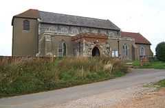
Location |
Type |
Completed | Date designated |
Grid ref.
Geo-coordinates |
Entry number | Image |
|
|
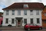
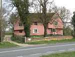
| Mill House |
Alpheton |
House |
1450 !15th century |
01953-01-10-000010 January 1953 |
TL8785349205
52°06′33″N 0°44′31″E / 52.10926°N 0.74181°E / 52.10926; 0.74181 (Mill House) |
1285943 |

|
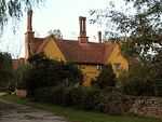
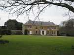
| Erwarton Hall |
Arwarton |
House |
1575 !c.1575 |
01989-02-23-000023 February 1989 |
TM2229735122
51°58′12″N 1°14′05″E / 51.970089°N 1.234847°E / 51.970089; 1.234847 (Erwarton Hall) |
1351638 |
More images
|
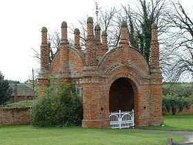
| Gatehouse at north approach drive to Erwarton Hall |
Arwarton |
Gatehouse |
1549 !c.1549 |
01989-02-23-000023 February 1989 |
TM2232535206
51°58′15″N 1°14′07″E / 51.970832°N 1.235309°E / 51.970832; 1.235309 (Gatehouse at north approach drive to Erwarton Hall) |
1193599 |
More images
|
| Belstead Hall |
Belstead |
House |
1650 !17th century |
01955-02-22-000022 February 1955 |
TM1273041246
52°01′44″N 1°05′59″E / 52.028809°N 1.099592°E / 52.028809; 1.099592 (Belstead Hall) |
1351648 |
|
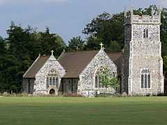
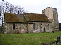
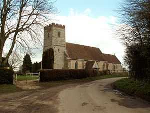
| Church of St Mary |
Belstead |
Church |
1350 !14th century |
01955-02-22-000022 February 1955 |
TM1265941098
52°01′39″N 1°05′54″E / 52.027507°N 1.098466°E / 52.027507; 1.098466 (Church of St Mary) |
1194048 |
More images
|
| Bentley Hall |
Bentley |
House |
1750 !18th century |
01955-02-22-000022 February 1955 |
TM1187038395
52°00′13″N 1°05′07″E / 52.003542°N 1.085312°E / 52.003542; 1.085312 (Bentley Hall) |
1351964 |
|
| Meeting Hall/Stables, approximately 30 metres south of Bentley Hall |
Bentley |
Jettied house |
1500 !15th/16th century |
01955-02-22-000022 February 1955 |
TM1187738372
52°00′12″N 1°05′07″E / 52.003333°N 1.0854°E / 52.003333; 1.0854 (Meeting Hall/Stables, approximately 30 metres south of Bentley Hall) |
1033423 |
|
| Barn on opposite side of road and approximately 100 metres north east of Bentley Hall |
Bentley |
Barn |
1510 !Early 16th century |
01955-02-22-000022 February 1955 |
TM1193738462
52°00′15″N 1°05′11″E / 52.004118°N 1.086328°E / 52.004118; 1.086328 (Barn on opposite side of road and approximately 100 metres north east of Bentley Hall) |
1351965 |
|
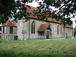
| Church of St Mary |
Bentley |
Church |
1150 !12th century nave |
01955-02-22-000022 February 1955 |
TM1186038142
52°00′05″N 1°05′06″E / 52.001275°N 1.08501°E / 52.001275; 1.08501 (Church of St Mary) |
1193823 |
|
| Bentley Old Hall |
Bentley |
House |
1300 !13th/14th century |
01990-10-30-000030 October 1990 |
TM1187139700
52°00′55″N 1°05′10″E / 52.015258°N 1.086133°E / 52.015258; 1.086133 (Bentley Old Hall) |
1193864 |
|
| Newbury Farmhouse |
Bildeston |
House |
1500 !15th–16th century |
01958-01-23-000023 January 1958 |
TL9939949075
52°06′15″N 0°54′36″E / 52.104054°N 0.910112°E / 52.104054; 0.910112 (Newbury Farmhouse) |
1037409 |
|
| Bec Cottage, 15 Chapel Street |
Bildeston |
House |
Medieval |
01958-01-23-000023 January 1958 |
TL9921649421
52°06′26″N 0°54′28″E / 52.107227°N 0.907646°E / 52.107227; 0.907646 (Bec Cottage, 15 Chapel Street) |
1351383 |
|
| 23–33 Chapel Street |
Bildeston |
House |
1500 !15th–16th century |
01958-01-23-000023 January 1958 |
TL9918149403
52°06′25″N 0°54′26″E / 52.107078°N 0.907125°E / 52.107078; 0.907125 (23–33 Chapel Street) |
1193239 |
|
| Spinners Cottage and Weavers Cottage, 35 and 37 Chapel Street |
Bildeston |
House |
1500 !15th–16th century |
01958-01-23-000023 January 1958 |
TL9917249398
52°06′25″N 0°54′25″E / 52.107036°N 0.906991°E / 52.107036; 0.906991 (Spinners Cottage and Weavers Cottage, 35 and 37 Chapel Street) |
1037448 |
|
| The Crown Inn |
Bildeston |
Jettied house |
1495 |
01958-01-23-000023 January 1958 |
TL9931049430
52°06′26″N 0°54′32″E / 52.107274°N 0.909022°E / 52.107274; 0.909022 (The Crown Inn) |
1286228 |
|
| The Fleece Hotel |
Boxford |
House |
1750 !18th century |
01958-01-23-000023 January 1958 |
TL9629040564
52°01′43″N 0°51′36″E / 52.028742°N 0.859888°E / 52.028742; 0.859888 (The Fleece Hotel) |
1037389 |
|
| Boxted Hall |
Boxted |
House |
1550 !16th century |
01953-01-10-000010 January 1953 |
TL8276850570
52°07′24″N 0°40′06″E / 52.123221°N 0.668374°E / 52.123221; 0.668374 (Boxted Hall) |
1351740 |
|
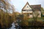
| Fishers |
Boxted |
Hall house |
1450 !15th century |
01953-01-10-000010 January 1953 |
TL8076050394
52°07′20″N 0°38′20″E / 52.1223°N 0.638983°E / 52.1223; 0.638983 (Fishers) |
1036708 |
|
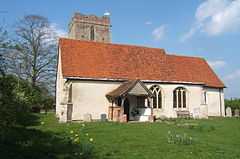
| Church of St Michael the Archangel |
Brantham |
Church |
1350 !14th century |
01955-02-22-000022 February 1955 |
TM1121634195
51°57′58″N 1°04′24″E / 51.966085°N 1.073215°E / 51.966085; 1.073215 (Church of St Michael the Archangel) |
1033431 |
More images
|
| Corner Farmhouse |
Brent Eleigh |
Jettied house |
1550 !16th century |
01958-01-23-000023 January 1958 |
TL9424147879
52°05′43″N 0°50′03″E / 52.095148°N 0.834217°E / 52.095148; 0.834217 (Corner Farmhouse) |
1285914 |
|
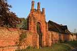
| Wall and gateway southwest of Wells Hall |
Brent Eleigh |
Gate |
1550 !16th century |
01958-01-23-000023 January 1958 |
TL9457147304
52°05′24″N 0°50′19″E / 52.089869°N 0.8387°E / 52.089869; 0.8387 (Wall and gateway southwest of Wells Hall) |
1037386 |
|
| Old Buckenham Hall School |
Brettenham Park, Brettenham |
Country house |
1550 !16th century |
01958-01-23-000023 January 1958 |
TL9571652965
52°08′25″N 0°51′31″E / 52.140298°N 0.858643°E / 52.140298; 0.858643 (Old Buckenham Hall School) |
1037349 |
|
| Poplars Farmhouse |
Brettenham |
House |
1450 !15th century and later |
01958-01-23-000023 January 1958 |
TL9527052710
52°08′17″N 0°51′07″E / 52.138166°N 0.851988°E / 52.138166; 0.851988 (Poplars Farmhouse) |
1351456 |
|
| Great Bevills |
Bures St. Mary |
House |
1490 !c.1490 |
01953-01-10-000010 January 1953 |
TL9070934684
51°58′40″N 0°46′31″E / 51.977884°N 0.775369°E / 51.977884; 0.775369 (Great Bevills) |
1036684 |
|
| Malthouse and premises occupied by W A Church (Bures) Ltd |
Bures St. Mary |
House |
1600 !16th–17th century |
01953-01-10-000010 January 1953 |
TL9078534135
51°58′23″N 0°46′34″E / 51.972928°N 0.77617°E / 51.972928; 0.77617 (Malthouse and premises occupied by W A Church (Bures) Ltd) |
1036677 |
|
| Sawyer's Farmhouse |
Little Cornard, Bures St. Mary |
House |
1550 !16th century |
01978-02-09-00009 February 1978 |
TL9068737192
52°00′01″N 0°46′35″E / 52.000414°N 0.776443°E / 52.000414; 0.776443 (Sawyer's Farmhouse) |
1036687 |
|
| Smallbridge Hall |
Bures St. Mary |
Country house |
1550 !c.1550 |
01953-01-10-000010 January 1953 |
TL9293933065
51°57′45″N 0°48′25″E / 51.962576°N 0.806888°E / 51.962576; 0.806888 (Smallbridge Hall) |
1194489 |
|
| The Old Bakery |
Bures St. Mary |
Jettied house |
1550 !16th century |
01973-01-10-000010 January 1973 |
TL9075934171
51°58′24″N 0°46′33″E / 51.97326°N 0.775812°E / 51.97326; 0.775812 (The Old Bakery) |
1351766 |
|
| Boynton Hall |
Capel St. Mary |
House |
1550 !16th century |
01972-03-16-000016 March 1972 |
TM0917037231
51°59′39″N 1°02′43″E / 51.994115°N 1.045327°E / 51.994115; 1.045327 (Boynton Hall) |
1033394 |
|
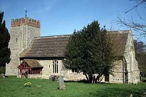
| Church of St Mary |
Capel St. Mary |
Church |
1300 !13th/14th century |
01955-02-22-000022 February 1955 |
TM0858338242
52°00′12″N 1°02′15″E / 52.003412°N 1.037404°E / 52.003412; 1.037404 (Church of St Mary) |
1285712 |
More images
|
| Church of All Saints |
Chattisham |
Church |
1310 !Early 14th century |
01955-02-22-000022 February 1955 |
TM0922642150
52°02′18″N 1°02′57″E / 52.038256°N 1.049144°E / 52.038256; 1.049144 (Church of All Saints) |
1351620 |
More images
|
| Princhetts |
Chelsworth |
House |
1600 !Probably 16th–17th century |
01958-01-23-000023 January 1958 |
TL9827148058
52°05′43″N 0°53′35″E / 52.095328°N 0.893073°E / 52.095328; 0.893073 (Princhetts) |
1037362 |
|
| The Grange |
Chelsworth |
House |
1650 !17th century |
01980-07-10-000010 July 1980 |
TL9807247982
52°05′41″N 0°53′24″E / 52.094716°N 0.890128°E / 52.094716; 0.890128 (The Grange) |
1037325 |
|
| The Old Forge |
Chelsworth |
Jettied house |
1500 !15th–16th century |
01958-01-23-000023 January 1958 |
TL9832548085
52°05′44″N 0°53′38″E / 52.095551°N 0.893876°E / 52.095551; 0.893876 (The Old Forge) |
1351422 |
|
| Chilton Hall |
Chilton |
House |
1490 !Late 15th century |
01953-01-10-000010 January 1953 |
TL8904342716
52°03′02″N 0°45′20″E / 52.050583°N 0.755573°E / 52.050583; 0.755573 (Chilton Hall) |
1036689 |
|
| Church House |
Cockfield |
Cruck house |
Medieval |
01958-01-23-000023 January 1958 |
TL9037954944
52°09′36″N 0°46′55″E / 52.159933°N 0.781861°E / 52.159933; 0.781861 (Church House) |
1194237 |
|
| Church of St Mary |
Washbrook, Copdock and Washbrook |
Church |
1150 !12th century |
01955-02-22-000022 February 1955 |
TM1095342589
52°02′30″N 1°04′28″E / 52.041544°N 1.074556°E / 52.041544; 1.074556 (Church of St Mary) |
1194408 |
More images
|
| Church of St Peter |
Copdock, Copdock and Washbrook |
Church |
1400 !14th and 15th century |
01955-02-22-000022 February 1955 |
49°46′01″N 7°33′26″W / 49.766806°N 7.55716°W / 49.766806; -7.55716 (Church of St Peter) |
1194324 |
More images
|
| Bellcage to north side of churchyard |
East Bergholt |
Bell tower |
1590 !Late 16th century |
01955-02-22-000022 February 1955 |
TM0704134484
51°58′13″N 1°00′46″E / 51.970249°N 1.012706°E / 51.970249; 1.012706 (Bellcage to north side of churchyard) |
1033451 |
More images
|
| Bridge Cottage |
Flatford, East Bergholt |
House |
1590 !Late 16th century |
01955-02-22-000022 February 1955 |
TM0758233336
51°57′35″N 1°01′12″E / 51.95974°N 1.019877°E / 51.95974; 1.019877 (Bridge Cottage) |
1033472 |
|
| Chaplins |
Gaston End, East Bergholt |
House |
1510 !Early 16th century |
01955-02-22-000022 February 1955 |
TM0743635367
51°58′41″N 1°01′08″E / 51.978029°N 1.018981°E / 51.978029; 1.018981 (Chaplins) |
1286166 |
|
| Churchgate House |
Rectory Hill, East Bergholt |
House |
1500 !c.1500 |
01955-02-22-000022 February 1955 |
TM0708634463
51°58′12″N 1°00′48″E / 51.970044°N 1.013348°E / 51.970044; 1.013348 (Churchgate House) |
1033454 |
|
| Claycotts |
Flatford Road, East Bergholt |
House |
1510 !Early 16th century |
01955-02-22-000022 February 1955 |
TM0776534226
51°58′04″N 1°01′23″E / 51.967663°N 1.023074°E / 51.967663; 1.023074 (Claycotts) |
1351932 |
|
| The Gables |
The Street, East Bergholt |
House |
1590 !Late 16th century |
01955-02-22-000022 February 1955 |
TM0695834733
51°58′21″N 1°00′42″E / 51.972515°N 1.01165°E / 51.972515; 1.01165 (The Gables) |
1285872 |
|
| The Lodge |
Hadleigh Rd, East Bergholt |
House |
1750 !18th century |
01955-02-22-000022 February 1955 |
TM0648735428
51°58′44″N 1°00′19″E / 51.97893°N 1.005221°E / 51.97893; 1.005221 (The Lodge) |
1286124 |
|
| Church of St Peter |
Freston |
Church |
1300 !13th–14th century |
01955-02-22-000022 February 1955 |
TM1709639511
52°00′42″N 1°09′43″E / 52.011544°N 1.162032°E / 52.011544; 1.162032 (Church of St Peter) |
1036973 |
More images
|
| Freston Tower |
Freston Park, Freston |
Watchtower |
1550 !c.1550 |
01955-02-22-000022 February 1955 |
TM1779239664
52°00′46″N 1°10′20″E / 52.012645°N 1.172255°E / 52.012645; 1.172255 (Freston Tower) |
1203980 |
More images
|
| Angel House |
Glemsford |
Jettied house |
1550 !16th century |
01961-03-23-000023 March 1961 |
TL8287647515
52°05′45″N 0°40′06″E / 52.095749°N 0.668311°E / 52.095749; 0.668311 (Angel House) |
1036656 |
|
| Monks Hall |
Low St, Glemsford |
House |
1450 !15th century |
01961-03-23-000023 March 1961 |
TL8342048820
52°06′26″N 0°40′37″E / 52.107289°N 0.676945°E / 52.107289; 0.676945 (Monks Hall) |
1285414 |
|
| Peverells |
21–25, Tye Green, Glemsford |
Hall house |
1500 !15th–16th century |
01953-01-10-000010 January 1953 |
TL8262348025
52°06′01″N 0°39′54″E / 52.100413°N 0.664895°E / 52.100413; 0.664895 (Peverells) |
1036665 |
|
| 13–17, Chequers Lane |
Glemsford |
Jettied house |
1600 !16th and 17th century |
01961-03-23-000023 March 1961 |
TL8298448806
52°06′26″N 0°40′14″E / 52.107308°N 0.670578°E / 52.107308; 0.670578 (13–17, Chequers Lane) |
1036649 |
|
| Poplars Farmhouse |
Great Cornard |
House |
1450 !15th century |
01953-01-10-000010 January 1953 |
TL9030741094
52°02′08″N 0°46′23″E / 52.035585°N 0.773081°E / 52.035585; 0.773081 (Poplars Farmhouse) |
1036630 |
|
| Babergh Hall |
Great Waldingfield |
House |
1900 !Late 18th–early 19th century |
01953-01-10-000010 January 1953 |
TL9031444498
52°03′58″N 0°46′30″E / 52.06615°N 0.775078°E / 52.06615; 0.775078 (Babergh Hall) |
1036634 |
|
| Groton Hall |
Groton |
House |
1750 !18th century |
01958-01-23-000023 January 1958 |
TL9597741658
52°02′19″N 0°51′21″E / 52.038676°N 0.855958°E / 52.038676; 0.855958 (Groton Hall) |
1285612 |
|
| Bank House and the White Lion Hotel |
42 & 44, High St, Hadleigh |
House |
1750 !18th century |
01950-04-26-000026 April 1950 |
TM0271642428
52°02′35″N 0°57′16″E / 52.043169°N 0.954531°E / 52.043169; 0.954531 (Bank House and the White Lion Hotel) |
1036802 |
|
| Barclays Bank |
Hadleigh |
Loggia |
1810 !Early 19th century |
01950-04-26-000026 April 1950 |
TM0272542421
52°02′35″N 0°57′17″E / 52.043103°N 0.954658°E / 52.043103; 0.954658 (Barclays Bank) |
1351707 |
|
| Benton End House |
Raydon Rd, Hadleigh |
House |
1750 !18th century |
01950-04-26-000026 April 1950 |
TM0334341357
52°02′00″N 0°57′47″E / 52.033323°N 0.963024°E / 52.033323; 0.963024 (Benton End House) |
1194592 |
|
| Deanery |
Church Walk, Hadleigh |
Deanery |
1831 |
01972-05-22-000022 May 1972 |
TM0249442470
49°46′01″N 7°33′26″W / 49.766806°N 7.55716°W / 49.766806; -7.55716 (Deanery) |
1194061 |
|
| East House |
George St, Hadleigh |
House |
1750 !18th century |
01950-04-26-000026 April 1950 |
TM0287742615
52°02′41″N 0°57′25″E / 52.044789°N 0.956986°E / 52.044789; 0.956986 (East House) |
1036786 |
|
| Sun Court |
12–16, Bridge St, Hadleigh |
Timber-framed house |
1550 !16th century |
01950-04-26-000026 April 1950 |
TM0233042967
52°02′53″N 0°56′57″E / 52.048149°N 0.949229°E / 52.048149; 0.949229 (Sun Court) |
1193958 |
|
| Sun Court |
107, High St, Hadleigh |
House |
1510 !Early 16th century |
01950-04-26-000026 April 1950 |
TM0252142695
52°02′44″N 0°57′07″E / 52.045637°N 0.951849°E / 52.045637; 0.951849 (Sun Court) |
1036746 |
|
| The Manse |
90, Benson St, Hadleigh |
House |
1750 !18th century |
01950-04-26-000026 April 1950 |
TM0294541860
52°02′17″N 0°57′27″E / 52.037985°N 0.957528°E / 52.037985; 0.957528 (The Manse) |
1351708 |
|
| Toppesfield Bridge |
Hadleigh |
Bridge |
1350 !14th century |
01950-04-26-000026 April 1950 |
TM0257442147
52°02′27″N 0°57′08″E / 52.040698°N 0.952297°E / 52.040698; 0.952297 (Toppesfield Bridge) |
1036780 |
|
| White Hart Inn |
Hadleigh |
Inn |
1500 !15th/16th century |
01950-04-26-000026 April 1950 |
TM0222843055
52°02′56″N 0°56′52″E / 52.048977°N 0.947796°E / 52.048977; 0.947796 (White Hart Inn) |
1193977 |
|
| 95, 97 and 99 Angel Street |
Hadleigh |
House |
1550 !16th century |
01950-04-26-000026 April 1950 |
TM0289242860
52°02′49″N 0°57′26″E / 52.046983°N 0.95735°E / 52.046983; 0.95735 (95, 97 and 99 Angel Street) |
1193765 |
|
| 13 Bridge Street |
Hadleigh |
Timber-framed house |
1650 !17th century |
01950-04-26-000026 April 1950 |
TM0239642836
52°02′49″N 0°57′00″E / 52.046949°N 0.950113°E / 52.046949; 0.950113 (13 Bridge Street) |
1036811 |
|
| 15 Bridge Street |
Hadleigh |
Timber-framed house |
1750 !18th century |
01950-04-26-000026 April 1950 |
TM0238842839
52°02′49″N 0°57′00″E / 52.046979°N 0.949998°E / 52.046979; 0.949998 (15 Bridge Street) |
1036812 |
|
| 21 Bridge Street |
Hadleigh |
House |
1750 !18th century |
01950-04-26-000026 April 1950 |
TM0229442950
52°02′53″N 0°56′55″E / 52.04801°N 0.948695°E / 52.04801; 0.948695 (21 Bridge Street) |
1193934 |
|
| 77–81 Benton Street |
Hadleigh |
House |
1750 !18th century |
01950-04-26-000026 April 1950 |
TM0293941936
52°02′19″N 0°57′27″E / 52.03867°N 0.957486°E / 52.03867; 0.957486 (77–81 Benton Street) |
1193819 |
|
| 92 and 94 Benton Street |
Hadleigh |
Inn |
1550 !16th century |
01950-04-26-000026 April 1950 |
TM0299341820
52°02′15″N 0°57′30″E / 52.037609°N 0.958203°E / 52.037609; 0.958203 (92 and 94 Benton Street) |
1036804 |
|
| 45 and 47 High Street |
Hadleigh |
Hall house |
1790 !Late 18th century |
01950-04-26-000026 April 1950 |
TM0268442443
52°02′36″N 0°57′15″E / 52.043315°N 0.954074°E / 52.043315; 0.954074 (45 and 47 High Street) |
1036779 |
|
| 46 and 48 High Street |
Hadleigh |
Shop |
1650 !17th century |
01950-04-26-000026 April 1950 |
TM0270542444
52°02′36″N 0°57′16″E / 52.043317°N 0.95438°E / 52.043317; 0.95438 (46 and 48 High Street) |
1036757 |
|
| 49 High Street |
Hadleigh |
Timber-framed house |
1774 |
01950-04-26-000026 April 1950 |
TM0267942450
52°02′36″N 0°57′14″E / 52.04338°N 0.954005°E / 52.04338; 0.954005 (49 High Street) |
1036735 |
|
| 79–83 High Street |
Hadleigh |
Hall house |
1450 !15th century |
01950-04-26-000026 April 1950 |
TM0258442575
52°02′40″N 0°57′10″E / 52.044537°N 0.952696°E / 52.044537; 0.952696 (79–83 High Street) |
1036740 |
|
| 91 and 93 High Street |
Hadleigh |
Timber-framed house |
1650 !17th century |
01950-04-26-000026 April 1950 |
TM0256342623
52°02′42″N 0°57′09″E / 52.044976°N 0.952418°E / 52.044976; 0.952418 (91 and 93 High Street) |
1194454 |
|
| 97 and 99 High Street |
Hadleigh |
House |
1650 !17th century |
01950-04-26-000026 April 1950 |
TM0255042649
52°02′43″N 0°57′08″E / 52.045214°N 0.952244°E / 52.045214; 0.952244 (97 and 99 High Street) |
1036744 |
|
| 124 and 126 High Street |
Hadleigh |
House |
1550 !16th century |
01950-04-26-000026 April 1950 |
TM0252342800
52°02′48″N 0°57′07″E / 52.046579°N 0.951941°E / 52.046579; 0.951941 (124 and 126 High Street) |
1194322 |
|
| 108 and 110 High Street |
Hadleigh |
House |
1649 |
01950-04-26-000026 April 1950 |
TM0255142732
52°02′45″N 0°57′08″E / 52.045959°N 0.952308°E / 52.045959; 0.952308 (108 and 110 High Street) |
1194306 |
|
| 22–26 George Street |
Hadleigh |
Timber-framed house |
1500 !15th–16th century |
01950-04-26-000026 April 1950 |
TM0283242582
52°02′40″N 0°57′23″E / 52.044509°N 0.956311°E / 52.044509; 0.956311 (22–26 George Street) |
1351701 |
|
| 28 George Street |
Hadleigh |
House |
1700 !17th–18th century |
01950-04-26-000026 April 1950 |
TM0284042579
52°02′40″N 0°57′23″E / 52.044479°N 0.956426°E / 52.044479; 0.956426 (28 George Street) |
1036785 |
|
| 48 George Street |
Hadleigh |
Cross-wing house |
1450 !15th century |
01950-04-26-000026 April 1950 |
TM0303742686
52°02′43″N 0°57′34″E / 52.045368°N 0.959358°E / 52.045368; 0.959358 (48 George Street) |
1036788 |
|
| Church of St Mary |
Harkstead |
Church |
1150 !12th century |
01955-02-22-000022 February 1955 |
TM1940835280
51°58′22″N 1°11′35″E / 51.972655°N 1.192961°E / 51.972655; 1.192961 (Church of St Mary) |
1286085 |
More images
|
| Church of St Mary |
Higham |
Church |
1250 !13th century |
01955-02-22-000022 February 1955 |
TM0356335232
51°58′42″N 0°57′45″E / 51.978249°N 0.96259°E / 51.978249; 0.96259 (Church of St Mary) |
1351625 |
|
| Service ranges, stables, former coachhouse and brewhouse attached to Hintlesham Hall |
Hintlesham |
Brewhouse |
1750 !18th century |
01955-02-22-000022 February 1955 |
TM0828243846
52°03′14″N 1°02′11″E / 52.053838°N 1.036434°E / 52.053838; 1.036434 (Service ranges, stables, former coachhouse and brewhouse attached to Hintlesham Hall) |
1036918 |
|
| Royal Hospital School, main range including assembly hall, dining room, gymnasium, administration and teaching accommodation |
Holbrook |
Hospital school |
1933 !c.1925–33 |
01981-01-16-000016 January 1981 |
TM1654335227
51°58′24″N 1°09′05″E / 51.973302°N 1.151284°E / 51.973302; 1.151284 (Royal Hospital School, main range including assembly hall, dining room, gymnasium, administration and teaching accommodation) |
1036871 |
|
| Chapel of the Royal Hospital School |
Holbrook |
Chapel |
1933 !c.1925–33 |
01989-02-23-000023 February 1989 |
TM1672635223
51°58′23″N 1°09′14″E / 51.973194°N 1.153942°E / 51.973194; 1.153942 (Chapel of the Royal Hospital School) |
1036873 |
|
| Church of All Saints |
Holbrook |
Church |
1350 !14th century |
01955-02-22-000022 February 1955 |
TM1704036128
51°58′52″N 1°09′33″E / 51.981196°N 1.159078°E / 51.981196; 1.159078 (Church of All Saints) |
1193727 |
More images
|
| Church of St Mary |
Holton St. Mary |
Church |
1250 !13th century |
01955-02-22-000022 February 1955 |
TM0592736787
51°59′29″N 0°59′52″E / 51.99134°N 0.997894°E / 51.99134; 0.997894 (Church of St Mary) |
1351596 |
|
| Ailsa Cottage & Greenan |
Kersey |
Cross-wing house |
1500 !15th–16th century |
01958-01-23-000023 January 1958 |
TM0005144050
52°03′31″N 0°55′00″E / 52.0587°N 0.916674°E / 52.0587; 0.916674 (Ailsa Cottage & Greenan) |
1037237 |
|
| Corner House |
Kersey |
House |
1500 !15th–16th century |
01958-01-23-000023 January 1958 |
TM0000144277
52°03′39″N 0°54′58″E / 52.060756°N 0.916079°E / 52.060756; 0.916079 (Corner House) |
1180414 |
|
| Cressland & Kedges End |
Kersey |
House |
1650 !17th century |
01958-01-23-000023 January 1958 |
TM0002444133
52°03′34″N 0°54′59″E / 52.059455°N 0.916329°E / 52.059455; 0.916329 (Cressland & Kedges End) |
1037247 |
|
| Kersey Mill |
Kersey |
Mill |
1800 !18th–19th century |
01958-01-23-000023 January 1958 |
TM0117444417
52°03′42″N 0°56′00″E / 52.061589°N 0.933248°E / 52.061589; 0.933248 (Kersey Mill) |
1180340 |
|
| Mill House |
Kersey |
Mill house |
1650 !17th century |
01958-01-23-000023 January 1958 |
TM0003544208
52°03′36″N 0°55′00″E / 52.060124°N 0.916534°E / 52.060124; 0.916534 (Mill House) |
1351458 |
|
| River House |
Kersey |
House |
1550 !16th century |
01958-01-23-000023 January 1958 |
TM0007244114
52°03′33″N 0°55′01″E / 52.059267°N 0.917017°E / 52.059267; 0.917017 (River House) |
1234780 |
|
| The Little Manor |
Kersey |
Cross-wing house |
1400 !14th–15th century |
01958-01-23-000023 January 1958 |
TM0014143987
52°03′29″N 0°55′05″E / 52.058102°N 0.917948°E / 52.058102; 0.917948 (The Little Manor) |
1351461 |
|
| 1 & 2 The Street |
Kersey |
Jettied house |
1600 !16th–17th century |
01958-01-23-000023 January 1958 |
TM0000444180
52°03′36″N 0°54′58″E / 52.059884°N 0.916066°E / 52.059884; 0.916066 (1 & 2 The Street) |
1351485 |
|
| 3 & 4 The Street |
Kersey |
Jettied house |
1550 !16th century |
01958-01-23-000023 January 1958 |
TL9999944188
52°03′36″N 0°54′58″E / 52.059958°N 0.915997°E / 52.059958; 0.915997 (3 & 4 The Street) |
1285468 |
|
| 5 & 6, The Street |
Kersey |
Jettied house |
1500 !15th–16th century |
01958-01-23-000023 January 1958 |
TL9999844202
52°03′36″N 0°54′58″E / 52.060084°N 0.915991°E / 52.060084; 0.915991 (5 & 6, The Street) |
1037249 |
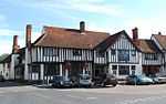
|
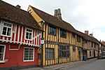
| Angel Hotel |
Lavenham |
Hotel |
1750 !18th century |
01958-01-23-000023 January 1958 |
TL9161549357
52°06′34″N 0°47′48″E / 52.109335°N 0.796762°E / 52.109335; 0.796762 (Angel Hotel) |
1037184 |
|
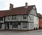
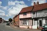
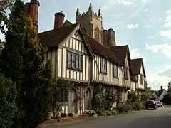
| Little Hall |
Lavenham |
Cross-wing house |
1450 !15th century |
01958-01-23-000023 January 1958 |
TL9163749327
52°06′33″N 0°47′49″E / 52.109058°N 0.797066°E / 52.109058; 0.797066 (Little Hall) |
1351533 |
More images
|
| Swan Hotel (that part formerly listed as No 102) |
Lavenham |
House/hotel |
1500 !15th–16th century |
01958-01-23-000023 January 1958 |
TL9153949186
52°06′28″N 0°47′44″E / 52.107826°N 0.795557°E / 52.107826; 0.795557 (Swan Hotel (that part formerly listed as No 102)) |
1037174 |
|
| Swan Hotel (that part formerly listed as Swan Inn) |
Lavenham |
House |
1550 !16th century |
01958-01-23-000023 January 1958 |
TL9155449185
52°06′28″N 0°47′45″E / 52.107812°N 0.795775°E / 52.107812; 0.795775 (Swan Hotel (that part formerly listed as Swan Inn)) |
1037175 |
|
| Swan Hotel (that part formerly listed as No 101) |
Lavenham |
House |
1550 !Probably 16th century |
01958-01-23-000023 January 1958 |
TL9153649201
52°06′29″N 0°47′44″E / 52.107962°N 0.795522°E / 52.107962; 0.795522 (Swan Hotel (that part formerly listed as No 101)) |
1351529 |
|
| The Barn |
Lavenham |
Barn |
1500 !15th–16th century |
01958-01-23-000023 January 1958 |
TL9169249244
52°06′30″N 0°47′52″E / 52.108294°N 0.797821°E / 52.108294; 0.797821 (The Barn) |
1037216 |
|
| The Great House |
Lavenham |
House |
1750 !18th century |
01958-01-23-000023 January 1958 |
TL9163049344
52°06′33″N 0°47′49″E / 52.109213°N 0.796973°E / 52.109213; 0.796973 (The Great House) |
1181062 |
|
| The Manor House |
Lavenham |
House |
1450 !15th century |
01958-01-23-000023 January 1958 |
TL9171849107
52°06′25″N 0°47′53″E / 52.107055°N 0.798123°E / 52.107055; 0.798123 (The Manor House) |
1037129 |
|
| Woolstaplers |
Lavenham |
House |
1410 !Early 15th (or possibly 14th) century |
01958-01-23-000023 January 1958 |
TL9175649454
52°06′37″N 0°47′56″E / 52.110158°N 0.798873°E / 52.110158; 0.798873 (Woolstaplers) |
1037190 |
|
| 58 Water Street |
Lavenham |
Jettied house |
1425 |
01958-01-23-000023 January 1958 |
TL9169149113
52°06′26″N 0°47′52″E / 52.107118°N 0.797733°E / 52.107118; 0.797733 (58 Water Street) |
1037130 |
|
| No 9, Church St, including outbuilding adjoining on the north, and no 10 |
Lavenham |
House |
1450 !15th century |
01958-01-23-000023 January 1958 |
TL9153749076
52°06′25″N 0°47′44″E / 52.106839°N 0.795466°E / 52.106839; 0.795466 (No 9, Church St, including outbuilding adjoining on the north, and no 10) |
1037228 |
|
| Blaize House, 11 and 12 Church Street |
Lavenham |
Clothier's house |
1500 !15th–16th century |
01958-01-23-000023 January 1958 |
TL9152649062
52°06′24″N 0°47′43″E / 52.106717°N 0.795298°E / 52.106717; 0.795298 (Blaize House, 11 and 12 Church Street) |
1180575 |
|
| 13–15 Church Street |
Lavenham |
Clothier's house |
1500 !15th–16th century |
01958-01-23-000023 January 1958 |
TL9152049054
52°06′24″N 0°47′43″E / 52.106647°N 0.795206°E / 52.106647; 0.795206 (13–15 Church Street) |
1351478 |
|
| 81 Church Street |
Lavenham |
House |
1750 !c.1750 |
01958-01-23-000023 January 1958 |
TL9146849054
52°06′24″N 0°47′40″E / 52.106665°N 0.794448°E / 52.106665; 0.794448 (81 Church Street) |
1351480 |
|
| 85 Church Street |
Lavenham |
Jettied house |
1550 !16th century |
01958-01-23-000023 January 1958 |
TL9150349073
52°06′25″N 0°47′42″E / 52.106824°N 0.794969°E / 52.106824; 0.794969 (85 Church Street) |
1180676 |
|
| 86 Church Street |
Lavenham |
Jettied house |
1550 !16th century |
01958-01-23-000023 January 1958 |
TL9150649080
52°06′25″N 0°47′42″E / 52.106886°N 0.795016°E / 52.106886; 0.795016 (86 Church Street) |
1037192 |
|
| 87 Church Street |
Lavenham |
Jettied house |
1500 !15th–16th century |
01958-01-23-000023 January 1958 |
TL9150849087
52°06′25″N 0°47′42″E / 52.106948°N 0.79505°E / 52.106948; 0.79505 (87 Church Street) |
1351499 |
|
| 88 & 89 Church Street |
Lavenham |
Jettied house |
1500 !15th–16th century |
01958-01-23-000023 January 1958 |
TL9151049092
52°06′25″N 0°47′42″E / 52.106992°N 0.795082°E / 52.106992; 0.795082 (88 & 89 Church Street) |
1037193 |
|
| 90 Church Street |
Lavenham |
Jettied house |
1500 !15th–16th century |
01958-01-23-000023 January 1958 |
TL9151449102
52°06′25″N 0°47′43″E / 52.107081°N 0.795146°E / 52.107081; 0.795146 (90 Church Street) |
1037194 |
|
| 91 Church Street |
Lavenham |
House |
1550 !16th century |
01958-01-23-000023 January 1958 |
TL9151649119
52°06′26″N 0°47′43″E / 52.107232°N 0.795184°E / 52.107232; 0.795184 (91 Church Street) |
1351500 |
|
| The Willows [92 Church Street] |
Lavenham |
House |
1750 !c.1750 |
01958-01-23-000023 January 1958 |
TL9151449146
52°06′27″N 0°47′43″E / 52.107476°N 0.79517°E / 52.107476; 0.79517 (The Willows [92 Church Street)] |
1037195 |
|
| 10–13 High Street |
Lavenham |
House |
1800 !18th or early 19th century |
01958-01-23-000023 January 1958 |
TL9150449271
52°06′31″N 0°47′42″E / 52.108602°N 0.795095°E / 52.108602; 0.795095 (10–13 High Street) |
1285335 |
|
| 97 High Street |
Lavenham |
House |
1500 !15th–16th century |
01958-01-23-000023 January 1958 |
TL9153149228
52°06′30″N 0°47′44″E / 52.108206°N 0.795464°E / 52.108206; 0.795464 (97 High Street) |
1351528 |
|
| 98–100 High Street |
Lavenham |
Cross-wing house |
1410 !Early 15th century |
01958-01-23-000023 January 1958 |
TL9153449215
52°06′29″N 0°47′44″E / 52.108088°N 0.795501°E / 52.108088; 0.795501 (98–100 High Street) |
1037173 |
|
| Lawshall Hall |
Lawshall |
House |
1550 !Mid-16th century |
01953-01-10-000010 January 1953 |
TL8633354290
52°09′20″N 0°43′21″E / 52.155439°N 0.722424°E / 52.155439; 0.722424 (Lawshall Hall) |
1036593 |
|
| Honey Hall |
Honey Tye, Leavenheath |
Hall house |
1450 !15th century |
01953-01-10-000010 January 1953 |
TL9559535644
51°59′05″N 0°50′49″E / 51.984808°N 0.846964°E / 51.984808; 0.846964 (Honey Hall) |
1036600 |
|
| Bourchier Galleries, House and Shop |
Long Melford |
House |
1690 !Late 17th century |
01961-03-23-000023 March 1961 |
TL8624745487
52°04′35″N 0°42′59″E / 52.076413°N 0.716356°E / 52.076413; 0.716356 (Bourchier Galleries, House and Shop) |
1033698 |
|
| Bridge Street Farmhouse |
Bridge Street, Long Melford |
House |
Medieval |
01953-01-10-000010 January 1953 |
TL8715348463
52°06′10″N 0°43′52″E / 52.102834°N 0.731193°E / 52.102834; 0.731193 (Bridge Street Farmhouse) |
1036574 |
|
| Brook House |
Long Melford |
House |
1600 !16th and 17th century |
01953-01-10-000010 January 1953 |
TL8642945909
52°04′49″N 0°43′09″E / 52.080142°N 0.719239°E / 52.080142; 0.719239 (Brook House) |
1183049 |
|
| Bull Hotel |
Long Melford |
Hotel |
1580 !1580 or earlier |
01978-02-09-00009 February 1978 |
TL8648745878
52°04′47″N 0°43′12″E / 52.079844°N 0.720068°E / 52.079844; 0.720068 (Bull Hotel) |
1182781 |
|
| Chapel at Melford Place |
Long Melford |
House |
1350 !14th century |
01953-01-10-000010 January 1953 |
TL8619644966
52°04′18″N 0°42′55″E / 52.071752°N 0.715329°E / 52.071752; 0.715329 (Chapel at Melford Place) |
1183356 |
|
| Dovecote to the southwest of Kentwell Hall |
Kentwell, Long Melford |
Dovecote |
1750 !18th century |
01978-02-09-00009 February 1978 |
TL8630447882
52°05′52″N 0°43′07″E / 52.097902°N 0.718494°E / 52.097902; 0.718494 (Dovecote to the southwest of Kentwell Hall) |
1351844 |
|
| Garden walls to Melford Hall |
Long Melford |
Garden wall |
1559 !c.1559 |
01978-02-09-00009 February 1978 |
TL8657646198
52°04′58″N 0°43′18″E / 52.082688°N 0.72154°E / 52.082688; 0.72154 (Garden walls to Melford Hall) |
1351818 |
|
| Gateway and lodges to Melford Hall |
Long Melford |
Gate lodge |
1559 !c.1559 |
01971-04-16-000016 April 1971 |
TL8658646294
52°05′01″N 0°43′18″E / 52.083547°N 0.721738°E / 52.083547; 0.721738 (Gateway and lodges to Melford Hall) |
1033703 |
|
| Summerhouse at Melford Hall |
Long Melford |
Summerhouse |
1550 !16th century |
01953-01-10-000010 January 1953 |
TL8659046257
52°05′00″N 0°43′18″E / 52.083213°N 0.721776°E / 52.083213; 0.721776 (Summerhouse at Melford Hall) |
1351819 |
|
| Premises occupied by Cadge and Son, Builders |
Long Melford |
Hall house |
Medieval |
01953-01-10-000010 January 1953 |
TL8627245180
52°04′25″N 0°43′00″E / 52.073648°N 0.716553°E / 52.073648; 0.716553 (Premises occupied by Cadge and Son, Builders) |
1351864 |
|
| The Elms |
Long Melford |
House |
1750 !18th century |
01953-01-10-000010 January 1953 |
TL8627545305
52°04′29″N 0°43′00″E / 52.07477°N 0.716665°E / 52.07477; 0.716665 (The Elms) |
1033641 |
|
| Water conduit |
Long Melford |
Conduit |
1550 !16th century |
01953-01-10-000010 January 1953 |
TL8659746427
52°05′05″N 0°43′19″E / 52.084737°N 0.721971°E / 52.084737; 0.721971 (Water conduit) |
1033704 |
|
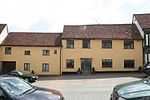
| Milden Hall |
Milden |
Timber-framed house |
1750 !18th century |
01958-01-23-000023 January 1958 |
TL9443046274
52°04′50″N 0°50′10″E / 52.08067°N 0.836058°E / 52.08067; 0.836058 (Milden Hall) |
1181918 |
|
| The Fenn |
Swingleton Green, Monks Eleigh |
House |
1550 !16th century |
01958-01-23-000023 January 1958 |
TL9619247312
52°05′22″N 0°51′44″E / 52.089369°N 0.862335°E / 52.089369; 0.862335 (The Fenn) |
1182166 |
|
| Dresden Cottage |
Nayland-with-Wissington |
House |
1450 !15th century |
01978-02-09-00009 February 1978 |
TL9748534427
51°58′24″N 0°52′26″E / 51.973212°N 0.87375°E / 51.973212; 0.87375 (Dresden Cottage) |
1351862 |
|
| Odd Corners |
Nayland-with-Wissington |
Jettied house |
1550 !16th century |
01953-01-10-000010 January 1953 |
TL9748934404
51°58′23″N 0°52′26″E / 51.973004°N 0.873795°E / 51.973004; 0.873795 (Odd Corners) |
1033592 |
|
| Wiston Mill |
Wiston, Nayland-with-Wissington |
House |
1800 !18th–19th century |
01978-02-09-00009 February 1978 |
TL9623333282
51°57′48″N 0°51′18″E / 51.963373°N 0.854893°E / 51.963373; 0.854893 (Wiston Mill) |
1033616 |
|
| 1 Birch Street |
Nayland, Nayland-with-Wissington |
House |
1550 !16th century |
01953-01-10-000010 January 1953 |
TL9748634392
51°58′22″N 0°52′25″E / 51.972897°N 0.873745°E / 51.972897; 0.873745 (1 Birch Street) |
1033591 |
|
| 6 and 8 Birch Street |
Nayland, Nayland-with-Wissington |
House |
1450 !15th century |
01978-02-09-00009 February 1978 |
TL9748034421
51°58′23″N 0°52′25″E / 51.97316°N 0.873674°E / 51.97316; 0.873674 (6 and 8 Birch Street) |
1033633 |
|
| 17 and 19 Court Street |
Nayland, Nayland-with-Wissington |
Timber-framed building |
1350 !14th century |
01978-02-09-00009 February 1978 |
TL9745434152
51°58′15″N 0°52′23″E / 51.970753°N 0.873142°E / 51.970753; 0.873142 (17 and 19 Court Street) |
1351850 |
|
| 1 and 3 High Street |
Nayland, Nayland-with-Wissington |
House |
1450 !15th century |
01953-01-10-000010 January 1953 |
TL9748434310
51°58′20″N 0°52′25″E / 51.972161°N 0.873668°E / 51.972161; 0.873668 (1 and 3 High Street) |
1033572 |
|
| Brickhouse Farmhouse |
Naughton, Nedging-with-Naughton |
Farmhouse |
1500 !15th–16th century |
01980-07-10-000010 July 1980 |
TM0289248998
52°06′08″N 0°57′40″E / 52.102094°N 0.960996°E / 52.102094; 0.960996 (Brickhouse Farmhouse) |
1037104 |
|
| Church of All Saints |
Newton |
Church |
1350 !Mainly 14th century |
01961-03-23-000023 March 1961 |
TL9197141267
52°02′12″N 0°47′51″E / 52.036565°N 0.797407°E / 52.036565; 0.797407 (Church of All Saints) |
1283418 |
|
| Rogers Farmhouse |
Newton |
Jettied house |
1600 !c.1600 |
01978-02-09-00009 February 1978 |
TL9314241404
52°02′15″N 0°48′52″E / 52.037389°N 0.814534°E / 52.037389; 0.814534 (Rogers Farmhouse) |
1033552 |
|
| Polstead Hall |
Polstead Park, Polstead, Babergh |
House |
1550 !16th century |
01958-01-23-000023 January 1958 |
TL9881638157
52°00′22″N 0°53′43″E / 52.00623°N 0.895262°E / 52.00623; 0.895262 (Polstead Hall) |
1037049 |
|
| Preston Hall |
Preston St. Mary |
House |
1600 !16th–17th century |
01958-01-23-000023 January 1958 |
TL9465150231
52°06′58″N 0°50′30″E / 52.116124°N 0.841538°E / 52.116124; 0.841538 (Preston Hall) |
1182472 |
|
| Church of St Mary |
Raydon |
Church |
1300 !Late 13th–early 14th century |
01955-02-22-000022 February 1955 |
TM0493138620
52°00′29″N 0°59′04″E / 52.008165°N 0.984504°E / 52.008165; 0.984504 (Church of St Mary) |
1286247 |
More images
|
| Church of All Saints |
Shelley |
Church |
1310 !Early 14th century |
01955-02-22-000022 February 1955 |
TM0308238457
52°00′27″N 0°57′27″E / 52.007381°N 0.957505°E / 52.007381; 0.957505 (Church of All Saints) |
1351959 |
More images
|
| Church of St Mary |
Shotley |
Church |
1300 !13th/14th century |
01955-02-22-000022 February 1955 |
TM2370136021
51°58′39″N 1°15′21″E / 51.977596°N 1.255837°E / 51.977596; 1.255837 (Church of St Mary) |
1194504 |
More images
|
| Church of All Saints |
Sproughton |
Church |
1310 !Early 14th century |
01955-02-22-000022 February 1955 |
TM1251545029
52°03′46″N 1°05′56″E / 52.062853°N 1.098813°E / 52.062853; 1.098813 (Church of All Saints) |
1285956 |
More images
|
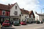
| Church of St James |
Stanstead |
Church |
1350 !14th century |
01961-03-23-000023 March 1961 |
TL8433949342
52°06′42″N 0°41′26″E / 52.111672°N 0.690631°E / 52.111672; 0.690631 (Church of St James) |
1033528 |
|
| The Oaklands |
Stanstead |
House |
1600 !16th–17th century |
01953-01-10-000010 January 1953 |
TL8435148590
52°06′18″N 0°41′25″E / 52.104914°N 0.690399°E / 52.104914; 0.690399 (The Oaklands) |
1033523 |
|
| Street House |
Stoke-by-Nayland |
Jettied house |
1500 !15th–16th century |
01953-01-10-000010 January 1953 |
TL9879636286
51°59′22″N 0°53′38″E / 51.989437°N 0.893887°E / 51.989437; 0.893887 (Street House) |
1033538 |
|
| The Downs Farmhouse |
Stoke-by-Nayland |
Farmhouse |
1510 !Early 16th century |
01978-02-09-00009 February 1978 |
TL9863436054
51°59′15″N 0°53′29″E / 51.987412°N 0.891397°E / 51.987412; 0.891397 (The Downs Farmhouse) |
1200113 |
|
| The Maltings |
Stoke-by-Nayland |
House |
1550 !16th century and later |
01961-03-23-000023 March 1961 |
TL9856836306
51°59′23″N 0°53′26″E / 51.989698°N 0.890583°E / 51.989698; 0.890583 (The Maltings) |
1033513 |
|
| The Old Guildhall (Tudor Cottages) |
Stoke-by-Nayland |
House |
1600 !16th and 17th century |
01953-01-10-000010 January 1953 |
TL9856536258
51°59′21″N 0°53′26″E / 51.989268°N 0.890511°E / 51.989268; 0.890511 (The Old Guildhall (Tudor Cottages)) |
1200348 |
|
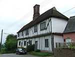
| Thorington Hall |
Stoke-by-Nayland |
Jettied house |
1650 !17th century |
01953-01-10-000010 January 1953 |
TM0131235465
51°58′52″N 0°55′48″E / 51.98116°N 0.929998°E / 51.98116; 0.929998 (Thorington Hall) |
1200597 |
More images
|
| Lowe Hill House |
Stratford St. Mary |
House |
1510 !Early 16th century |
01955-02-22-000022 February 1955 |
TM0425135021
51°58′34″N 0°58′21″E / 51.976102°N 0.972468°E / 51.976102; 0.972468 (Lowe Hill House) |
1036991 |
|
| Weavers House |
Stratford St. Mary |
House |
1625 !Early–mid-16th century |
01955-02-22-000022 February 1955 |
TM0426033820
51°57′55″N 0°58′19″E / 51.965315°N 0.971885°E / 51.965315; 0.971885 (Weavers House) |
1351601 |
|
| Church of St Peter |
Stutton |
Church |
1450 !15th century |
01955-02-22-000022 February 1955 |
TM1615434462
51°58′00″N 1°08′43″E / 51.966585°N 1.145149°E / 51.966585; 1.145149 (Church of St Peter) |
1285520 |
More images
|
| Crowe Hall |
Stutton |
House |
1605 !c.1605 |
01956-02-22-000022 February 1956 |
TM1528034214
51°57′53″N 1°07′56″E / 51.964698°N 1.132291°E / 51.964698; 1.132291 (Crowe Hall) |
1036862 |
|
| Garden wall and gateway attached to and enclosing a garden to north of Stutton Hall |
Stutton Park, Stutton |
Gate |
1550 !16th century |
01989-02-23-000023 February 1989 |
TM1403433746
51°57′40″N 1°06′50″E / 51.960977°N 1.113891°E / 51.960977; 1.113891 (Garden wall and gateway attached to and enclosing a garden to north of Stutton Hall) |
1180369 |
|
| Stutton Hall |
Stutton Park, Stutton |
House |
1553 !c.1553 |
01955-02-22-000022 February 1955 |
TM1403233702
51°57′38″N 1°06′50″E / 51.960583°N 1.113835°E / 51.960583; 1.113835 (Stutton Hall) |
1036866 |
|
| Ballingdon Hall |
Sudbury |
Timber-framed house |
1593 !c.1593 |
01952-03-03-00003 March 1952 |
TL8626740189
52°01′44″N 0°42′50″E / 52.028828°N 0.713762°E / 52.028828; 0.713762 (Ballingdon Hall) |
1037550 |
|
| Barn at St Bartholomew's Priory Farm |
Sudbury |
Grange |
1650 !17th century |
01971-10-26-000026 October 1971 |
TL8715942790
52°03′07″N 0°43′41″E / 52.051886°N 0.728171°E / 52.051886; 0.728171 (Barn at St Bartholomew's Priory Farm) |
1037547 |
|
| Brundon Hall |
Brundon, Sudbury |
House |
1750 !18th century |
01952-03-03-00003 March 1952 |
TL8657242180
52°02′48″N 0°43′09″E / 52.046606°N 0.719288°E / 52.046606; 0.719288 (Brundon Hall) |
1037518 |
|
| Chapel at St Bartholomew's Priory Farm |
Sudbury |
Chapel |
1410 !Early 15th century |
01952-03-03-00003 March 1952 |
TL8709942803
52°03′07″N 0°43′38″E / 52.052023°N 0.727304°E / 52.052023; 0.727304 (Chapel at St Bartholomew's Priory Farm) |
1037546 |
|
| Corn Exchange & Public Library |
Sudbury |
Corn exchange |
1841 |
01971-10-26-000026 October 1971 |
TL8735241252
52°02′17″N 0°43′49″E / 52.038009°N 0.73014°E / 52.038009; 0.73014 (Corn Exchange & Public Library) |
1037457 |
|
| Priory Gate |
Sudbury |
House |
1500 !c.1500 |
01952-03-03-00003 March 1952 |
TL8706241036
52°02′10″N 0°43′33″E / 52.036167°N 0.725799°E / 52.036167; 0.725799 (Priory Gate) |
1285460 |
|
| Stour Hall |
Sudbury |
House |
1650 !17th century |
01952-03-03-00003 March 1952 |
TL8697841250
52°02′17″N 0°43′29″E / 52.038117°N 0.724693°E / 52.038117; 0.724693 (Stour Hall) |
1037437 |
|
| The Red House |
Bullocks Lane, Sudbury |
House |
1700 !17th/18th century |
01952-03-03-00003 March 1952 |
TL8781841412
52°02′21″N 0°44′13″E / 52.039288°N 0.737014°E / 52.039288; 0.737014 (The Red House) |
1351342 |
|
| Ye Old Moot Hall |
Sudbury |
House |
1450 !15th century |
01952-03-03-00003 March 1952 |
TL8682641046
52°02′11″N 0°43′21″E / 52.036336°N 0.722368°E / 52.036336; 0.722368 (Ye Old Moot Hall) |
1180344 |
|
| Church of St Mary |
Tattingstone |
Church |
1350 !14th century |
01955-05-22-000022 May 1955 |
TM1360437143
51°59′30″N 1°06′35″E / 51.991639°N 1.109755°E / 51.991639; 1.109755 (Church of St Mary) |
1351983 |
More images
|
| The Tattingstone Wonder |
Tattingstone |
House |
1790 !c.1790 |
01955-02-22-000022 February 1955 |
TM1391436285
51°59′02″N 1°06′49″E / 51.983817°N 1.113728°E / 51.983817; 1.113728 (The Tattingstone Wonder) |
1033392 |
More images
|
| Thorpe Hall |
Thorpe Morieux |
House |
1550 !16th century |
01958-01-23-000023 January 1958 |
TL9432053235
52°08′36″N 0°50′18″E / 52.143215°N 0.838424°E / 52.143215; 0.838424 (Thorpe Hall) |
1284474 |
|
| Church of St Nicholas |
Wattisham |
Church |
1350 !14th century |
01958-01-23-000023 January 1958 |
TM0098251376
52°07′27″N 0°56′04″E / 52.124142°N 0.934551°E / 52.124142; 0.934551 (Church of St Nicholas) |
1037033 |
|
| Church of St John |
Wenham Magna |
Church |
1350 !14th century |
01955-02-22-000022 February 1955 |
TM0709838128
52°00′11″N 1°00′57″E / 52.002944°N 1.015733°E / 52.002944; 1.015733 (Church of St John) |
1033403 |
|
| Priory Farmhouse |
Wenham Magna |
House |
1450 !15th century or earlier |
01955-02-22-000022 February 1955 |
TM0726038174
52°00′12″N 1°01′05″E / 52.003297°N 1.018118°E / 52.003297; 1.018118 (Priory Farmhouse) |
1351956 |
|
| Wenham Place |
Wenham Magna |
House |
1550 !16th century |
01955-02-22-000022 February 1955 |
TM0719537760
51°59′59″N 1°01′01″E / 51.999604°N 1.016922°E / 51.999604; 1.016922 (Wenham Place) |
1351955 |
|
| Barn approximately 150 metres north of Little Wenham Castle and west of Church of St Lawrence |
Wenham Parva |
Timber-framed barn |
1550 !16th century |
01990-10-30-000030 October 1990 |
TM0803539212
52°00′44″N 1°01′48″E / 52.012327°N 1.030021°E / 52.012327; 1.030021 (Barn approximately 150 metres north of Little Wenham Castle and west of Church of St Lawrence) |
1194552 |
|
| Church of St Mary |
Wherstead Park, Wherstead |
Church |
1150 !12th century |
01955-02-22-000022 February 1955 |
TM1614140699
52°01′21″N 1°08′56″E / 52.022581°N 1.148889°E / 52.022581; 1.148889 (Church of St Mary) |
1204027 |
More images
|
| Church of St Michael |
Woolverstone Park, Woolverstone |
Church |
1350 !14th century |
01955-02-22-000022 February 1955 |
TM1902138583
52°00′09″N 1°11′22″E / 52.002457°N 1.189443°E / 52.002457; 1.189443 (Church of St Michael) |
1204060 |
|
| Woolverstone House including walls attached to each side |
Woolverstone |
Jettied house |
1901 |
01972-03-16-000016 March 1972 |
TM1828838758
52°00′16″N 1°10′44″E / 52.004317°N 1.178893°E / 52.004317; 1.178893 (Woolverstone House including walls attached to each side) |
1204044 |
|
.jpg)

.jpg)
.jpg)
.jpg)
.jpg)

.jpg)


.jpg)

.jpg)


.jpg)
.jpg)


.jpg)


.jpg)


%2C_Lavenham%2C_Suffolk.jpg)


.jpg)


_St._James_Church_(geograph_1859238).jpg)


.jpg)

.jpg)

.jpg)