Graceville, Queensland
| Graceville Brisbane, Queensland | |||||||||||||
|---|---|---|---|---|---|---|---|---|---|---|---|---|---|
|
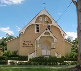
Christ the King Catholic church | |||||||||||||
| Population | 4,213 (2011 census)[1] | ||||||||||||
| Postcode(s) | 4075 | ||||||||||||
| Location | 8 km (5 mi) from Brisbane GPO | ||||||||||||
| LGA(s) | City of Brisbane | ||||||||||||
| State electorate(s) | Electoral district of Indooroopilly | ||||||||||||
| Federal Division(s) | Moreton | ||||||||||||
| |||||||||||||
Graceville is a suburb in Brisbane, Queensland, Australia. It is located 7.8 kilometres (4.8 mi) south-west of the Brisbane CBD. Graceville is bordered by the Brisbane River to the North-East and West, Oxley Creek to the East, Chelmer to the North and Sherwood to the South. At the 2011 Australian Census the suburb recorded a population of 4,213.[1]
The suburb is centred on its own railway station on the Ipswich railway line. The suburb is predominantly residential, with houses generally being in the Queenslander style. The main roads in Graceville are Oxley Road, Graceville Avenue and Honour Avenue. Graceville has two primary schools, Graceville State School and Christ the King which is a private Catholic school. The suburb also has a number of parks (Simpson's Playground, Graceville Memorial Park, Faulkner Park).
Graceville also houses a number of sporting clubs, such as South West United Hockey Club, West Taylor Bridge Rugby Club, Rangers Netball Club, Western Suburbs Cricket Club and Graceville Amateur Swimming Club, which is based at Graceville State School.
Demographics
In the 2011 Census the population of Graceville is 4,213, 51.7% female and 48.3% male. The median/average age of the Graceville population is 37 years of age. 77.1% of people living in Graceville were born in Australia. The other top responses for country of birth were England 4.4%, New Zealand 2.9%, United States of America 1.1%, Scotland 0.9%, South Africa 0.8%. 89.4% of people speak English as their first language 0.8% Vietnamese, 0.7% Mandarin, 0.6% Polish, 0.5% German, 0.5% Cantonese.
Landmarks and architecture
One of Graceville's most recognisable landmarks is the Graceville Uniting Church, on the intersection of Oxley Road and Verney Road East. The church was completed in 1930 and designed and built by local contractor Walter Taylor who was responsible for many local landmarks including the Walter Taylor Bridge which was named after him. Another landmark is the Graceville Memorial Oval, which has the Memorial for the soldiers who died in wars that lived in the area.
Heritage listings

Graceville has a number of heritage-listed sites, including:
- 85 Bank Road: Beth-Eden[2]
- 110 Long Street: Graceville railway station[3]
- 173 Oxley Road: Graceville Memorial Park[4]
- 215 Oxley Road: Graceville Uniting Church[5]
References
- ↑ 1.0 1.1 Australian Bureau of Statistics (31 October 2012). "Graceville (State Suburb)". 2011 Census QuickStats. Retrieved 22 January 2013.
- ↑ "Beth-Eden (entry 14990)". Queensland Heritage Register. Queensland Heritage Council. Retrieved 2013-06-19.
- ↑ "Graceville Railway Station (entry 30579)". Queensland Heritage Register. Queensland Heritage Council. Retrieved 2013-06-19.
- ↑ "Graceville Memorial Park (entry 19565)". Queensland Heritage Register. Queensland Heritage Council. Retrieved 2013-06-19.
- ↑ "Graceville Uniting Church Complex (entry 16345)". Queensland Heritage Register. Queensland Heritage Council. Retrieved 2013-06-19.
External links
| Wikimedia Commons has media related to Graceville, Queensland. |
- University of Queensland: Queensland Places: Graceville
- "Graceville". BRISbites. Brisbane City Council. Archived from the original on 19 July 2008.
- "Graceville". Our Brisbane. Brisbane City Council. Archived from the original on 11 February 2008.