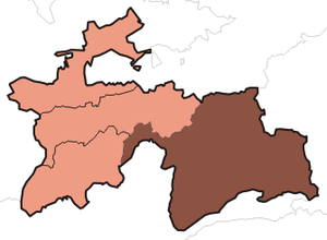
Gorno-Badakhshan Autonomous Region
Coordinates: 38°0′N 73°0′E / 38.000°N 73.000°E
| Gorno-Badakhshan Autonomous Region (Gorno-Badakhshan Autonomous Oblast, GBAO) | |
| Kuhistoni Badakhshon, Kuhistan-Badakhshan, Viloyati Mukhtori Kuhistoni Badakhshon | |
| Region | |
.jpg) Lake Karakul | |
| Country | |
|---|---|
| Capital | Khorugh |
| Area | 64,200 km2 (24,788 sq mi) |
| Population | 218,000 (2008) |
| Density | 3.4 / km2 (9 / sq mi) |
| Chairman of GBAO | Shodikhon Jamshedov |
| ISO 3166-2 | TJ-GB |
 | |

Gorno-Badakhshan Autonomous Region (Tajik: Вилояти Мухтори Кӯҳистони Бадахшон, Viloyati Mukhtori Kūhistoni Badakhshon; Russian: Горно-Бадахшанская автономная область, Gorno-Badakhšanskaya avtonomnaya oblast’) is an autonomous region in the east of Tajikistan. Located in the Pamir Mountains, it makes up 45% of the land area of the country but only 3% of the population.[1]
The Tajik name Kūhistoni Badakhshon (Кӯҳистони Бадахшон), now the official name of the region, expresses the meaning Mountainous Region of Badakhshan, which is equivalent to Gorno-Badakhshan, a standard construction derived from Gornîy Badakhšan (Горный Бадахшан) in Russian.
History
Prior to 1895, the area of today's Gorno-Badakhshan A.R. consisted of several semi-self governing statelets, including Darwaz, Shughnun-Rushan, and Wakhan, who ruled over territories that today are part of Gorno-Badakhshan A.R. in Tajikistan and Badakhshan Province in Afghanistan. The territory was claimed by the Chinese and Russian empires and the Emirate of Afghanistan. The Qing rulers of China claimed control of the entire Pamir Mountains,[2] but Qing military units only controlled the passes just east of Tashkorgan Town. In the 1890s, the Chinese, Russian, and Afghan governments signed a series of agreements that divided Badakhshan, but the Chinese continued to contest these borders, until it signed a 2002 agreement with the government of Tajikistan.[3] The Republic of China continues to claim the territory as part of its land area, along with the rest of China.
Gorno-Badakhshan Autonomous Region was created in January 1925. It was attached to Tajik Soviet Socialist Republic after the republic's creation in 1929. During the 1950s, the native inhabitants of Gorno-Badakhshan, including many ethnic Pamiris, were forcibly relocated to southwestern Tajikistan. Gorno-Badakhshan absorbed some of the territory of the Gharm Oblast when that territory was dissolved in 1955.
When the civil war broke out in Tajikistan in 1992, the local government in Gorno-Badakhshan declared independence from the Republic of Tajikistan. During the civil war many Pamiris were targeted for killing by rival groups and Gorno-Badakhshan became a bastion for the opposition. Later the Gorno-Badakhshan government backed down from its calls for independence. Gorno-Badakhshan remains an autonomous region within Tajikistan.[4][5]
In 2012, the region saw a series of clashes between the Tajik military and militants loyal to former warlord Tolib Ayombekov after the latter was accused of murdering a Tajik general.[6]
Districts and geography
| Mountain | Valley | District |
| Darvoz Range | ||
| Vanj River | Vanj District | |
| Sarikol Range | ||
| Murghob District | ||
| Vanj Range | ||
| Yazgulyam River | ||
| Yazgulem Range | ||
| Bartang River | Rushon District | |
| Rushan Range | ||
| Gunt River | Shughnon District | |
| Shughon Range | ||
| Shakhdara River | Roshtqal'a District | |
| Shakhdara Range | ||
| Panj River | Ishkoshim District | |
| Afghanistan | Amu Darya |
Darvoz District is the western 'beak' of the province. West-central Gorno-Badakhshan is mostly a series of east-west mountain ranges separated by valleys of rivers that flow into the Panj River. The districts correspond the river valleys. Murghob District occupies the eastern half of the province and is mostly a desolate plateau with high mountains on the west.
- Darvoz District (westernmost, north)
- Vanj District (west, north)
- Rushon District (west, center)
- Shughnon District (west, center)
- Roshtqal'a District (west, south)
- Ishkoshim District (west, southernmost)
- Murghob District (eastern two-thirds)
GBAO covers all the eastern part of the country and borders in the East—the Xinjiang Province of China, in the West and South—the Badakhshan Province of Afghanistan, and in the North—the Osh Province of Kyrgyzstan. Within Tajikistan the region's western border is with the Districts of Republican Subordination (DRP) and the tip of its south-western finger (Darvoz District) borders on Khatlon Region. The highest mountains are in the Pamirs (ancient Mount Imeon), which is known as the roof of the world, and three of the five 7,000 meter summits in formerly Soviet Central Asia are located here, including Ismoil Somoni Peak (formerly Communism Peak, and, before that, Stalin Peak; 7,495 m), Ibn Sina Peak (formerly Lenin Peak, and still known by that name on its Kyrgyz flank; 7,134 m), on the border with Kyrgyzstan, and Peak Korzhenevskaya (7,105 m).
Demographics
The population of GBAO increased from 160,900 to 206,000 between the censuses in 1989 and 2000. The population as of January 2008 is estimated at 218,000. According to the State Statistical Committee of Tajikistan, the main ethnic group in GBAO are Pamiris.[7] The remainder of the population is ethnic Kyrgyz and other nationalities. The largest city in GBAO is Khorugh, population 29,000 (2008 est.);[1] the second largest is Murghab, with about 4,000 residents.
GBAO is home to a number of distinct languages and dialects of the Pamir languages group. The Pamiri language speakers represented in Gorno-Badakshan are speakers of Shughni, Rushani, Wakhi, Ishkashimi, Sarikoli, Bartangi, Khufi, Yazgulyam, and Oroshani. Vanji, formerly spoken in the Vanj River valley, became extinct in the 19th century. There is a sizable population of Kyrgyz speakers in the Murghab district. Russian and Tajik are also widely spoken throughout GBAO. The majority religion in GBAO is Ismaili Shi'ite and adherence to the Aga Khan is widespread.
Transport
Only two easily navigable roads connect GBAO to the outside world, Khorog-Osh and Khorog-Dushanbe, both of which are segments of the Pamir Highway. A third road from Khorog to Tashkurgan in China through the Kulma Pass is very rough. Gorno-Badakhshan is separated from Khyber Pakhtunkhwa and Gilgit Baltistan by the narrow, but nearly impassable, Wakhan Corridor. Another road leads from Khorog into the Wakhan and across the Afghan border. Khorog Airport is serviced by Tajik Air and as of 2014 had regularly scheduled flights to Dushanbe.
Sports
Khorugh is the location of highest altitude where bandy has been played.[8]
See also
References
- ↑ 1.0 1.1 Population of the Republic of Tajikistan as of 1 January 2008, State Statistical Committee, Dushanbe, 2008 (Russian)
- ↑ 中国近代史课程教案
- ↑ Ministry of Foreign Affairs, the People's Republic of China (2003). "China's Territorial and Boundary Affairs". Retrieved 27 November 2009.
- ↑ Suhrobsho Davlatshoev (2006). "The Formation and Consolidation of Pamiri Ethnic Identity in Tajikistan. Dissertation". School of Social Sciences of Middle East Technical University, Turkey (M.S. thesis). Retrieved 25 August 2006.
- ↑ http://tajikistan.orexca.com/gorno_badakhshan_region.shtml
- ↑ "Tajikistan clashes: 'Many dead' in Gorno-Badakhshan". BBC News. 24 July 2012. Retrieved 25 July 2012.
- ↑ Population census of Tajikistan, 2000 on demoscope.ru (Russian)
- ↑ Фоминых, Борис (15 January 2011). Опубликован календарь матчей турнира по хоккею с мячом Азиады-2011 (in Russian). Bandynet. Retrieved 21 February 2015.
Further reading
- Hoeck, Tobias; Droux, Roman; Breu, Thomas; Hurni, Hans; Maselli, Daniel (2007). "Rural energy consumption and land degradation in a post-Soviet setting – an example from the west Pamir mountains in Tajikistan". Energy for Sustainable Development 11 (1): 48–57. doi:10.1016/S0973-0826(08)60563-3.
- Robinson, Sarah; Guenther, Tanya (2007). "Rural Livelihoods in Three Mountainous Regions of Tajikistan". Post-Communist Economies 19 (3): 359–378. doi:10.1080/14631370701312352.
- Robinson, Sarah; Whitton, Mark; Biber-Klemm, Susette; Muzofirshoev, Nodaleb (2010). "The Impact of Land-Reform Legislation on Pasture Tenure in Gorno-Badakhshan: From Common Resource to Private Property?". Mountain Research and Development 30 (1): 4–13. doi:10.1659/MRD-JOURNAL-D-09-00011.1.
External links
- Map of the Gorno-Badakhshan region of Tajikistan
- State agency on antiexclusive politics and support of business at Government of Republic of Tadjikistan
 |
Districts of Republican Subordination | Osh Region, |
| |
| Khatlon Region | |
| ||
| ||||
| | ||||
| Takhar Province, |
Badakhshan Province, |
| |||||||||||||
